MyTopo
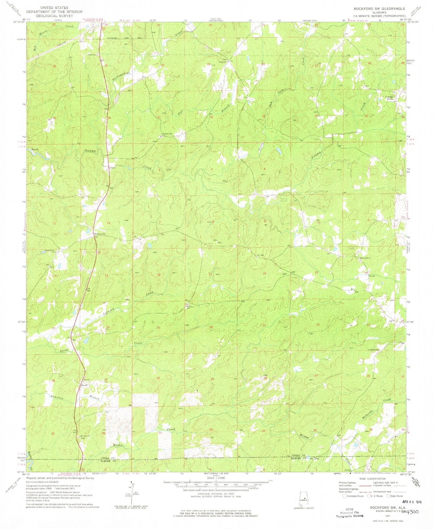
Classic USGS Rockford SW Alabama 7.5'x7.5' Topo Map
Couldn't load pickup availability
Historical USGS topographic quad map of Rockford SW in the state of Alabama. Map scale may vary for some years, but is generally around 1:24,000. Print size is approximately 24" x 27"
This quadrangle is in the following counties: Coosa, Elmore.
The map contains contour lines, roads, rivers, towns, and lakes. Printed on high-quality waterproof paper with UV fade-resistant inks, and shipped rolled.
Contains the following named places: Bethesda Creek, Concord Baptist Church, Concord Cemetery, Flat Branch, Hachemedega Creek, Lindsey Cemetery, Little Sam Jack Creek, Lybrand Creek, Mount Nebo Church, New Life Church, Pentonville, Pinthlocco, Pleasant Hill Methodist Church, Rehobeth Cemetery, Rehobeth Methodist Church, Rockford Division, Shady Grove Baptist Church, Shady Grove Cemetery, Speed, Swift Creek Hunting Club, The Baptist Temple Church, Thomas Mine, Union Academy, Union Cemetery, Union Presbyterian Church, ZIP Code: 36026