MyTopo
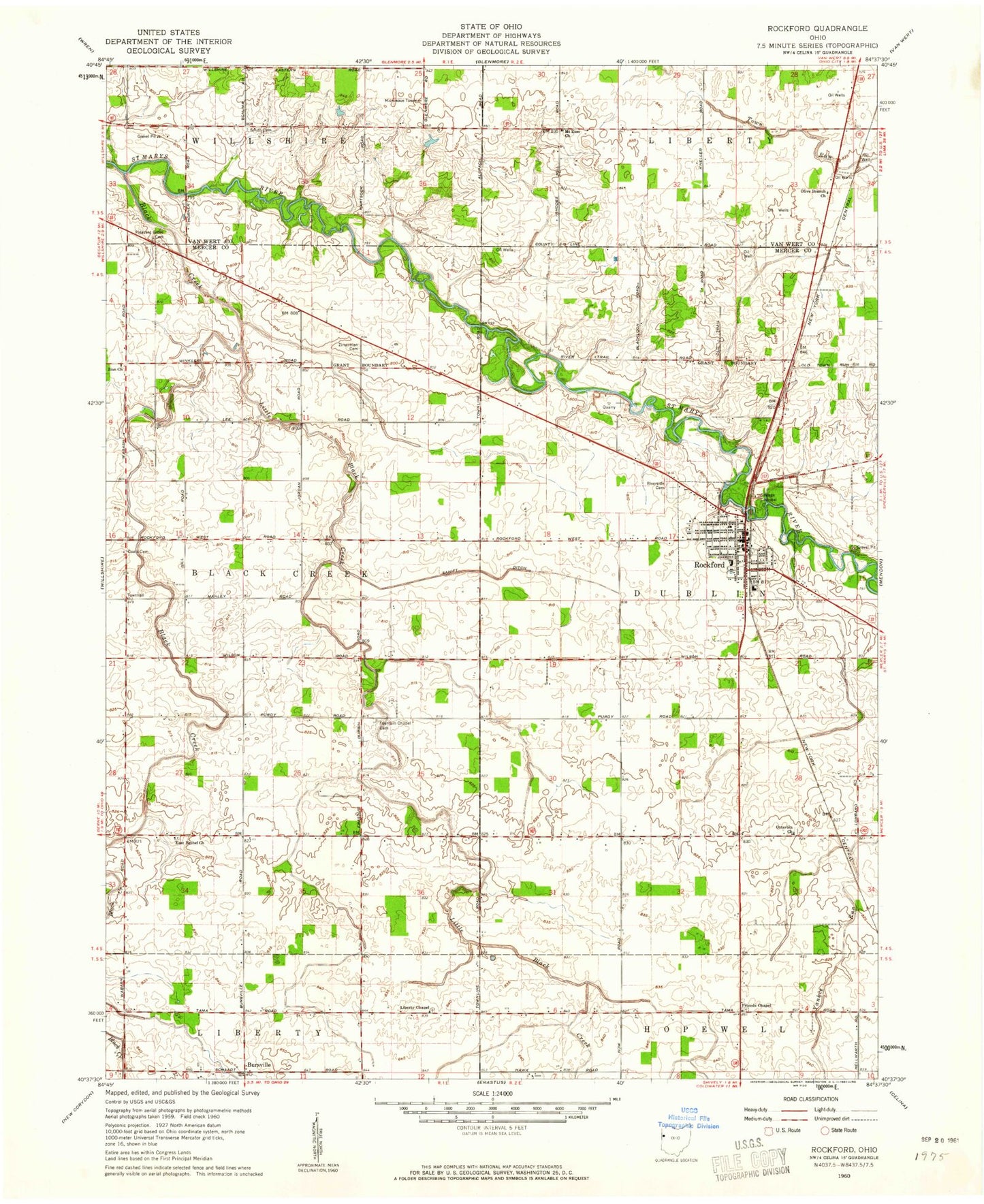
Classic USGS Rockford Ohio 7.5'x7.5' Topo Map
Couldn't load pickup availability
Historical USGS topographic quad map of Rockford in the state of Ohio. Map scale may vary for some years, but is generally around 1:24,000. Print size is approximately 24" x 27"
This quadrangle is in the following counties: Mercer, Van Wert.
The map contains contour lines, roads, rivers, towns, and lakes. Printed on high-quality waterproof paper with UV fade-resistant inks, and shipped rolled.
Contains the following named places: Barks School, Black Creek, Blackloon Reserve, Bursville, Calvary United Brethren in Christ Church, Central School, Charlies Reserve, Coats Cemetery, Crescent Reserve, Deitsch School, East Bethel Cemetery, East Bethel Church, First United Methodist Church, Fountain Chapel Cemetery, Friends Cemetery, Friends Chapel, Godfreys Reserve, Henderson School, Hopewell Dairy, King School, Labadie Reserve, Liberty Cemetery, Liberty Chapel, Little Black Creek, Manley School, Mercer County Emergency Medical Services, Meyers Mobile Home Park, Mount Zion Church, Olive Branch Church, Otterbein Cemetery, Otterbin Church, Parkway High School, Pleasant Grove Cemetery, Red School, Ridge Cemetery, Ridge School, Ripley Airport, Riverside Cemetery, Robinson School, Rockford, Rockford Community Fire Department, Rockford Police Department, Rockford Post Office, Rockford Presbyterian Church, Rockford Stone Quarry, Rogers Farms, Saint Teresas Catholic Church, Sanift Ditch, School Number 1, School Number 2, Shafters Station, Shanes Grant, Shanes Reserve, Shell School, Siebert School, Smith Cemetery, Stedke School, Stetler School, Stringtown School, Township of Black Creek, Township of Dublin, Village of Rockford, Winkler School, Zimerman Cemetery, Zion United Brethren Church, ZIP Code: 45882