MyTopo
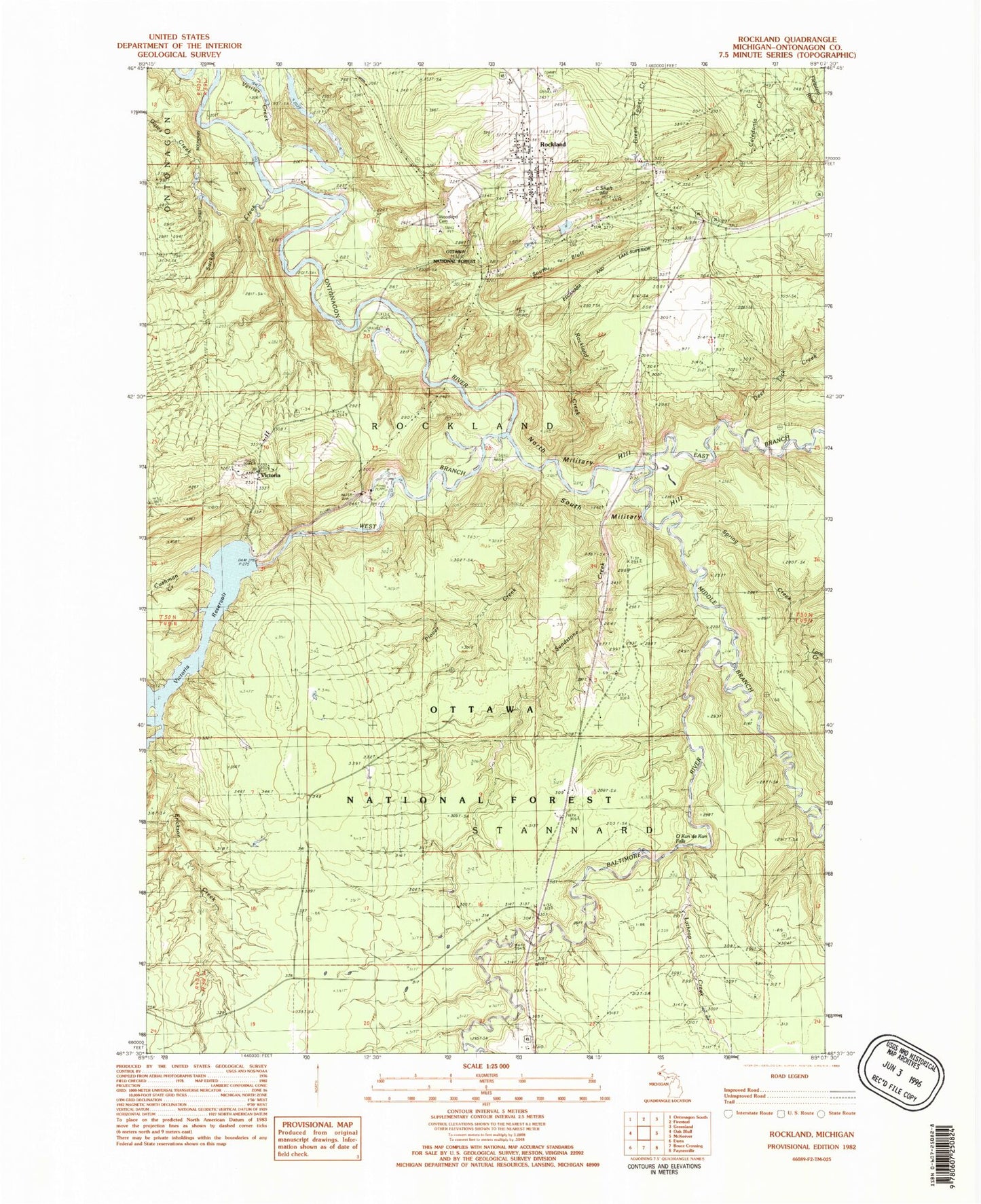
Classic USGS Rockland Michigan 7.5'x7.5' Topo Map
Couldn't load pickup availability
Historical USGS topographic quad map of Rockland in the state of Michigan. Typical map scale is 1:24,000, but may vary for certain years, if available. Print size: 24" x 27"
This quadrangle is in the following counties: Ontonagon.
The map contains contour lines, roads, rivers, towns, and lakes. Printed on high-quality waterproof paper with UV fade-resistant inks, and shipped rolled.
Contains the following named places: Baltimore River, C Shaft Hill, Cushman Creek, Deer Lick Creek, East Branch Ontonagon River, Erickson Creek, Irish Hollow Cemetery, Middle Branch Ontonagon River, Patty Creek, Rockland, South Bluff, Spring Creek, Sucker Creek, Victoria, Victoria Dam, Victoria Reservoir, West Branch Ontonagon River, Woodawn Cemetery, O Kun de Kun Falls, North Country National Scenic Trail, Old Victoria Historic Townsite, Sandstone Creek, Lane Creek, Rockland Creek, Plover Creek, Verrier Creek, North Military Hill, South Military Hill, Military Bridge, WUPY-FM (Ontonagon), Township of Rockland, Irish Rapid Falls, Victoria Post Office (historical), Old Indian Burial Grounds, Methodist Rose Cemetery, Rockland Volunteer Fire Department, Rockland Post Office, Rockland Station, Saint Mary's Church, Rockland Township Library, Childhood Cottage Museum, Rockland Census Designated Place