MyTopo
Classic USGS Rockville South Carolina 7.5'x7.5' Topo Map
Couldn't load pickup availability
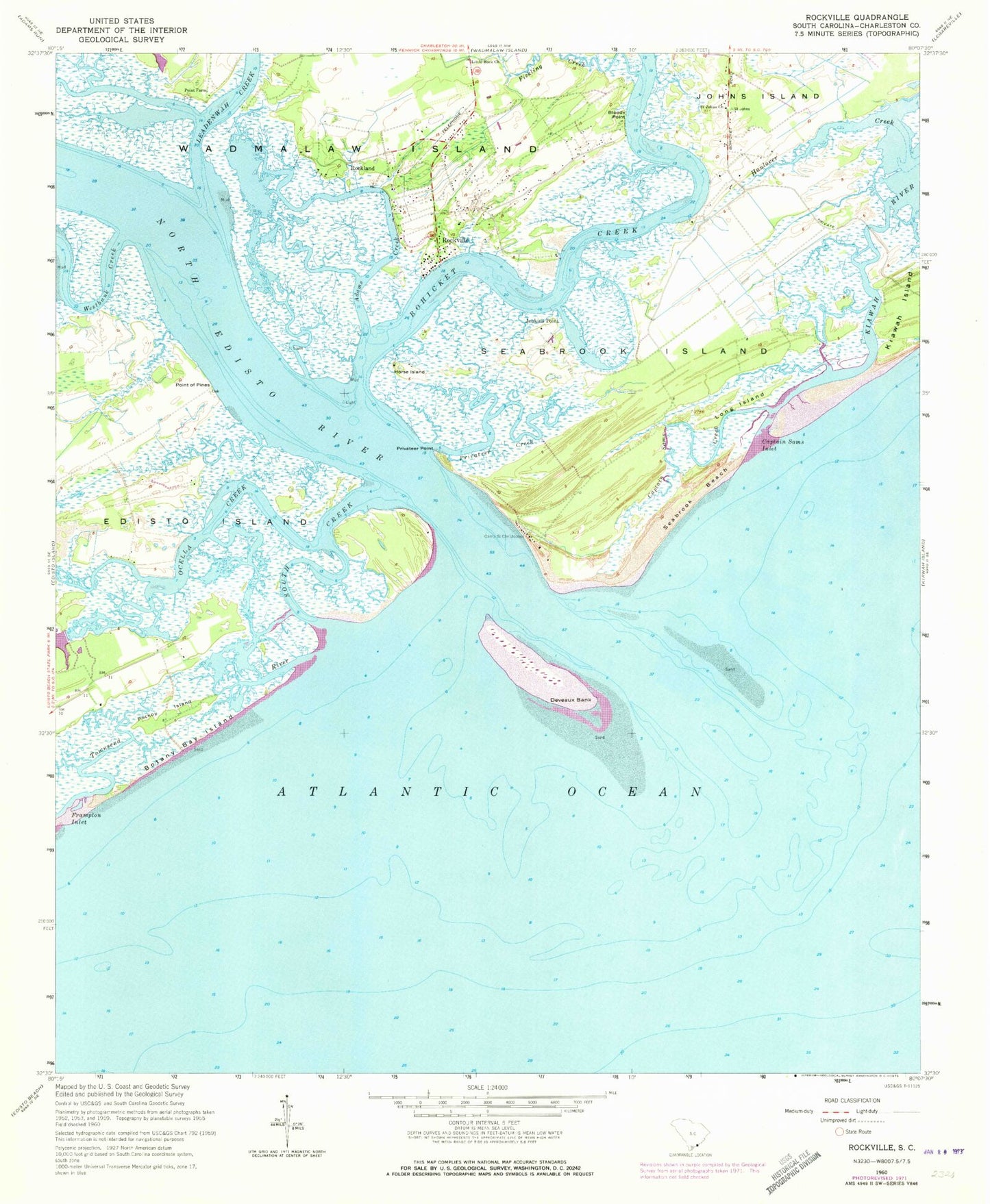
Historical USGS topographic quad map of Rockville in the state of South Carolina. Map scale may vary for some years, but is generally around 1:24,000. Print size is approximately 24" x 27"
This quadrangle is in the following counties: Charleston, Colleton.
The map contains contour lines, roads, rivers, towns, and lakes. Printed on high-quality waterproof paper with UV fade-resistant inks, and shipped rolled.
Contains the following named places: Adams Creek, Andell Bridge, Bloody Point, Bohicket Creek, Bohicket Marina, Botany Bay Island, Camp Saint Christopher, Captain Sams Creek, Captain Sams Inlet, Deveaux Bank, Fickling Creek, Frampton Inlet, Grace Chapel Protestant Episcopal Church, Greenway Plantation Pond, Horse Island, Jenkins Point, Leadenwah Creek, Little Rock Church, Long Island, Middleton Lake, Middleton Lake Dam D-2559, North Edisto River, Ocella Creek, Pockoy Island, Point Farm, Point of Pines, Privateer Creek, Privateer Point, Rockland, Rockville, Rockville Historic District, Rockville Presbyterian Church, Saint Johns Church, Saint Johns Fire Department Station 2, Seabrook Beach, Seabrook Island, South Carolina Noname 10006 D-3043 Dam, South Creek, Town of Rockville, Town of Seabrook Island, Townsend River, Westbank Creek