MyTopo
Classic USGS Rocky Point New Mexico 7.5'x7.5' Topo Map
Regular price
$16.95
Regular price
Sale price
$16.95
Unit price
per
Couldn't load pickup availability
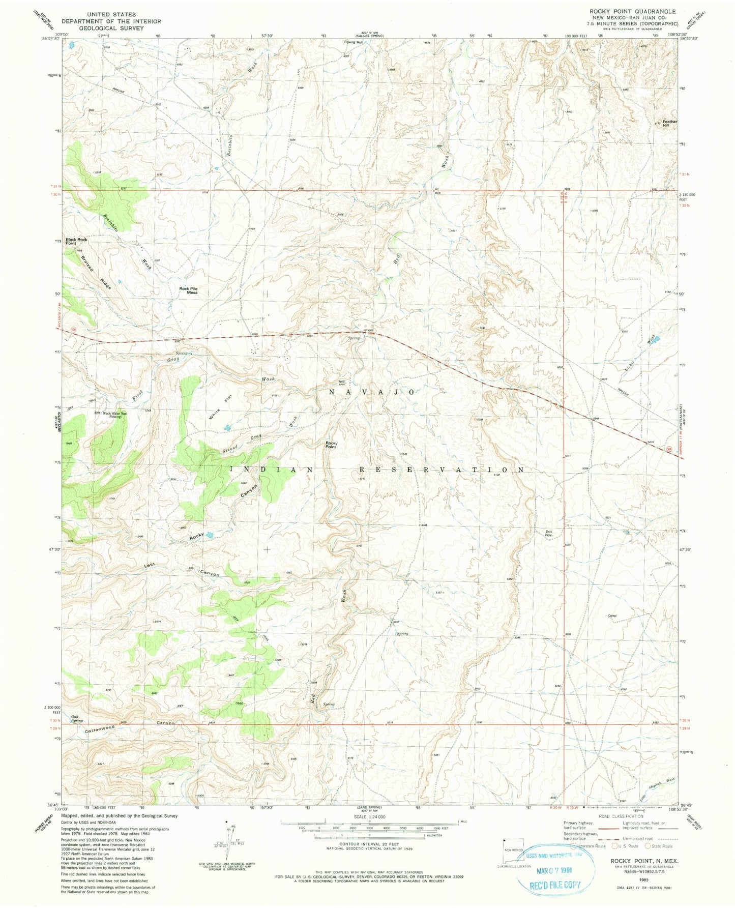
Historical USGS topographic quad map of Rocky Point in the state of New Mexico. Map scale may vary for some years, but is generally around 1:24,000. Print size is approximately 24" x 27"
This quadrangle is in the following counties: San Juan.
The map contains contour lines, roads, rivers, towns, and lakes. Printed on high-quality waterproof paper with UV fade-resistant inks, and shipped rolled.
Contains the following named places: 12P-355 Water Well, 12R-148 Water Well, 87420, Beclabito Chapter, Black Rock Point, Black Water Well, Bruised Ridge, Cottonwood Canyon, Feather Hill, First Gray Wash, Last Canyon, Oak Spring, Rock Pile Mesa, Rocky Canyon, Rocky Point, Second Gray Wash, White Flat