MyTopo
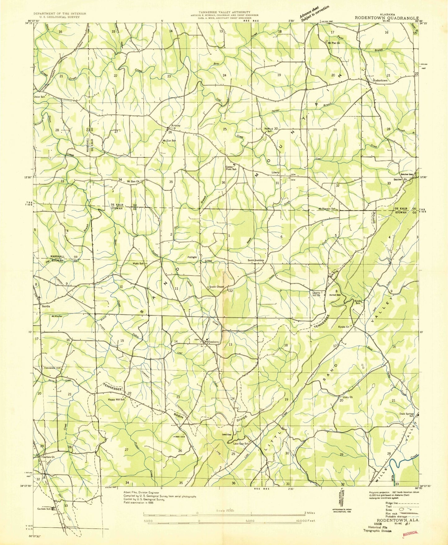
Classic USGS Rodentown Alabama 7.5'x7.5' Topo Map
Couldn't load pickup availability
Historical USGS topographic quad map of Rodentown in the state of Alabama. Map scale may vary for some years, but is generally around 1:24,000. Print size is approximately 24" x 27"
This quadrangle is in the following counties: DeKalb, Etowah, Marshall.
The map contains contour lines, roads, rivers, towns, and lakes. Printed on high-quality waterproof paper with UV fade-resistant inks, and shipped rolled.
Contains the following named places: Allen Branch, Arona, Aroney Fire Department Station 1, Aroney Fire Department Station 2, Belcher Chapel, Belcher Gap, Belchers Chapel Church Cemetery, Belchers Gap Church, Belview Heights Missionary Baptist Church, Bethlehem Baptist Church, Burns Branch, Burns Mill, Carlisle, Carlisle Missionary Baptist Church, Center Point Junior High School, Coal Creek, Cobbs Mill, Corinth Church, Cross Creek, Double Bridges, Duck Springs School, Dugout Valley, Fenton, Fenton Post Office, Flat Branch, Fletcher Bridge, Freedom Church Cemetery, Fricks Field, Halford School, Happy Hill, Happy Hill Missionary Baptist Church, Happy Hill School, Haworth, Hibbs Cemetery, Horseshoe Creek, Horton Gap, Jacob Creek, Jesus Army Church, John L Gap, Kyuka, Kyuka Baptist Church, Kyuka Baptist Church Cemetery, Kyuka School, Lake Bonnie, Leath Cemetery, Leath Gap, Leath Gap School, Liberty, Liberty Church, Liberty Hill, Liberty Hill Baptist Church, Lipscomb Cemetery, Malferd School, McPherson School, McWhorter Branch, Midway, Mount Flat Church, Mount Zion, Mount Zion Church, Mount Zion School, Mountainboro Division, Neighbors Hollow, Orr Branch, Owens Branch, Owens Creek, Painter Branch, Penitentiary Hollow, Pulltight, Reedy Creek, Rodentown, Rollins, Royse, Royse Post Office, Sardis Baptist Church, Sardis Cemetery, Sardis City, Sardis City Volunteer Fire Department, Sardis High School, Smith Chapel, Smith Institute, Smiths Chapel, Stephens Dam, Stephens Lake, Thrasher Cemetery, Thrashers Crossroads, Town of Sardis City, Union Cemetery, Union Church, Union School, Unity Baptist Church, Webb School, Whitesboro, Whitesboro Baptist Church, Whitesboro Baptist Church Cemetery, Whitesboro Census Designated Place, Whitesboro Elementary School, Williams Bridge, Wills Valley Division, Yellow Leaf Creek