MyTopo
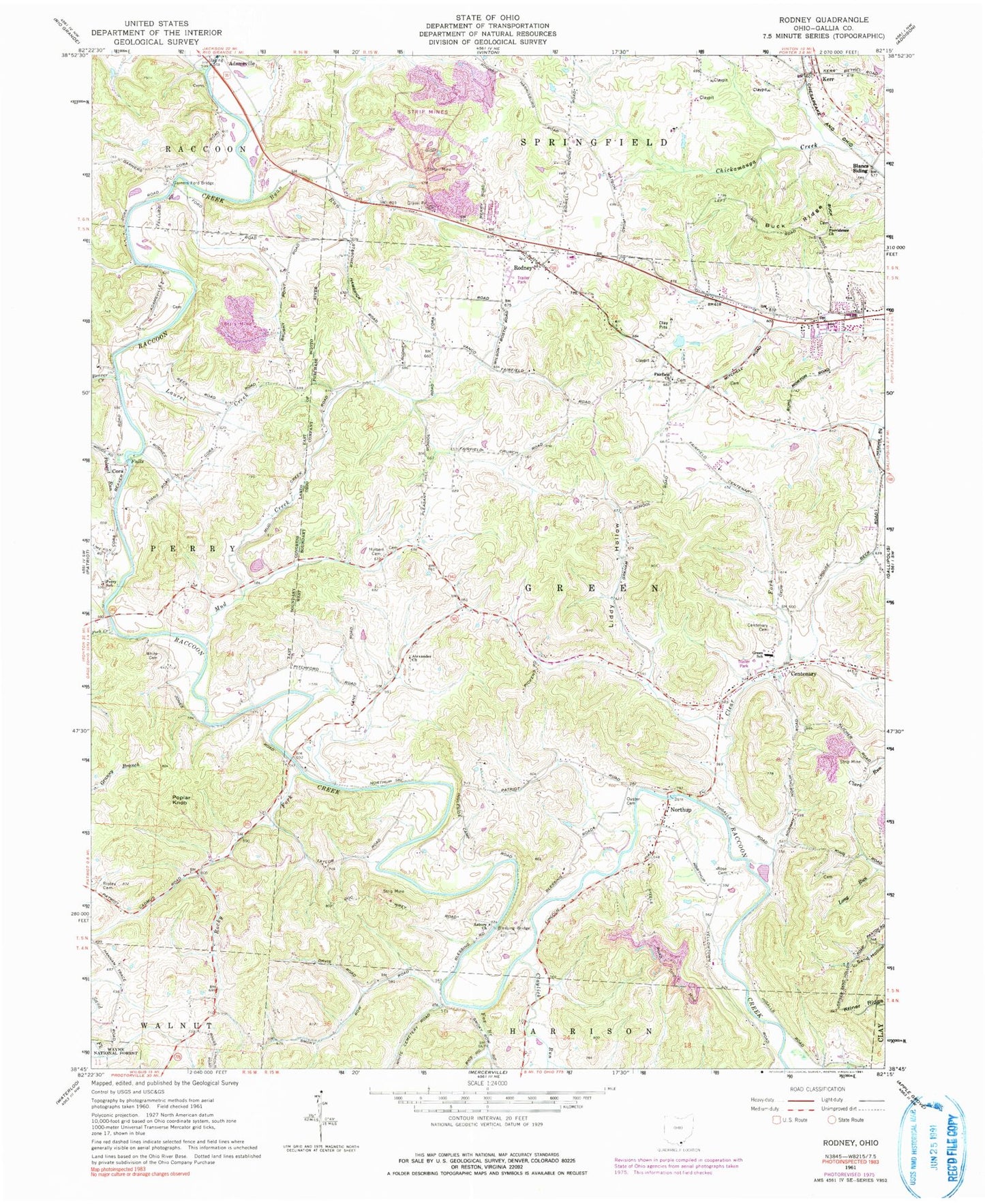
Classic USGS Rodney Ohio 7.5'x7.5' Topo Map
Couldn't load pickup availability
Historical USGS topographic quad map of Rodney in the state of Ohio. Map scale may vary for some years, but is generally around 1:24,000. Print size is approximately 24" x 27"
This quadrangle is in the following counties: Gallia.
The map contains contour lines, roads, rivers, towns, and lakes. Printed on high-quality waterproof paper with UV fade-resistant inks, and shipped rolled.
Contains the following named places: Adamsville Cemetery, Alexander Church, Asbury Cemetery, Asbury Church, Beaver Creek, Blancs Siding, Blessing Bridge, Buck Ridge, Buck Ridge Cemetery, Centenary, Centenary Cemetery, Centenary Methodist Church, Claylick Run, Clear Fork, Cora, Cora Covered Bridge, Cora Methodist Church, Cora Mill, Cora Post Office, Deer Hollow Trail, Fairfield Acres, Fairfield Church Cemetery, Fairfield Methodist Church, Fairview, Fork Creek, Fox Branch, Gallia County, Garners Ford Bridge, Green Elementary School, Hideaway Acres, Hulbert Cemetery, Kerr, Kriner Ridge, Laurel Creek, Liddy Hollow, Life Ambulance, Little Claylick Run, Lowvy Cemetery, McCormick, McCormick Post Office, Morton Flats, Mud Creek, Natural Gorge Trail, Northup, Northup Baptist Church, Northup post office, Ouster Cemetery, Perry School, Polecat Run, Poplar Knob, Porterbrook, Providence Church, Quail Creek Trailer Park, Raccoon Creek County Park, Ripley Cemetery, Rocky Fork, Rodney, Rodney United Methodist Church, Rose Cemetery, Ryan Run, Siloam, Siloam Post Office, Spring Valle Estates, Spring Valley, The Meadows, Township of Green, Westwood Acres, White Cemetery, Wigner, Wigner Post Office, ZIP Code: 45631