MyTopo
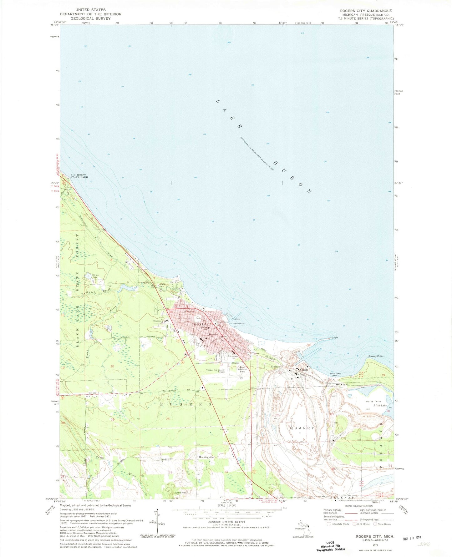
Classic USGS Rogers City Michigan 7.5'x7.5' Topo Map
Couldn't load pickup availability
Historical USGS topographic quad map of Rogers City in the state of Michigan. Map scale may vary for some years, but is generally around 1:24,000. Print size is approximately 24" x 27"
This quadrangle is in the following counties: Presque Isle.
The map contains contour lines, roads, rivers, towns, and lakes. Printed on high-quality waterproof paper with UV fade-resistant inks, and shipped rolled.
Contains the following named places: Bruningville, Calcite, Calvary Bible Church, City of Rogers City, Great Lakes Lore Maritime Museum, Gulpin Memorial Field, Hartwick Creek, Kingsbury Oil Company, Lakeside Park, Limestone Operations, Little Lake, Nagels Creek, North Shore Park, Northern Foot and Ankle Clinic, Peace Lutheran Church, Presque Isle County Airport, Presque Isle County Museum, Presque Isle County Sheriff's Office, Presque Isle Courthouse, Presque Isle Estates, Quarry Point, Quarry Post Office, Riverview Park, Rogers City, Rogers City Baptist Church, Rogers City Branch Library, Rogers City City Hall, Rogers City Community Health Center, Rogers City Elementary School, Rogers City Fire Department, Rogers City High School, Rogers City Memorial Park Cemetery, Rogers City Police Department, Rogers City Post Office, Rogers City Rehabilitation Hospital, Rogers City Station, Rogers City Yacht Harbor, Saint Ignatius Church, Saint Ignatius School, Saint John Lutheran Church, Saint Johns School, Saint Luke's Episcopal Church, Seagull Point Park, South Shore Park, Sunrise Assembly of God Church, Tendercare Health Center - Rogers City Rehab Hospital, Trout River, Trout River Park, United States Steel Corportation, Vogelheim Lumber Company, Westminster Presbyterian Church, WLC, World's Largest Limestone Quarry Historical Marker, ZIP Code: 49779