MyTopo
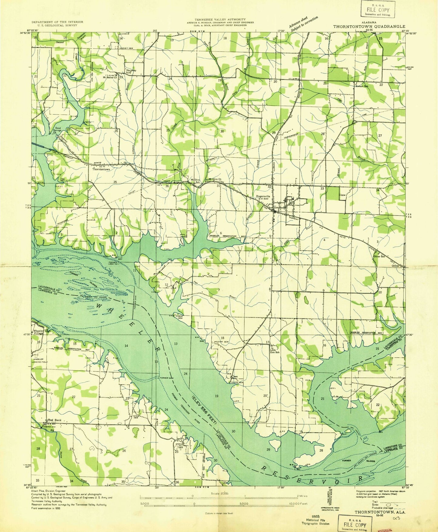
Classic USGS Rogersville Alabama 7.5'x7.5' Topo Map
Couldn't load pickup availability
Historical USGS topographic quad map of Rogersville in the state of Alabama. Map scale may vary for some years, but is generally around 1:24,000. Print size is approximately 24" x 27"
This quadrangle is in the following counties: Lauderdale, Lawrence, Limestone.
The map contains contour lines, roads, rivers, towns, and lakes. Printed on high-quality waterproof paper with UV fade-resistant inks, and shipped rolled.
Contains the following named places: Berry Cemetery, Blowing Spring, Butler Cemetery, Cooper Cemetery, Corn Island, Cox Cemetery, Coxs Bar, Cunningham Cemetery, Dean - McNairy Cemetery, Dells Vista Shores, East End High School, Elk River, Elk River Shoals, Elk River View, Estep, Ferry Shores, First Baptist Church, First Bars, First Creek, Freeman Acres, Fuqua - Sturdivant Cemetery, Gibson Cemetery, Good Springs Missionary Baptist Church, Gourd Island, Graceland Park, Haraway Cemetery, Harraway School, Harvey Cemetery, Howard Island, Ingram Cemetery, Jackson Chute, James Whitehead Cemetery, Lambs Ferry, Lauderdale County High School, Liberty Cemetery, Little Zion Cemetery, Little Zion Church, Lock One Hollow, McCartney Cemetery, McNairy School, Miller Cemetery, Moody Branch, Mount Olive, Mount Olive Cumberland Presbyterian Church, Mount Olive School, Nance - Simmons Cemetery, Nances Reef, Neeley Branch, New Mount Bethel United Methodist Church, Nugent Branch, Oak Grove School, Old Mount Bethel Cumberland Presbyterian Church, Old Romine Cemetery, Oliver, Oliver - Bedingfield Memorial Cemetery, Oliver Church of Christ, Oliver School, Page Branch, Perry Branch, Pine Haven Shores, Pinedale Home Sites, Poplar Spring, Poplar Springs Branch, Ramblewood Shores, Ray Cemetery, Red Bank, Red Bank Missionary Baptist Church, Red Bank School, Roberson Beach, Rogersville, Rogersville Church, Rogersville Civitan Cemetery, Rogersville Police Department, Rogersville Post Office, Rogersville Public Library, Rogersville Volunteer Fire Department, Romain School, Romine, Romine Cemetery, Romine Church of Christ, Saltpeter Cave Bluff, Sedge Grass Island, Sharps Shores, Simpson Branch, Slop Hollow, Southside Church, Spring Hill Cemetery, Sweetgum Island, Thompson Branch, Thornton, Thornton Cemetery, Thorntontown, Tick Island, Toonersville, Town of Rogersville, Wallace Cemetery, Warmack Cemetery, Warmack Spring, Watkins Cemetery, Weaver Branch, Weaver Cemetery, Weaver Family Cemetery, Weaver Island, West Rogersville Church, Wheeler Dam Subdivision, Yates Cemetery, York Branch, ZIP Code: 35652