MyTopo
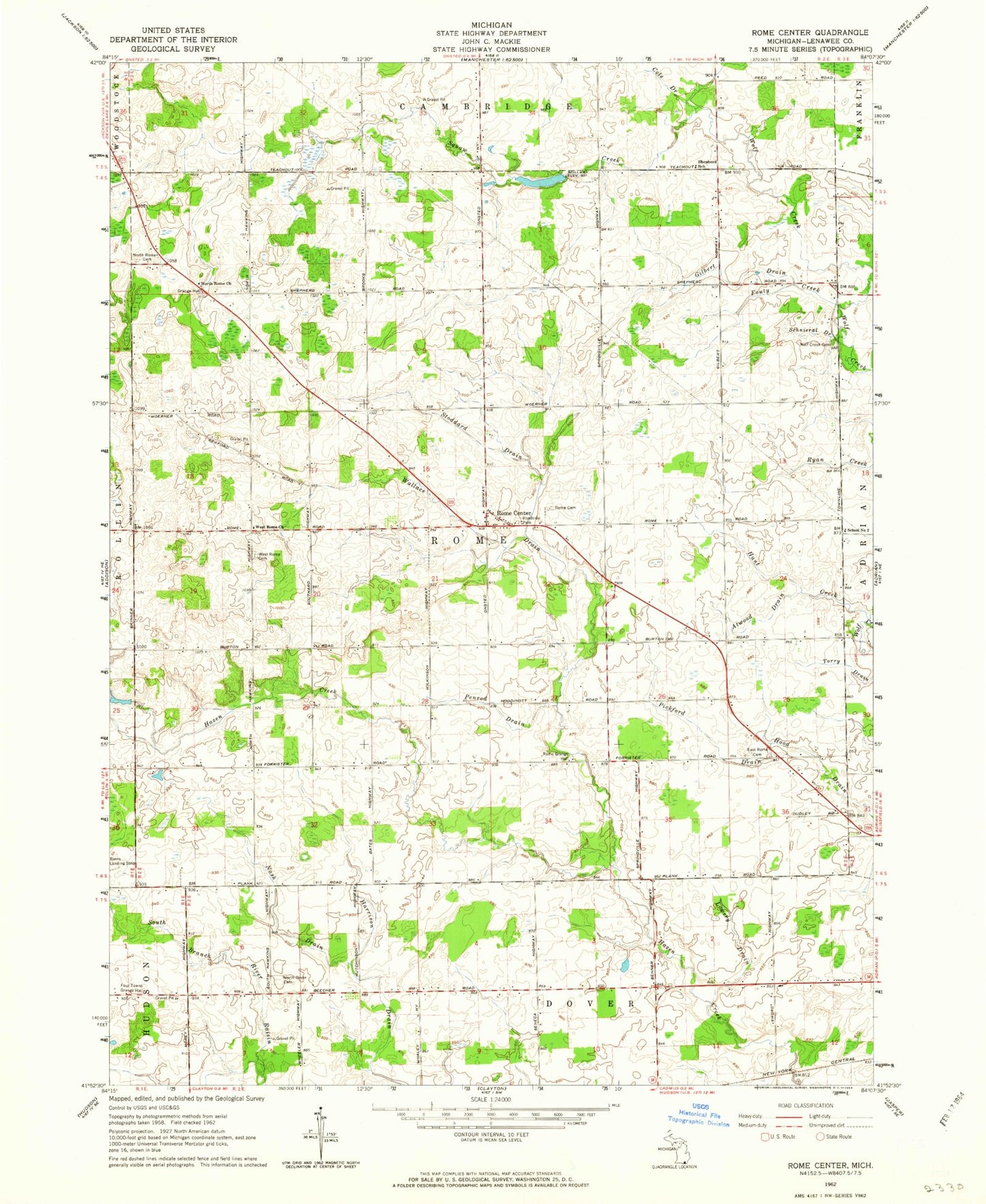
Classic USGS Rome Center Michigan 7.5'x7.5' Topo Map
Couldn't load pickup availability
Historical USGS topographic quad map of Rome Center in the state of Michigan. Map scale may vary for some years, but is generally around 1:24,000. Print size is approximately 24" x 27"
This quadrangle is in the following counties: Lenawee.
The map contains contour lines, roads, rivers, towns, and lakes. Printed on high-quality waterproof paper with UV fade-resistant inks, and shipped rolled.
Contains the following named places: Atwood Drain, Bates Farm Cemetery, Cole Drain, Dover Post Office, East Rome Cemetery, Four Towns Grange Hall, Fouty Creek, Gilbert Drain, Halstead Farm Cemetery, Hunt Creek, Loars Field Airport, Lowery Drain, Nash Drain, North Dover Cemetery, North Rome Cemetery, North Rome Church, Penrod Drain, Pickford Drain, Rollin Center United Methodist Church, Rome Cemetery, Rome Center, Rome Grange Hall, Rome Post Office, Rome Township Hall, Schnieral Drain, School Number 2, Shepherd School, Squaw Creek, Stoddard Drain, Stoddard Post Office, Township of Rome, Wallace Drain, West Rome Cemetery, West Rome Church, Wolf Creek Cemetery, Wolfcreek Post Office