MyTopo
Classic USGS Romney Indiana 7.5'x7.5' Topo Map
Couldn't load pickup availability
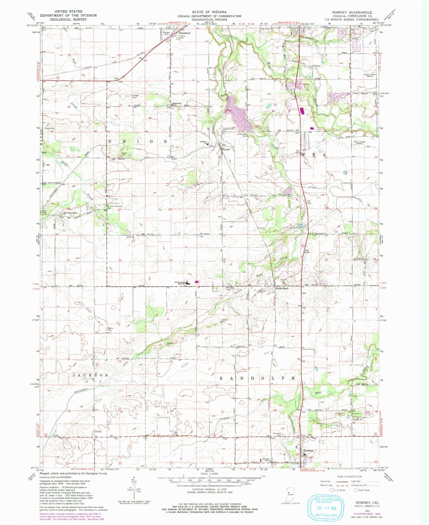
Historical USGS topographic quad map of Romney in the state of Indiana. Map scale may vary for some years, but is generally around 1:24,000. Print size is approximately 24" x 27"
This quadrangle is in the following counties: Tippecanoe.
The map contains contour lines, roads, rivers, towns, and lakes. Printed on high-quality waterproof paper with UV fade-resistant inks, and shipped rolled.
Contains the following named places: Agricultural Seed Airstrip, Corwin, Durkee Cemetery, Elmwood Cemetery, Fairfield Pit, Farmers Institute Cemetery, Farmers Institute Church, Fink Cemetery, Haywood Ditch, Hickory Grove Cemetery, Kellerman Leaming Ditch, Lafayette Fire Department Station 8, Mintonye Cemetery, Montgomery Ditch, O'Neall Ditch, Provault Cemetery, Randolph Township Volunteer Fire Department, Ratcliff Airport, Romney Census Designated Place, Romney Post Office, Shadeland, Shadeland School, Shadeland Volunteer Fire Department, Shelby Cemetery, South Raub, Southwestern Junior High School, Stidham Church, Taylor, Town of Shadeland, Township of Randolph, Township of Union, WBAA-AM (West Lafayette), WFTE-AM (Lafayette), ZIP Code: 47909