MyTopo
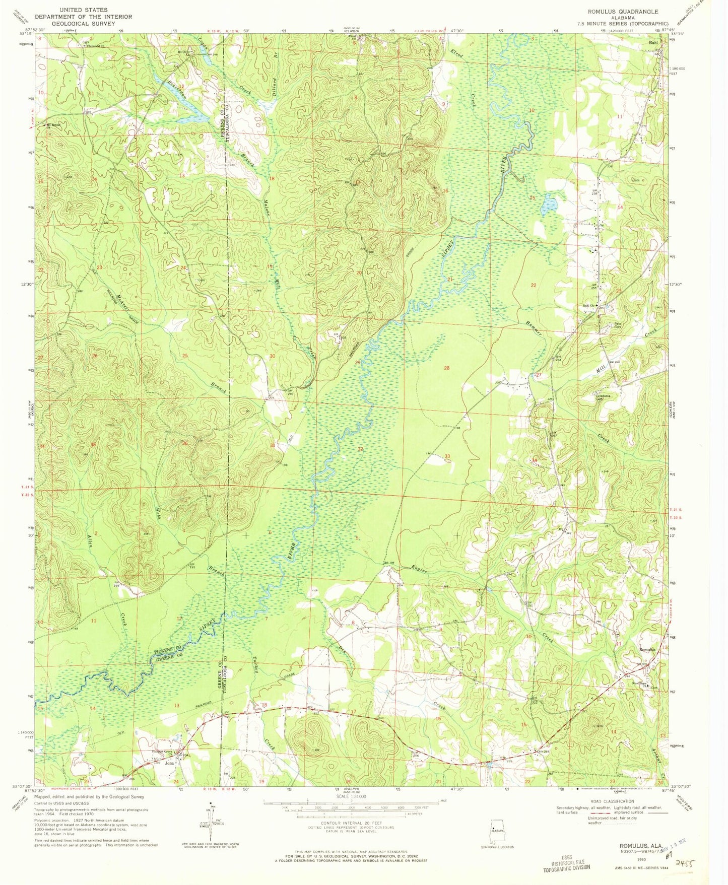
Classic USGS Romulus Alabama 7.5'x7.5' Topo Map
Couldn't load pickup availability
Historical USGS topographic quad map of Romulus in the state of Alabama. Map scale may vary for some years, but is generally around 1:24,000. Print size is approximately 24" x 27"
This quadrangle is in the following counties: Greene, Pickens, Tuscaloosa.
The map contains contour lines, roads, rivers, towns, and lakes. Printed on high-quality waterproof paper with UV fade-resistant inks, and shipped rolled.
Contains the following named places: Allen Creek, Backbone Cemetery, Beaver Dam Church, Beaverdam Branch, Buhl Church of God, Caledonia Cemetery, Dillard Branch, Dry Creek, Elledge Branch, Elrod Church, Elrod Creek, Engine Creek, Fifes Shop, Flatwood Cemetery, Flatwood Church, Gilliam Farms, Gregorys Ford, Hammer Creek, Huffmans Ford, Jena, Jena School, Jordan Cemetery, Leavelle Farms, Logan Creek, Malone Mill Creek, Marquis, McAteer Branch, Mill Creek, Mount Bethel Church, Mount Olive Cemetery, Mount Olive Church, New Hope Baptist Church, New Hope Cemetery, Pate Cemetery, Pates Bridge, Pleasant Grove Cemetery, Pleasant Grove Methodist Church, Raleigh, Romulus, Romulus Cemetery, Romulus Methodist Church, Romulus Volunteer Fire Department, Sipsey River Hunting Club, Sipsey Swamp, Turkey Creek, Turkey Ford, Webb Branch, Zion Church, ZIP Code: 35446