MyTopo
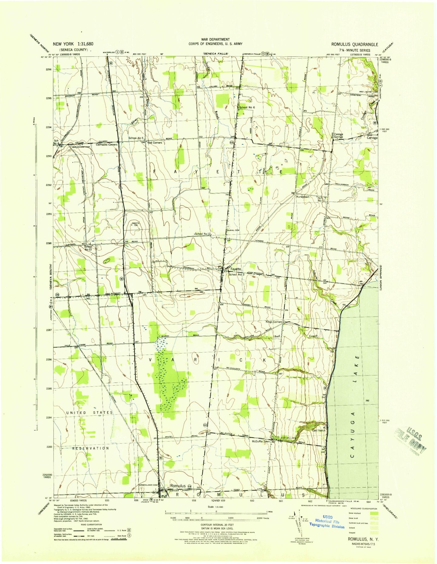
Classic USGS Romulus New York 7.5'x7.5' Topo Map
Couldn't load pickup availability
Historical USGS topographic quad map of Romulus in the state of New York. Map scale may vary for some years, but is generally around 1:24,000. Print size is approximately 24" x 27"
This quadrangle is in the following counties: Seneca.
The map contains contour lines, roads, rivers, towns, and lakes. Printed on high-quality waterproof paper with UV fade-resistant inks, and shipped rolled.
Contains the following named places: Airtrek Airport, Burgh Cemetery, Burroughs Creek, Canoga Cemetery, Canoga Springs, Cassim Farm, Clemsons Corners, Cobblestone Farm Winery And Vineyard, Cranberry Marsh, East Varick, Fayette, Fayette Church Cemetery, Fayette Mennonite Church, Fayette Mennonite School, Fayette Post Office, Fayette Volunteer Fire Department, Goose Watch Winery, Jersalem Cemetery, Kings Corners, Knapp Winery, Kuneytown, Lakeshore Winery, McDonald Farm, McDuffie Town, Mount Green Cemetery, Oak Hill Cemetery, Peterman Farms, Red Creek, Romulus, Romulus Census Designated Place, Romulus Post Office, Romulus Presbytarian Church, Romulus Volunteer Fire Department, Rural Cemetery, School Number 11, School Number 12, School Number 13, School Number 3, School Number 4, School Number 5, School Number 6, Schuyler Creek, Seneca County, Seneca Mennonite Fellowship, Swedish Hill Vineyard, The Church of Jesus Christ of Latter Day Saints, Town of Fayette, Town of Varick, Varick United Methodist Church, WNYR-FM (Waterloo), Yost Corners, ZIP Code: 14541