MyTopo
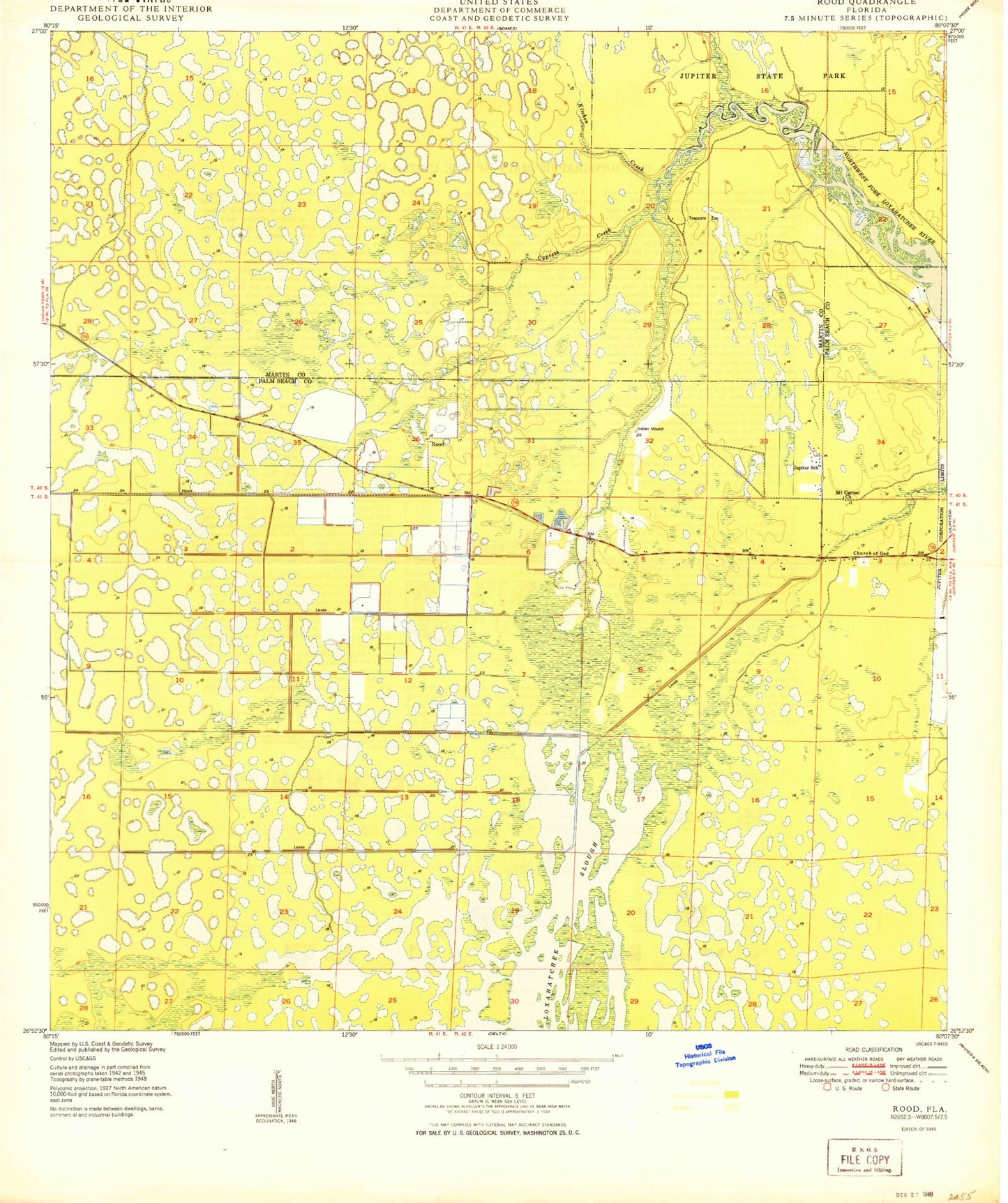
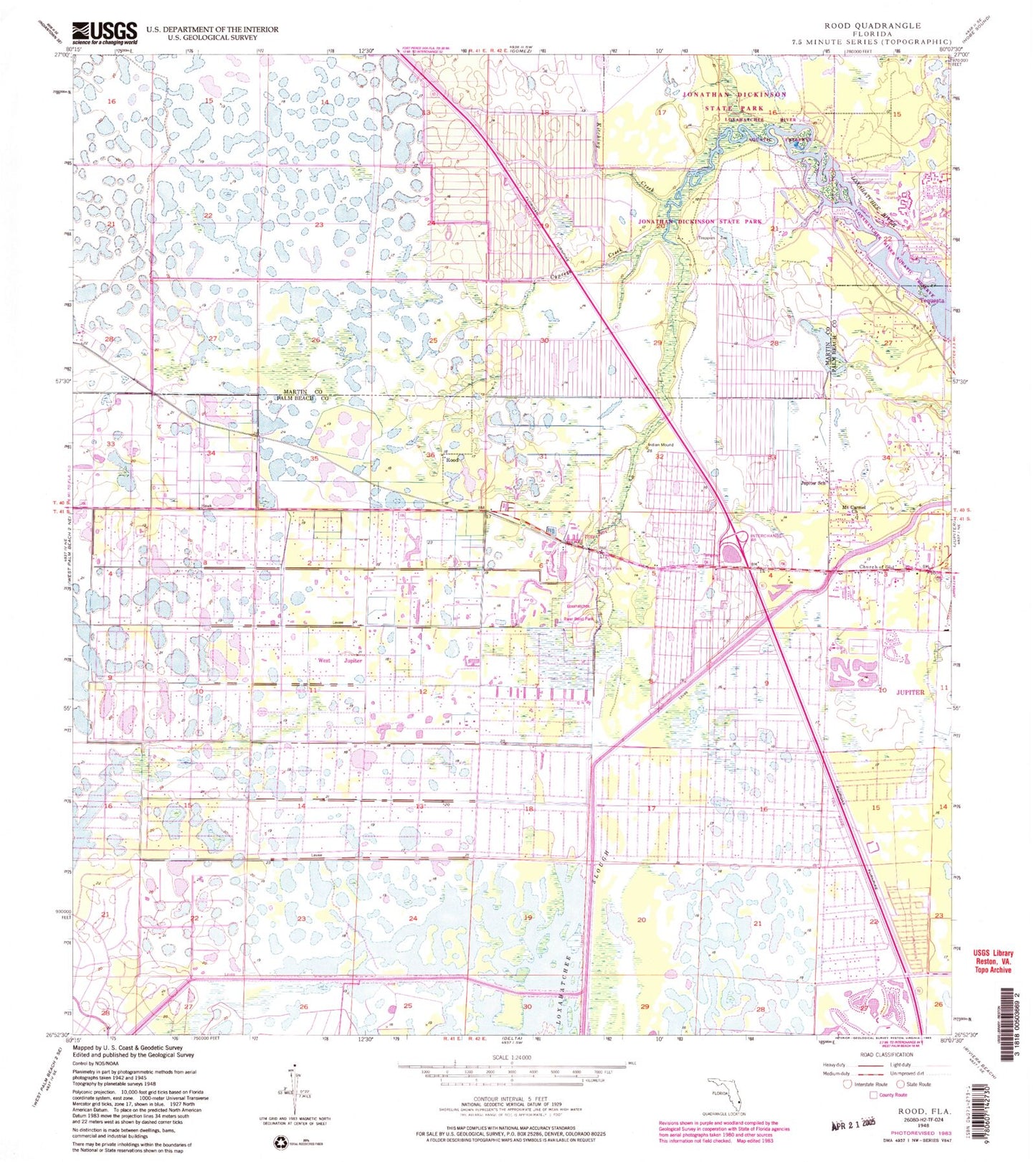
Classic USGS Rood Florida 7.5'x7.5' Topo Map
Couldn't load pickup availability
Historical USGS topographic quad map of Rood in the state of Florida. Typical map scale is 1:24,000, but may vary for certain years, if available. Print size: 24" x 27"
This quadrangle is in the following counties: Martin, Palm Beach.
The map contains contour lines, roads, rivers, towns, and lakes. Printed on high-quality waterproof paper with UV fade-resistant inks, and shipped rolled.
Contains the following named places: Church of God, Cypress Creek, Jupiter School, Kitching Creek, Mount Carmel Church, Trappers Zoo, Rood, North Palm Beach Heights, Loxahatchee River Aquatic Preserve, Tequesta, Loxahatchee River Bend Park, Hungryland Slough Canal, BR Ranch Airport (historical), Flying H Heliport (historical), Tailwinds Airport, Tanah Keeta Scout Reservation, Limestone Creek, West Jupiter, Limestone Creek Elementary School, John D MacArthur Campus, Jupiter Farms Elementary School, Fire Station Number 14, Fire Station Number 19, Palm Beach County Fire Rescue Station 14, Palm Beach County Fire Rescue Department Station 19, Limestone Creek Census Designated Place, Hillsboro Pines Golf Course, Hobe Sound Golf Club, West Jupiter Camping Resort, Jupiter Farms Census Designated Place, Loxahatchee Wild and Scenic River