MyTopo
Classic USGS Roosevelt Creek East North Dakota 7.5'x7.5' Topo Map
Regular price
$16.95
Regular price
Sale price
$16.95
Unit price
per
Couldn't load pickup availability
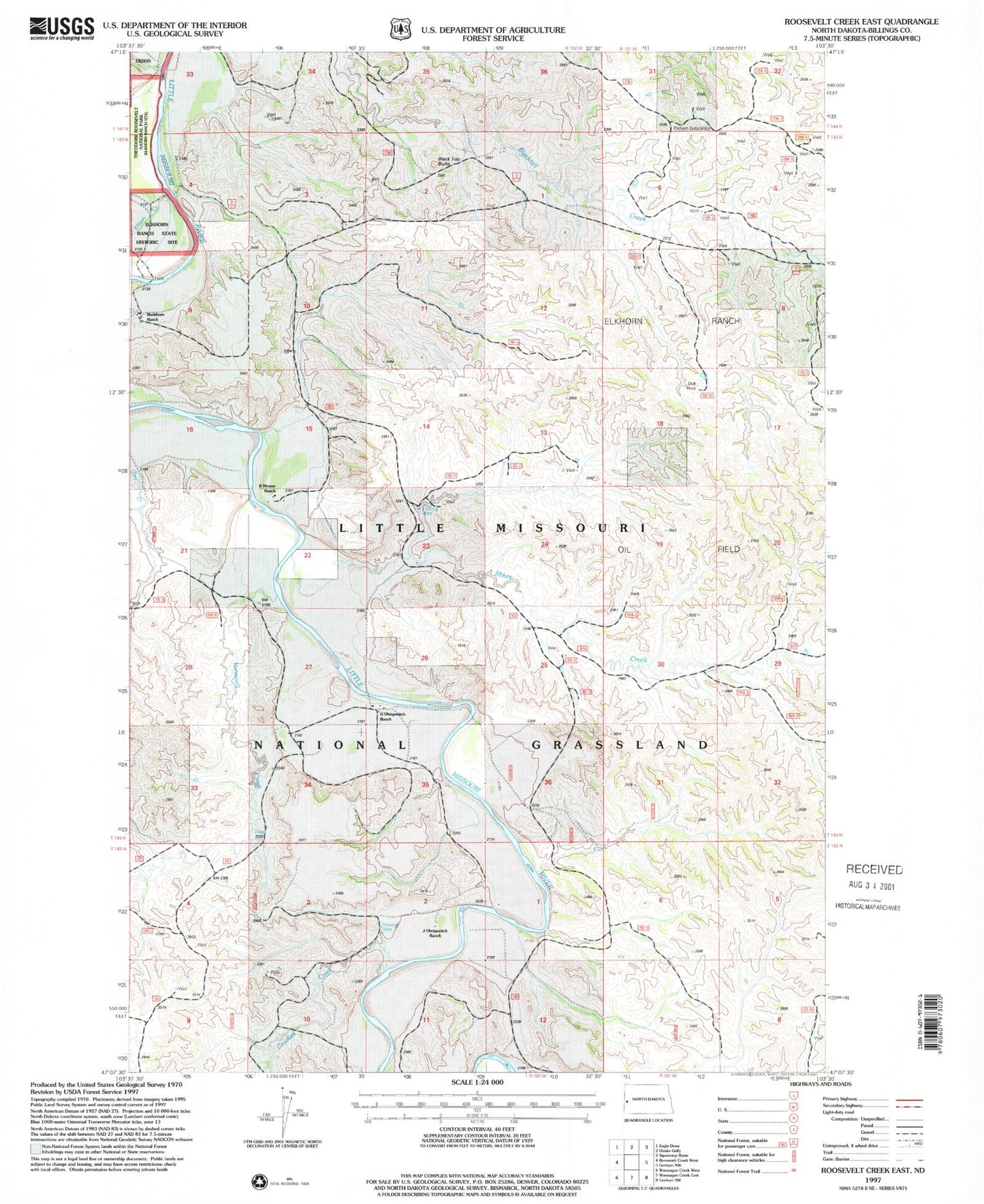
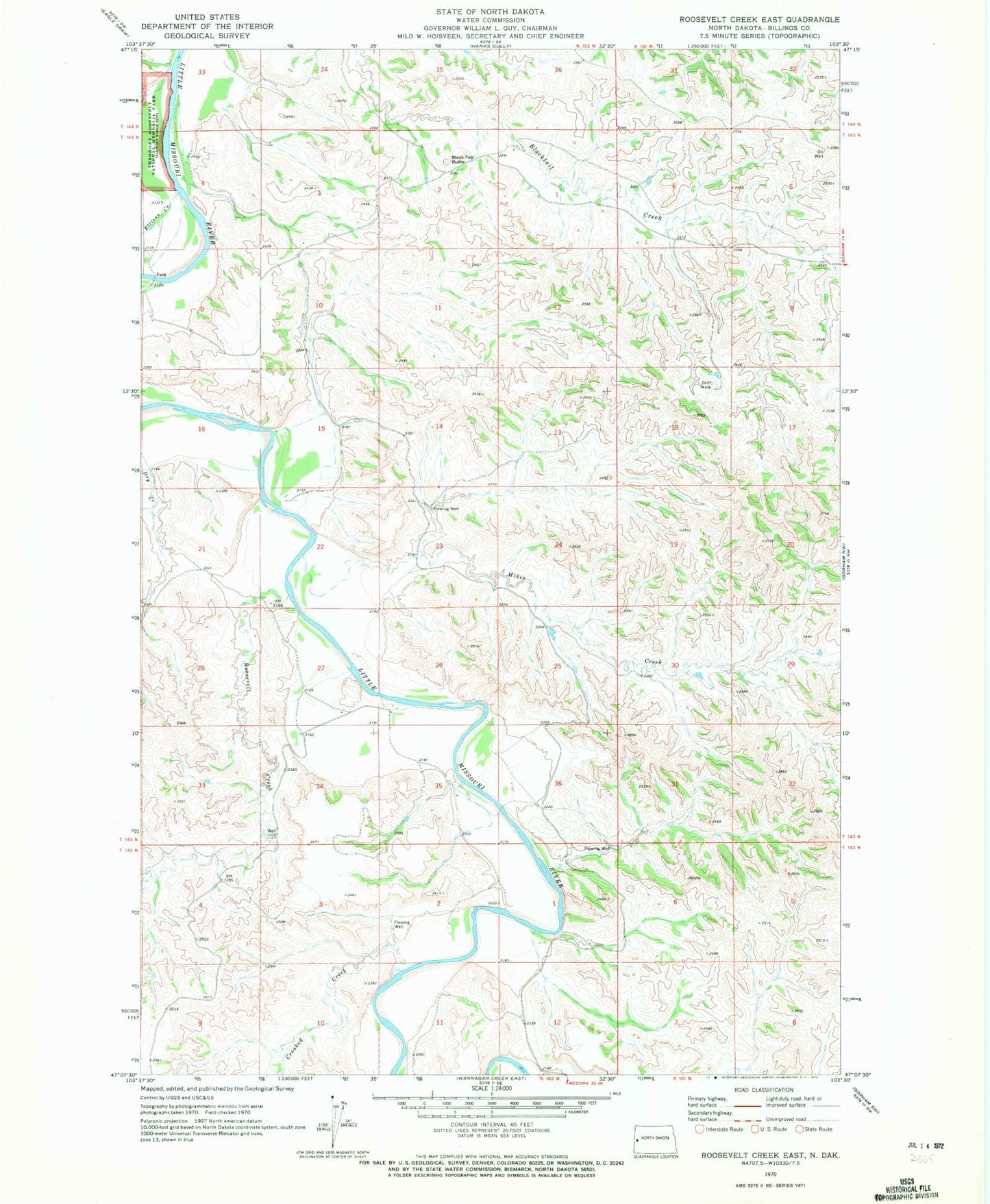
Historical USGS topographic quad map of Roosevelt Creek East in the state of North Dakota. Typical map scale is 1:24,000, but may vary for certain years, if available. Print size: 24" x 27"
This quadrangle is in the following counties: Billings.
The map contains contour lines, roads, rivers, towns, and lakes. Printed on high-quality waterproof paper with UV fade-resistant inks, and shipped rolled.
Contains the following named places: Little Missouri National Grassland, Black Top Butte, Crooked Creek, Ellison Creek, Mikes Creek, Roosevelt Creek, Elkhorn Substation, Badlands Scenic Area, Buckhorn Ranch, Mosser Ranch, Short Ranch