MyTopo
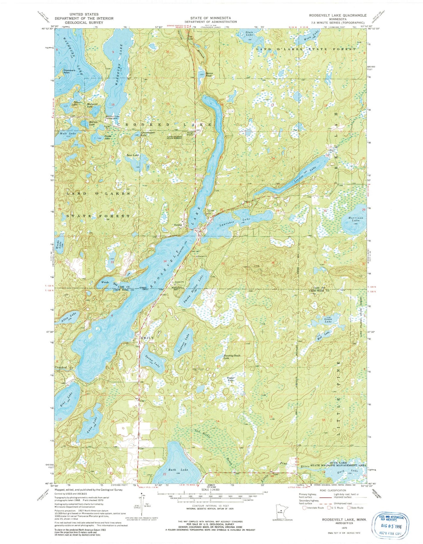
Classic USGS Roosevelt Lake Minnesota 7.5'x7.5' Topo Map
Couldn't load pickup availability
Historical USGS topographic quad map of Roosevelt Lake in the state of Minnesota. Map scale may vary for some years, but is generally around 1:24,000. Print size is approximately 24" x 27"
This quadrangle is in the following counties: Cass, Crow Wing.
The map contains contour lines, roads, rivers, towns, and lakes. Printed on high-quality waterproof paper with UV fade-resistant inks, and shipped rolled.
Contains the following named places: Allen Lake, Anna Lake, Bear Lake, Birch Bay Campground, Blue Lake, City of Emily, Cornerstone Christian School, Crooked Lake Volunteer Fire Department Canister Station, Department of Natural Resources Division of Forestry - Washburn Lake Ranger Station, Donut Lake, Duck Lake, Duck Lake Dam, Duck Lake State Wildlife Management Area, Emily Charter School, Emily Wesleyan Church, Goose Lake, Grasshopper Lake, Hunting Shack Lake, Lawrence Lake, Leavitt Lake, Little Emily Lake, Margaret Lake, Marion Lake, Morrison Lake, Mud Lake, Mule Lake, Outing, Outing Post Office, Outing Wayside Park, Papoose Lake, Plummers Point, Roosevelt Lake, Scout Camp Pond, Smoky Hollow Lake, Snake Lake, Spring Branch, State Lake, Taylor Lake, Thom's Resort and Campground, Township of Crooked Lake, Washburn Lake, Washburn Lake Campground, Woods Bay, Woods Lake, Wren Lake