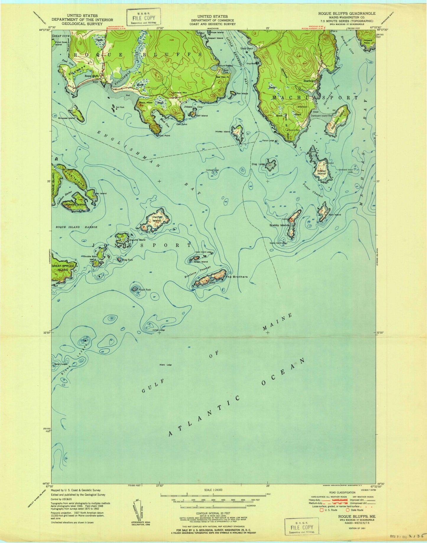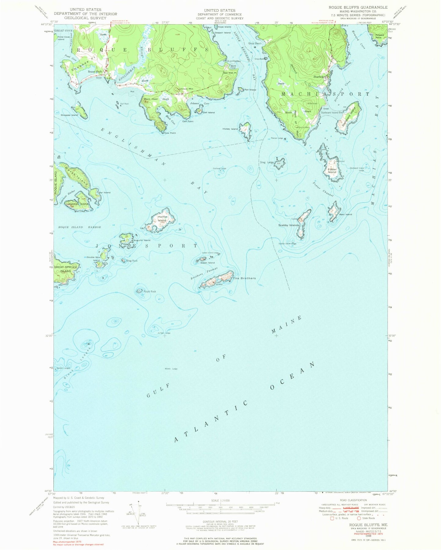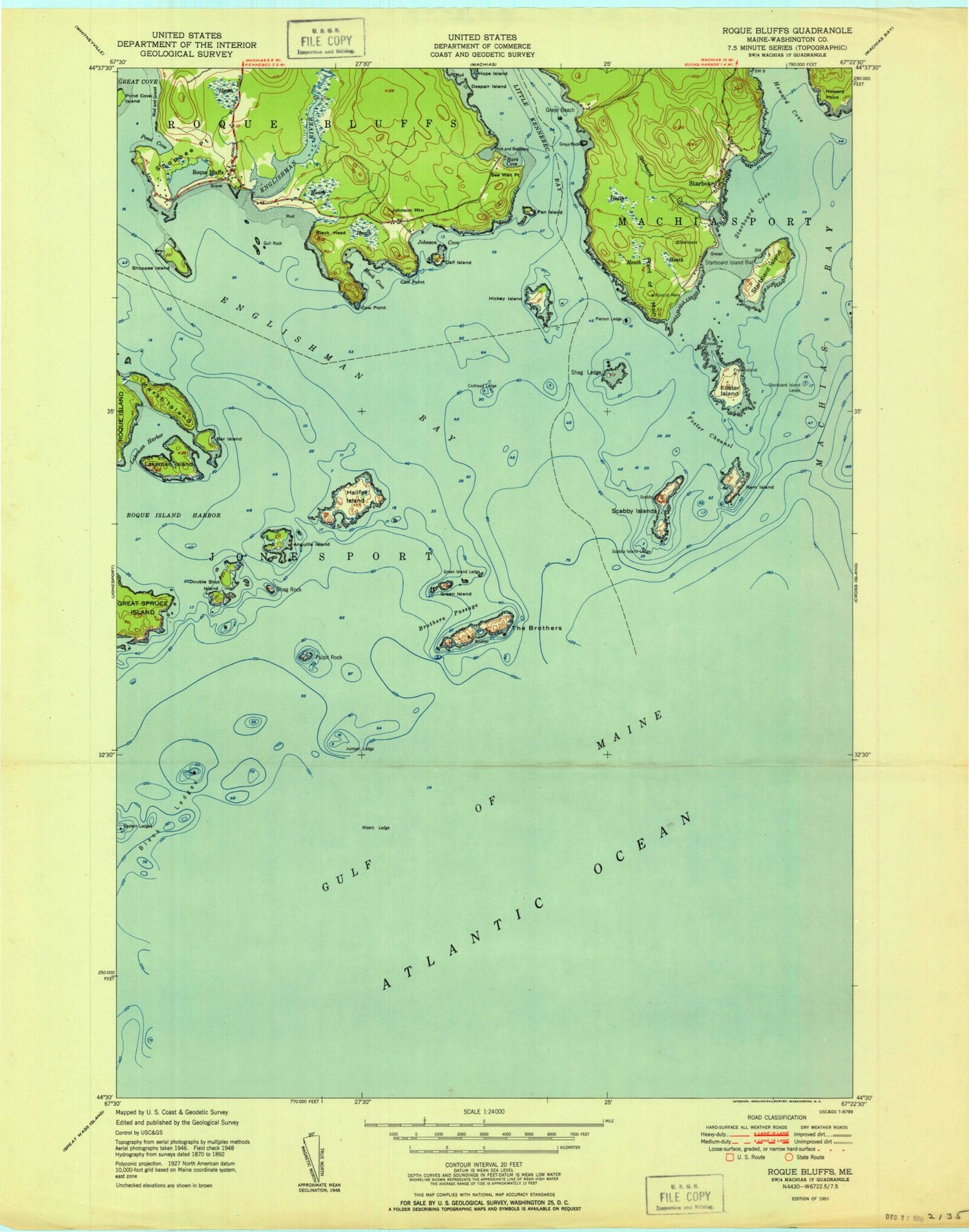

MyTopo
Classic USGS Roque Bluffs Maine 7.5'x7.5' Topo Map
Couldn't load pickup availability
Historical USGS topographic quad map of Roque Bluffs in the state of Maine. Map scale may vary for some years, but is generally around 1:24,000. Print size is approximately 24" x 27"
This quadrangle is in the following counties: Washington.
The map contains contour lines, roads, rivers, towns, and lakes. Printed on high-quality waterproof paper with UV fade-resistant inks, and shipped rolled.
Contains the following named places: Anguilla Island, Bar Island, Bare Cove, Black Head, Brothers Passage, Calf Island, Calf Point, Codhead Ledge, Cow Point, Despair Island, Double Shot Island, East Black Rock, Englishman Bay, Englishman River, Fan Island, Foster Channel, Foster Island, Grays Beach, Grays Rock, Green Island, Green Island Ledge, Gull Rock, Halifax Island, Hickey Island, Howard Cove, Howard Point, Johnson Cove, Johnson Mountain, Jumper Ledge, Lakeman Harbor, Lakeman Island, Mack Cove, Marsh Island, Middle Black Rock, Misery Ledge, Pierson Ledge, Point of Main, Pond Cove, Pulpit Rock, Ram Island, Roque Bluffs, Roque Bluffs Beach, Roque Bluffs State Park, Scabby Island Ledge, Scabby Islands, Sea Wall Point, Shag Ledge, Shag Rock, Shoppee Island, Shoppee Point, Simpson Pond, Starboard, Starboard Cove, Starboard Creek, Starboard Island, Starboard Island Bar, Starboard Island Ledge, The Biscuit, The Black Rocks, The Brothers, Town of Roque Bluffs, ZIP Code: 04649