MyTopo
Classic USGS Rosalia Kansas 7.5'x7.5' Topo Map
Couldn't load pickup availability
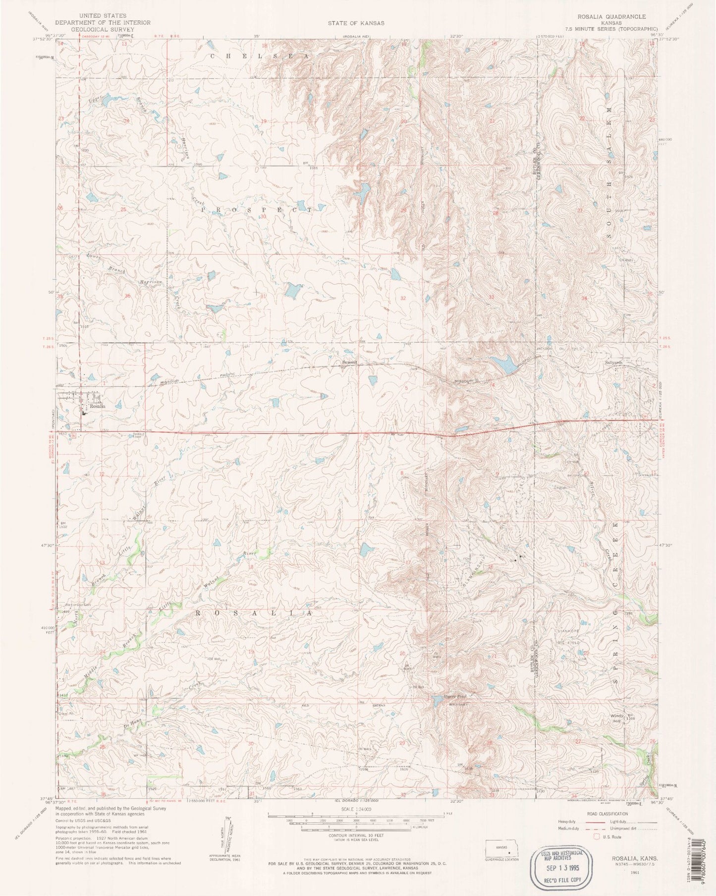
Historical USGS topographic quad map of Rosalia in the state of Kansas. Map scale may vary for some years, but is generally around 1:24,000. Print size is approximately 24" x 27"
This quadrangle is in the following counties: Butler, Greenwood.
The map contains contour lines, roads, rivers, towns, and lakes. Printed on high-quality waterproof paper with UV fade-resistant inks, and shipped rolled.
Contains the following named places: Blankenship Oil Field, Blankinship Cemetery, Butler County Fire District 5 Rosalia, Flinthills Intermediate School, Flinthills Middle / High School, Flinthills Middle School / High School, Jackson Oil Field, Rogers Pond, Rosalia, Rosalia Post Office, Rosalia United Methodist Church, Sallyards, Stanhope Oil Field, Summit, Township of Rosalia, Windy Hill, ZIP Code: 67132