MyTopo
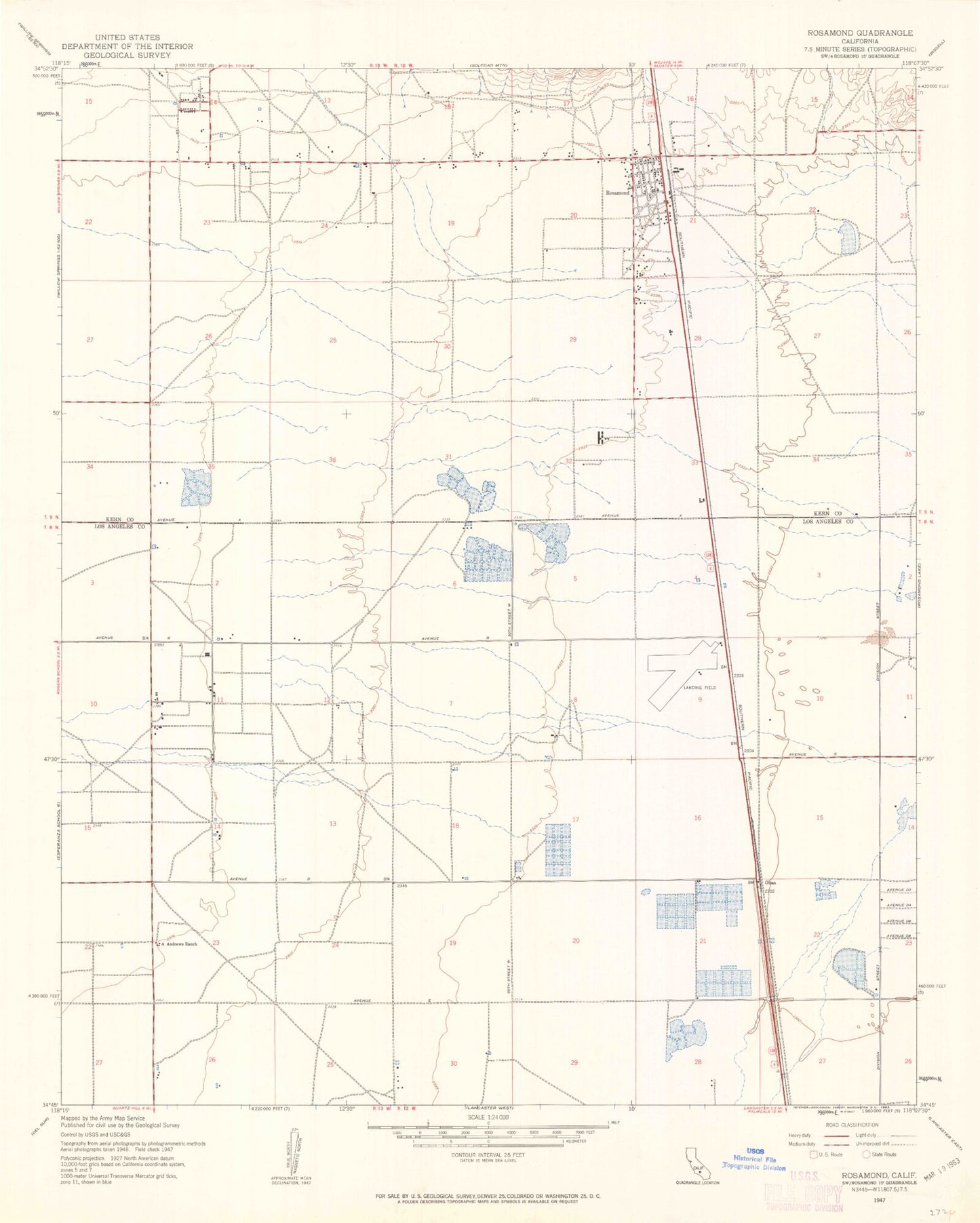
Classic USGS Rosamond California 7.5'x7.5' Topo Map
Couldn't load pickup availability
Historical USGS topographic quad map of Rosamond in the state of California. Map scale may vary for some years, but is generally around 1:24,000. Print size is approximately 24" x 27"
This quadrangle is in the following counties: Kern, Los Angeles.
The map contains contour lines, roads, rivers, towns, and lakes. Printed on high-quality waterproof paper with UV fade-resistant inks, and shipped rolled.
Contains the following named places: A Andrews Ranch, Amargosa Creek, Assembly of God Church, Avenue E Trailer Park, Clarke Club, First Southern Baptist Church, Gaskill Ranch, Glendale Rod and Gun Club, Hamilton Elementary School, Hoffman Club, Hummel Hall, KAVC-FM (Rosamond), KAVR-AM (Rosamond), Kern County Fire Department Station 15 Rosamond, Kern County Sheriff's Department, Kern County Union School, Lancaster Water Reclamation Plant, Liberty Flying School, New Life Church of God in Christ, Oban, Rainbow Farms, Rosamond, Rosamond Branch Kern County Library, Rosamond Census Designated Place, Rosamond Chamber of Commerce, Rosamond Christian School, Rosamond High School, Rosamond Park, Rosamond Post Office, Rosamond Skypark, Saint Mary of the Desert Church, Tropico Middle School, Wayside Chapel Community Church, Willow Springs Church