MyTopo
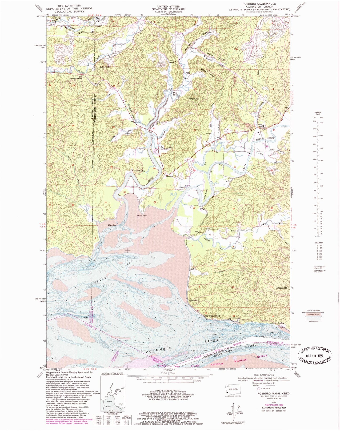
Classic USGS Rosburg Washington 7.5'x7.5' Topo Map
Couldn't load pickup availability
Historical USGS topographic quad map of Rosburg in the states of Washington, Oregon. Map scale may vary for some years, but is generally around 1:24,000. Print size is approximately 24" x 27"
This quadrangle is in the following counties: Clatsop, Pacific, Wahkiakum.
The map contains contour lines, roads, rivers, towns, and lakes. Printed on high-quality waterproof paper with UV fade-resistant inks, and shipped rolled.
Contains the following named places: Altoona, Altoona Hill, Brix Bay, Camp Brix, Campbell Creek, Cannery Light, Carlson Landing, Crooked Creek, Deep River, Deep River Census Designated Place, Devils Elbow, Eden, Eden Valley, Empi Creek, Frank Born Creek, Grays Bay, Grays Bay Light, Grays River, Grays River Valley Middle School, Halaya Slough, Harrington Point, Heldt Creek, Hendrickson Canyon, Hendrickson Creek, Hitchcock Creek, Johnson Canyon, Johnson Ranch, Lassila Creek, Malone Creek, Miller Point, Miller Sands Range, Nikka Creek, Old Camp Brix, Oneida, Person Creek, Pigeon Bluff, Rangila Hill, Rangila Slough, Rocky Point, Rocky Point Light, Rosburg, Rosburg Cemetery, Rosburg Census Designated Place, Rosburg Community Hall, Rosburg Post Office, Salme Creek, Salme Hill, Seal Creek, Seal Slough, Sisson Creek, South Creek, Svensens Landing, Upper Salmon Junction, Wahkiakum Fire District 3 Station 2, Wilcox Canyon, Wilme Slough, Yellow Bluff