MyTopo
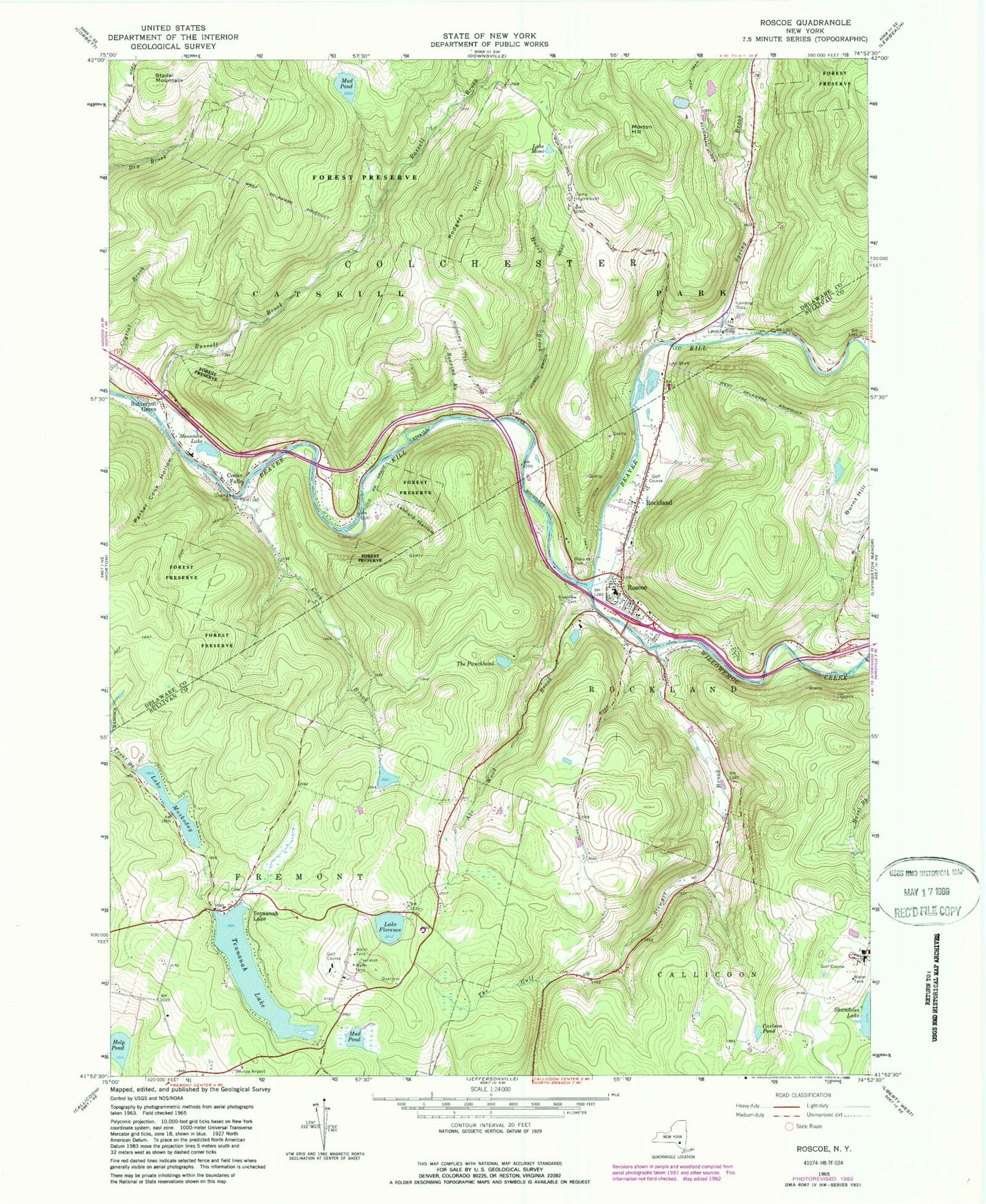
Classic USGS Roscoe New York 7.5'x7.5' Topo Map
Couldn't load pickup availability
Historical USGS topographic quad map of Roscoe in the state of New York. Typical map scale is 1:24,000, but may vary for certain years, if available. Print size: 24" x 27"
This quadrangle is in the following counties: Delaware, Sullivan.
The map contains contour lines, roads, rivers, towns, and lakes. Printed on high-quality waterproof paper with UV fade-resistant inks, and shipped rolled.
Contains the following named places: Abe Wood Brook, Bon Air Cemetery, Butternut Grove, Camp Highmount, Carlson Pond, Cook Brook, Cooks Falls, Cooks Hollow, Lake Florence, Holp Pond, Horse Brook, Lanfield Hollow, Lake Mimi, Morton Hill, Mountain Lake, Mud Pond, Mud Pond, Lake Muskoday, Parker Cook Hollow, Riverview Cemetery, Roaring Brook, Rockland, Rodgers Hill, Roscoe, Russell Brook, Spring Brook, Stadel Mountain, Stewart Brook, Tennanah Lake, Tennanah Lake, The Punchbowl, Willowemoc Creek, James Carl Memorial Heliport, Skytop Airport (historical), Roscoe Census Designated Place, Bendo Bridge, Beaverkill Road Bridge, Roscoe Campsites, Tennanah Lake Golf and Tennis Club, Twin Village Golf Club, Roscoe Free Library, Rockland - Roscoe Volunteer Ambulance Corps, Roscoe - Rockland Volunteer Fire Department Station 2, Cooks Falls Fire Company, Roscoe - Rockland Volunteer Fire Department Station 1, Agloe (not official), Roscoe Post Office, Cooks Falls Cemetery