MyTopo
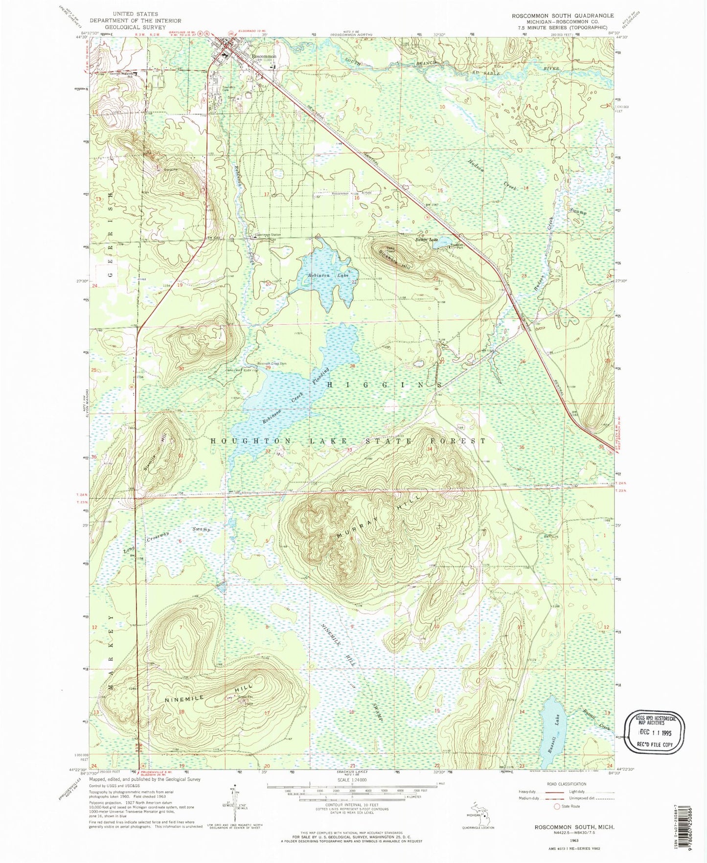
Classic USGS Roscommon South Michigan 7.5'x7.5' Topo Map
Couldn't load pickup availability
Historical USGS topographic quad map of Roscommon South in the state of Michigan. Map scale may vary for some years, but is generally around 1:24,000. Print size is approximately 24" x 27"
This quadrangle is in the following counties: Roscommon.
The map contains contour lines, roads, rivers, towns, and lakes. Printed on high-quality waterproof paper with UV fade-resistant inks, and shipped rolled.
Contains the following named places: Bambi Lake, First Congregational Church, Gerrish Higgins School, Higgins Township Cemetery, Higgins Township Fire Department - Emergency Medical Services, Higgins Township Hall, Hudson Creek Swamp, Long Crossway Swamp, Marguerite Gahagan Nature Preserve, Mercy Family Care Roscommon, Michigan Department of Natural Resources Forest Mineral And Fire Management Division, Mid Michigan Medical Offices, Moore Station, Murray Hill, Nine Mile Hill Rest Area, Ninemile Hill, Ninemile Hill Swamp, Pioneer House Historical Marker, Robinson Creek, Robinson Creek Dam, Robinson Creek Flooding, Robinson Lake, Roscommon, Roscommon Area Historical Society Museum, Roscommon Baptist Church, Roscommon Conservation Airport, Roscommon County Courthouse, Roscommon County Sheriff's Office, Roscommon Post Office, Roscommon Station, Roscommon Village Hall, Roscommon Walk-In Medical Clinic, Russell Lake, Saint Martin Lutheran Church, Sinkhole Hill, Sixmile Hill, Soul's Harbor Worship Center, Terney House Historical Marker, Township of Higgins, Village of Roscommon, ZIP Code: 48653