MyTopo
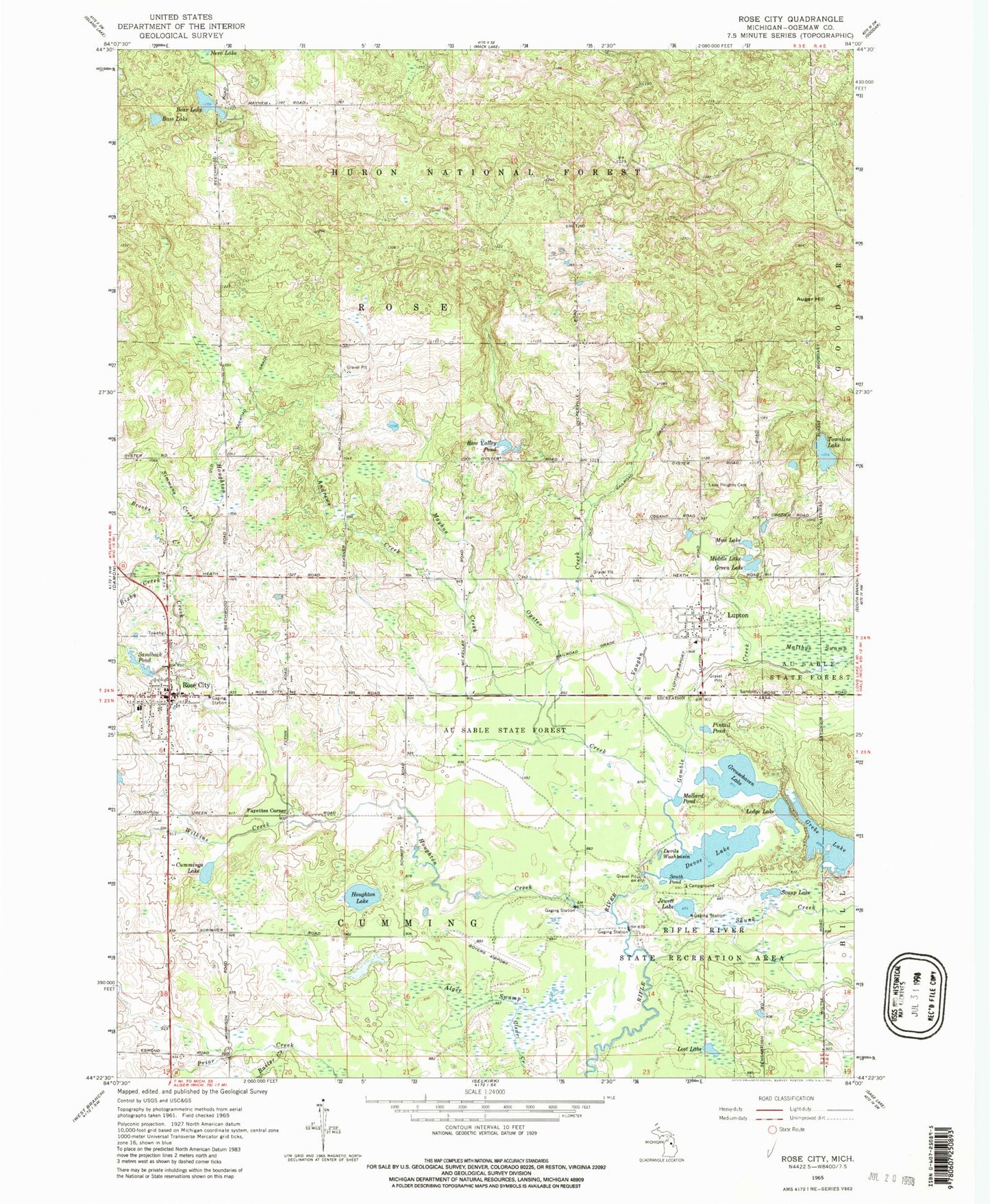
Classic USGS Rose City Michigan 7.5'x7.5' Topo Map
Couldn't load pickup availability
Historical USGS topographic quad map of Rose City in the state of Michigan. Typical map scale is 1:24,000, but may vary for certain years, if available. Print size: 24" x 27"
This quadrangle is in the following counties: Ogemaw.
The map contains contour lines, roads, rivers, towns, and lakes. Printed on high-quality waterproof paper with UV fade-resistant inks, and shipped rolled.
Contains the following named places: Rose City, Alger Swamp, Andrews Creek, Auger Hill, Bailer Creek, Bass Lake, Bear Lake, Bixby Creek, Brooks Creek, Cummings Lake, Devoe Lake, Fayettes Corner, Gamble Creek, Grebe Lake, Green Lake, Grousehaven Lake, Houghton Creek, Eagle Lake, Jewett Lake, Lane Heights Cemetery, Lodge Lake, Lost Lake, Lupton, Mallard Pond, Mayhue Creek, Middle Lake, Mud Lake, Oyster Creek, Pintail Pond, Rifle River State Recreation Area, Rose Valley Pond, Sandback Pond, Scaup Lake, Simmons Creek, Skunk Creek, South Pond, Townline Lake, Vaughn Creek, Wilkins Creek, Devils Washbasin, Boyer Airport (historical), Township of Cumming, Township of Rose, City of Rose City, Rifle River Ranch Rustic Campground, Rifle River Spruce Rustic Campground, Rifle River Grousehaven Lake Campground, Rifle River Devoe Lake Rustic Campground, Ogemaw District Library, Rose City Post Office, Rose City Police Department, Rose City City Hall, Trinity United Methodist Church, Saint Andrews Episcopal Church, New Hope Baptist Church, Bortz Health Care of Rose City, Rose City Station (historical), Rose City Elementary School, Lupton Station (historical), Bible Baptist Church, Lupton Friends Church, Rose Township Hall, Lupton Post Office, Rose City Cemetery, Rose City Historical Marker, Big Fire Historical Marker, Cleveland Park Pavilion Historical Marker, Rose City Area Fire Department, Lupton Fire Department, Lupton Census Designated Place


