MyTopo
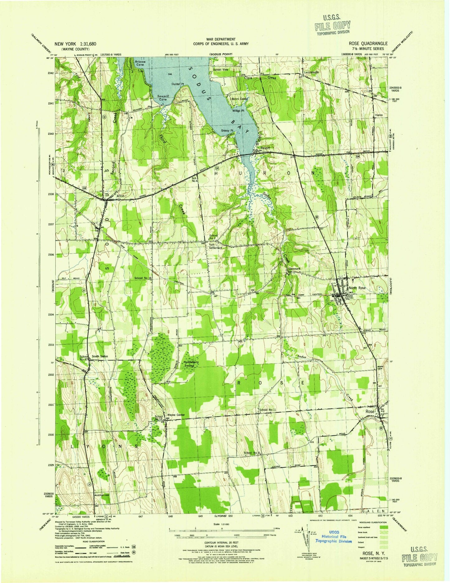
Classic USGS Rose New York 7.5'x7.5' Topo Map
Couldn't load pickup availability
Historical USGS topographic quad map of Rose in the state of New York. Map scale may vary for some years, but is generally around 1:24,000. Print size is approximately 24" x 27"
This quadrangle is in the following counties: Wayne.
The map contains contour lines, roads, rivers, towns, and lakes. Printed on high-quality waterproof paper with UV fade-resistant inks, and shipped rolled.
Contains the following named places: Alasa Farms, Alton, Alton Cemetery, Alton Fire Department, Alton Mobile Home Park, Alton Post Office, Alton United Methodist Church, Barton Cemetery, Bonni Castle, Briscoe Cove, Clark Creek, Farnsworths Air Strip, Free Methodist Church, Glenmark, Grassy Point, Huckleberry Swamp, Huron, Huron Presbyterian Church, Lummisville, Nicholas Point, North Rose, North Rose Cemetery, North Rose Census Designated Place, North Rose Elementary School, North Rose Post Office, North Rose Volunteer Fire Department, Resort, Rockland Orchards Farm, Rose, Rose Cemetery, Rose Free Library, Rose Post Office, Rose United Methodist Church, Rose Valley Farm, Rose Volunteer Fire Company, Rosedale Farm, Sawmill Cove, School Number 10, School Number 11, School Number 12, School Number 16, School Number 2, School Number 4, School Number 8, Second Creek, Sodus Bay Heights Golf Club, Sodus Creek, South Sodus, South Sodus Cemetery, Sunset View, Third Creek, Town of Huron, Town of Rose, Wayne Center, Willigs Point, York, York Settlement Cemetery, ZIP Code: 14516