MyTopo
Classic USGS Rosebud Buttes Montana 7.5'x7.5' Topo Map
Regular price
$16.95
Regular price
Sale price
$16.95
Unit price
per
Couldn't load pickup availability
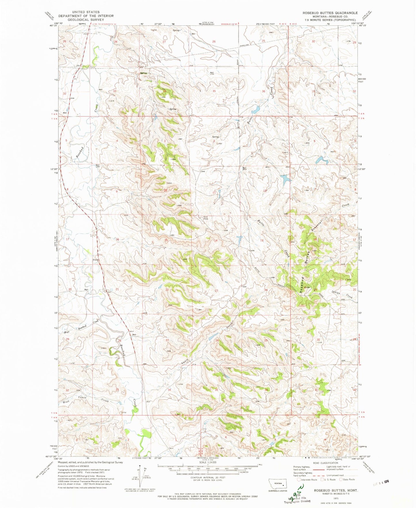
Historical USGS topographic quad map of Rosebud Buttes in the state of Montana. Map scale may vary for some years, but is generally around 1:24,000. Print size is approximately 24" x 27"
This quadrangle is in the following counties: Rosebud.
The map contains contour lines, roads, rivers, towns, and lakes. Printed on high-quality waterproof paper with UV fade-resistant inks, and shipped rolled.
Contains the following named places: 05N42E09CCBC01 Well, 05N42E12BBBD01 Well, 06N42E28BCAC01 Well, 06N42E32DCBD01 Well, KIKC-FM (Forsyth), Langohr Number 1 Dam, Montana Number 9 Dam, Peterson Reservoir Dam, Pleasant Hill School, Rosebud Buttes, Vance Creek, West Rosebud Creek, West Vance Creek