MyTopo
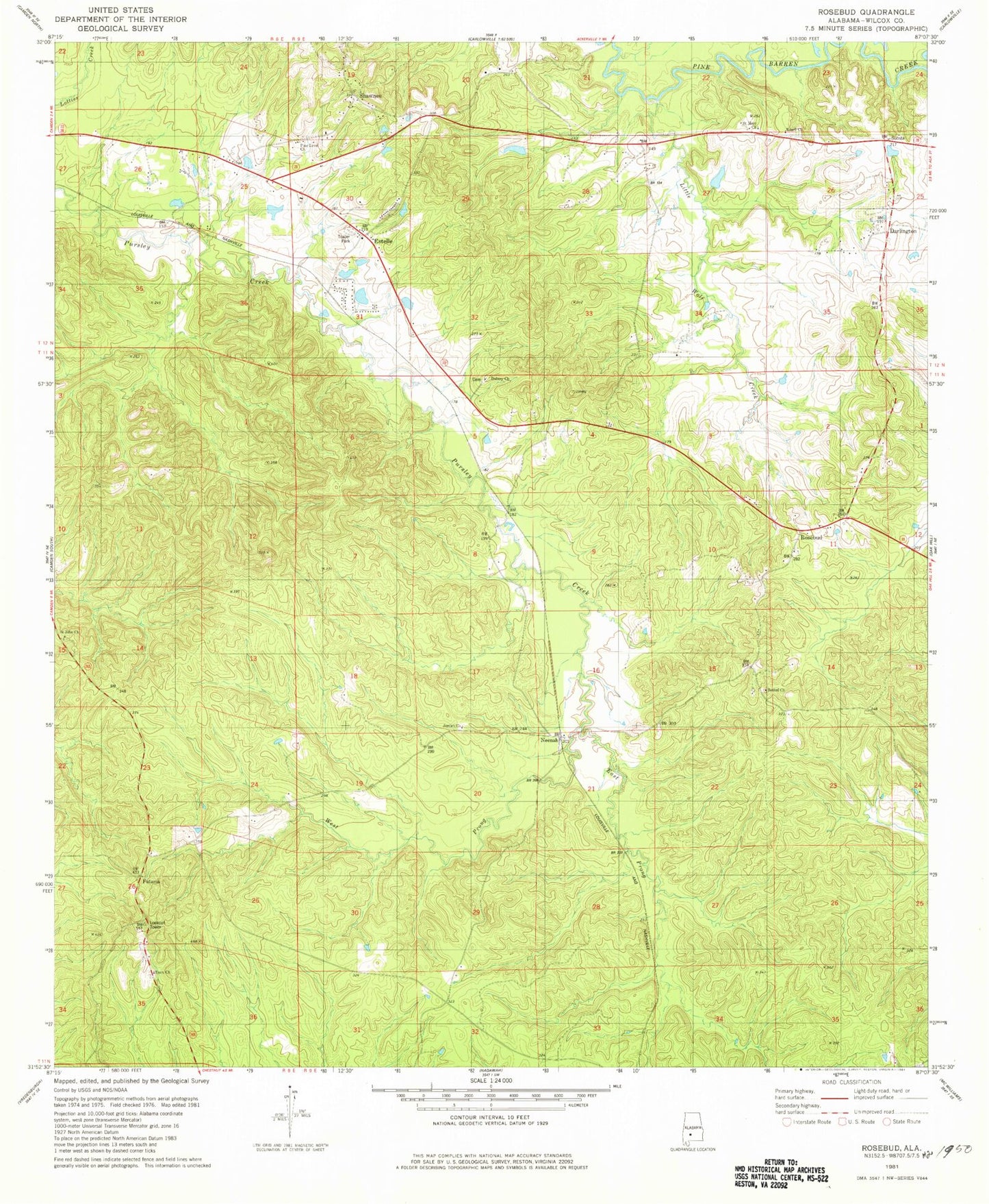
Classic USGS Rosebud Alabama 7.5'x7.5' Topo Map
Couldn't load pickup availability
Historical USGS topographic quad map of Rosebud in the state of Alabama. Map scale may vary for some years, but is generally around 1:24,000. Print size is approximately 24" x 27"
This quadrangle is in the following counties: Wilcox.
The map contains contour lines, roads, rivers, towns, and lakes. Printed on high-quality waterproof paper with UV fade-resistant inks, and shipped rolled.
Contains the following named places: Bethel Church, Darlington, Darlington Post Office, Dulany Church, East Prong Pursley Creek, Enon Church, Estelle, Fatama, Jordan Church, Little Wolf Creek, Neenah, Pine Level Church, Rosebud, Rosebud School, Saint John Church, Saint Mary Church, Second Baptist Church, Shawnee, Shelter Church, West Prong Pursley Creek