MyTopo
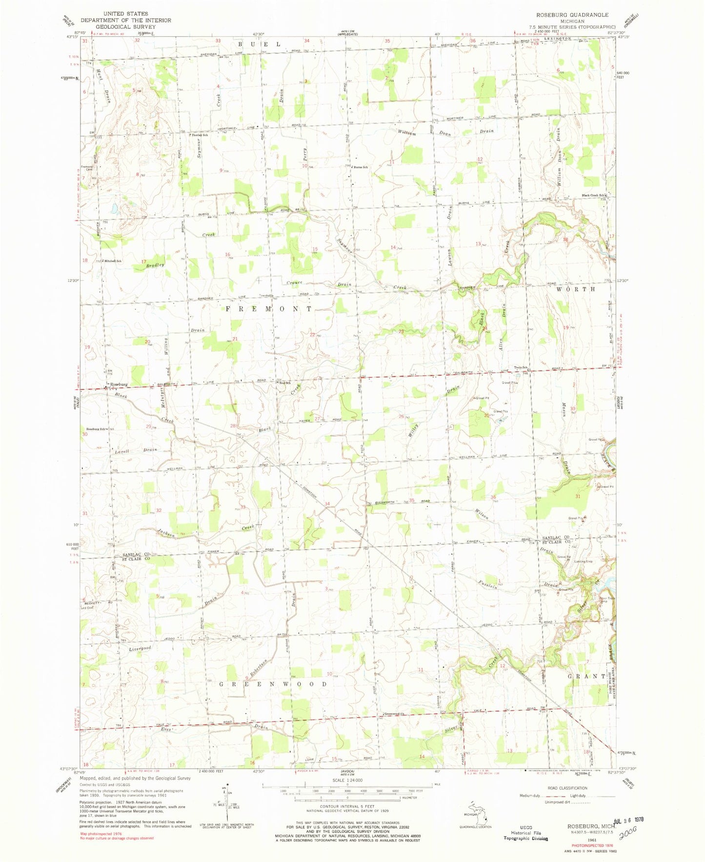
Classic USGS Roseburg Michigan 7.5'x7.5' Topo Map
Couldn't load pickup availability
Historical USGS topographic quad map of Roseburg in the state of Michigan. Map scale may vary for some years, but is generally around 1:24,000. Print size is approximately 24" x 27"
This quadrangle is in the following counties: Sanilac, St. Clair.
The map contains contour lines, roads, rivers, towns, and lakes. Printed on high-quality waterproof paper with UV fade-resistant inks, and shipped rolled.
Contains the following named places: Allen Drain, Bethel Missionary Church, Black Creek School, Bradley Creek, Burns School, Crouce Drain, East Fremont Post Office, East Greenwood Post Office, Fremont Cemetery, Fueslein Drain, Greenwood Church, Hunt Drain, Jackson Creek, Kenockee Township Fire Department Station 2, Lavell Drain, Lawson Drain, Lett Cemetery, Livergood Drain, Mason Drain, McIntyre and Willing Drain, Mitchell School, Perry Drain, Red School, Robertson Drain, Roseburg, Roseburg Post Office, Roseburg School, Seymour Creek, Silver Creek, Silver Trails Camp, Teets School, Thorley School, Township of Fremont, Willey Drain, William Doan Drain, Wilson Drain