MyTopo
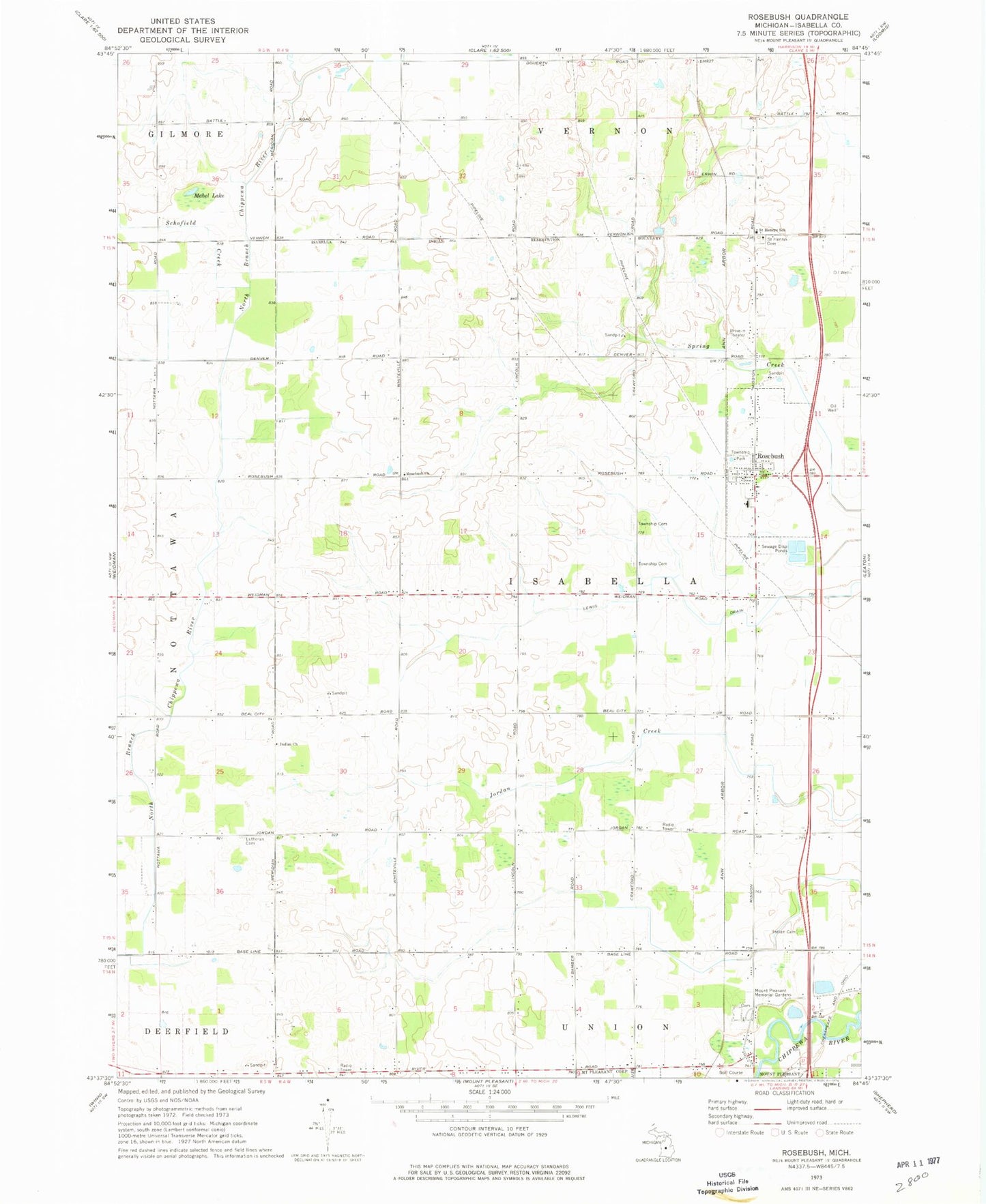
Classic USGS Rosebush Michigan 7.5'x7.5' Topo Map
Couldn't load pickup availability
Historical USGS topographic quad map of Rosebush in the state of Michigan. Map scale may vary for some years, but is generally around 1:24,000. Print size is approximately 24" x 27"
This quadrangle is in the following counties: Isabella.
The map contains contour lines, roads, rivers, towns, and lakes. Printed on high-quality waterproof paper with UV fade-resistant inks, and shipped rolled.
Contains the following named places: Baseline Indian Cemetery, Bible Baptist Church of Rosebush, Country Place Park, Indian Church, Isabella County, Isabella County Fairgrounds, Isabella Northeast Fire District, Isabella Reservation, Isabella Township Library, Isabella Township Park, Lewis Drain, Longwood Post Office, Mabel Lake, Mount Pleasant Meadows, Mount Pleasant Memorial Gardens, Oakview Mobile Home Estates, Rosebush, Rosebush Church, Rosebush Elementary School, Rosebush Post Office, Rosebush Presbyterian Church, Rosebush Station, Saint Henrys Catholic Church Cemetery, Saint Henry's Church, Saint Henrys School, Schofield Creek, Township of Isabella, Village of Rosebush, WCFX-FM (Clare), WCZY-FM (Mount Pleasant), Westwinds Mobile Home Park, Whiteville Post Office, Woodland Cemetery, Zion Lutheran Cemetery, ZIP Code: 48878