MyTopo
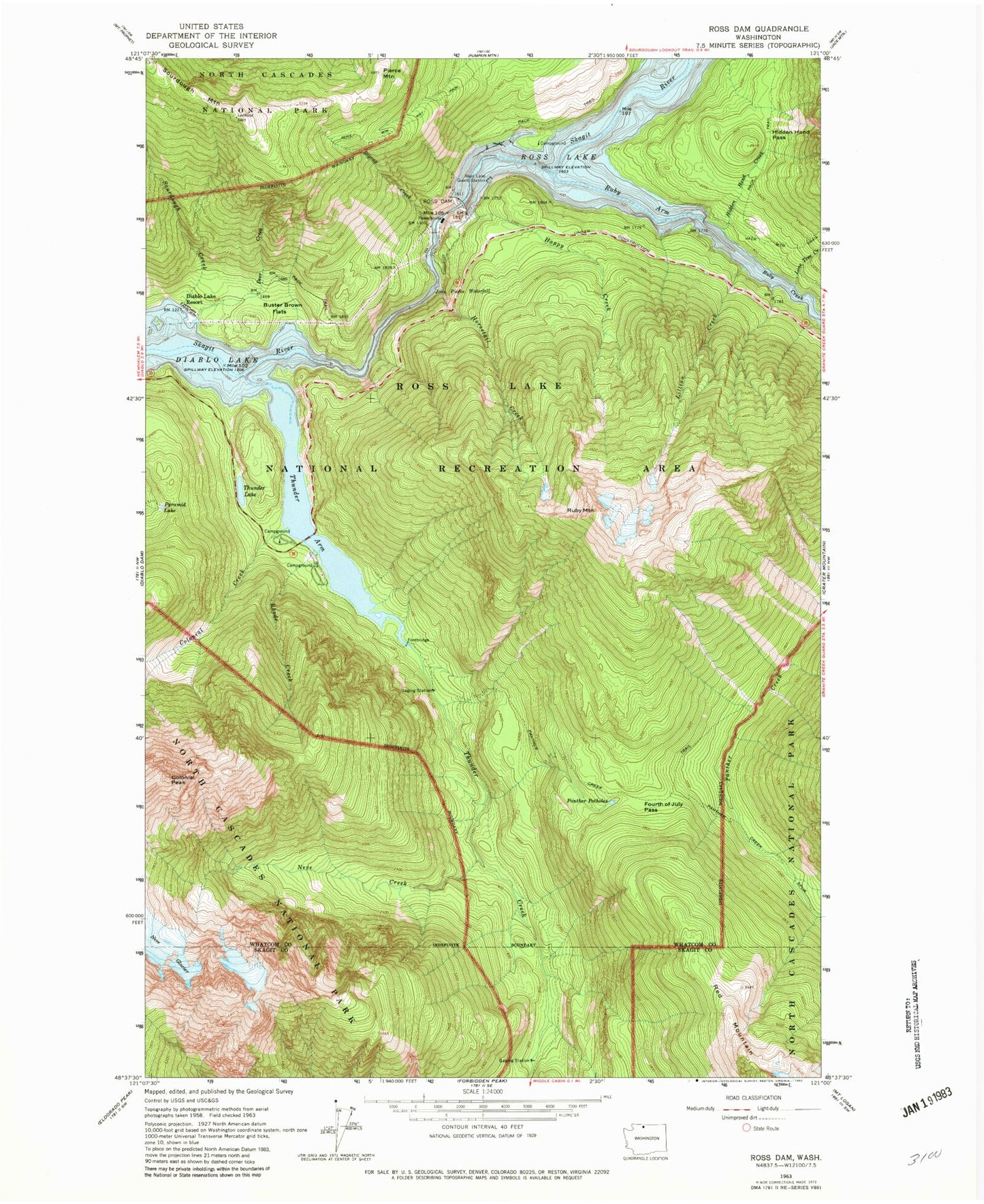
Classic USGS Ross Dam Washington 7.5'x7.5' Topo Map
Couldn't load pickup availability
Historical USGS topographic quad map of Ross Dam in the state of Washington. Typical map scale is 1:24,000, but may vary for certain years, if available. Print size: 24" x 27"
This quadrangle is in the following counties: Skagit, Whatcom.
The map contains contour lines, roads, rivers, towns, and lakes. Printed on high-quality waterproof paper with UV fade-resistant inks, and shipped rolled.
Contains the following named places: Buster Brown Flats, Colonial Creek, Colonial Peak, Deer Creek, Diablo Lake, Fourth of July Pass, Happy Creek, Hidden Hand Creek, Hidden Hand Pass, Horsetail Creek, John Pierce Waterfall, Lillian Creek, Lone Tree Creek, Neve Creek, Panther Creek Spur, Panther Creek Trail, Panther Potholes, Pierce Mountain, Pierce Mountain Way, Pyramid Lake, Rhode Creek, Riprap Creek, Ross Dam, Ross Lake, Ross Lake Guards Station, Ruby Arm, Ruby Mountain, Sourdough Creek, Thunder Arm, Thunder Creek, Thunder Lake, Berry Creek, Colonial Creek Campground, Diable Vista, Ruby Creek Barn and Horse Pasture, Ross Lake Viewpoint, Ross Dam District Ranger Office, Ross Lake Resort, Ruby (historical)