MyTopo
Classic USGS Ross Mountain Alabama 7.5'x7.5' Topo Map
Couldn't load pickup availability
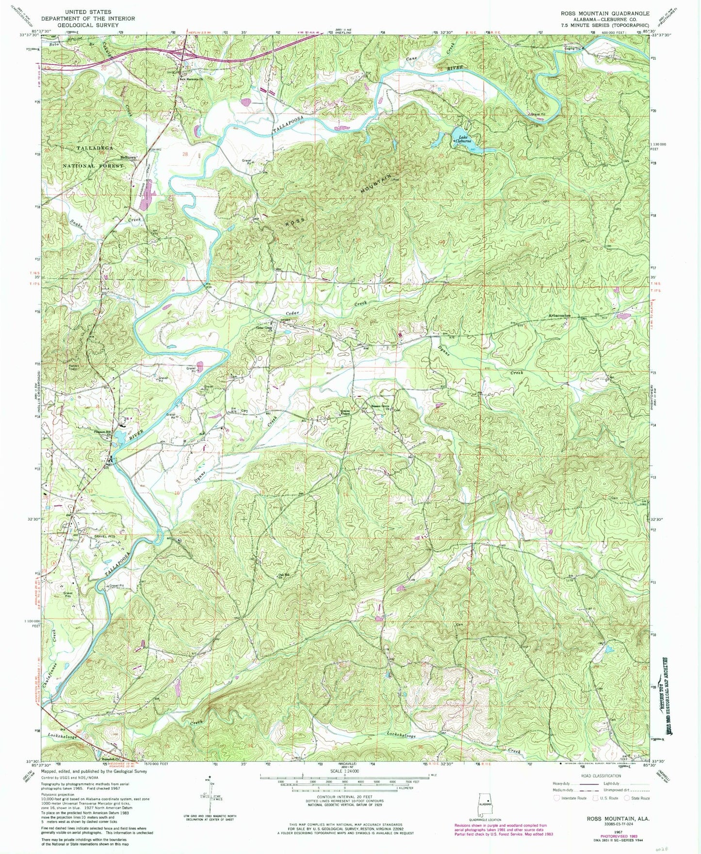
Historical USGS topographic quad map of Ross Mountain in the state of Alabama. Map scale may vary for some years, but is generally around 1:24,000. Print size is approximately 24" x 27"
This quadrangle is in the following counties: Cleburne.
The map contains contour lines, roads, rivers, towns, and lakes. Printed on high-quality waterproof paper with UV fade-resistant inks, and shipped rolled.
Contains the following named places: Arbacoochee, Arbacoochee Lode and Placer Mine, Bald Mountain, Beason Grove Baptist Church, Beason Grove Cemetery, Beason Mill, Belltown, Blake Mountain, Bobo Branch, Cahulga Creek, Cane Creek, Caver Mine, Cedar Creek, Cedar Creek Church, Chulafinnee Creek, Clear Creek, Denman Bridge, Dynne Creek, Endora, Evans Bridge, Evans Cemetery, Flemming Mine, Gold Hill, Greens Chapel, Harmony Grove School, Heflin Division, Hepsabah Cemetery, Hepsabah Church, Howells Grove School, Kemp Mountain, Lake Cleburne, Lake Cleburne Dam, Morris Mine, Mountain Grove Church, Mulkey Prospect, New Harmony Baptist Church Cemetery, New Harmony Church, Oak Hill Church, Oakfuskee, Oakfuskee Post Office, Oswalt, Pleasant Hill Church, Pleasant Hill School, Riddles Bridge, Ross Bridge, Ross Mountain, Sheep Creek, Snake Creek, Teagues Mill, Union Hill School, Vise Grove Church, Woodstock Mine, ZIP Code: 36264