MyTopo
Classic USGS Rosston Indiana 7.5'x7.5' Topo Map
Couldn't load pickup availability
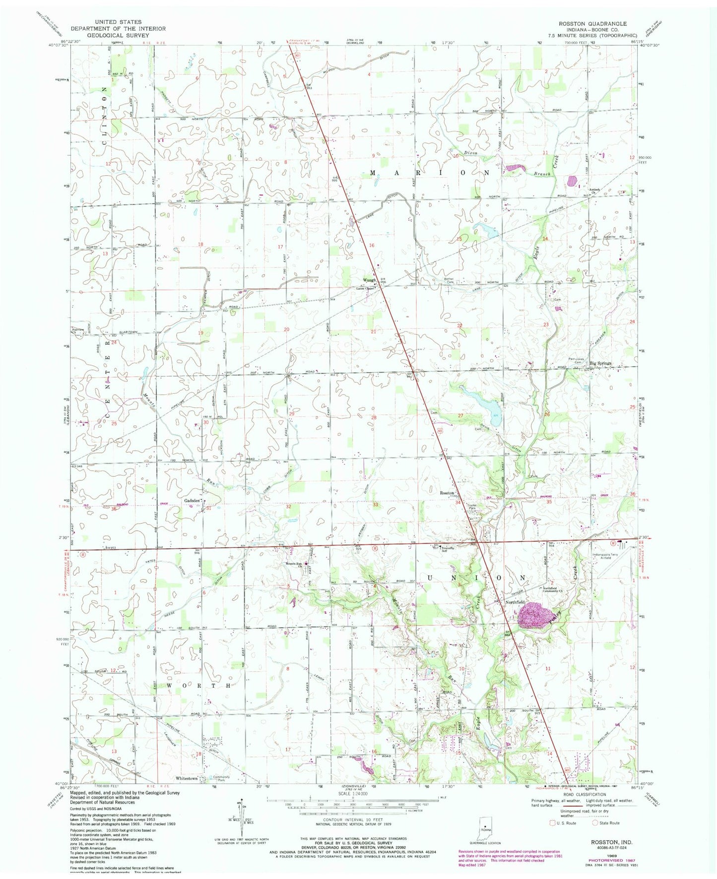
Historical USGS topographic quad map of Rosston in the state of Indiana. Map scale may vary for some years, but is generally around 1:24,000. Print size is approximately 24" x 27"
This quadrangle is in the following counties: Boone.
The map contains contour lines, roads, rivers, towns, and lakes. Printed on high-quality waterproof paper with UV fade-resistant inks, and shipped rolled.
Contains the following named places: Antioch Church, Artman Ditch, Bethel Cemetery, Big Springs, Campbell Ditch, Cobb Ditch, Davis Ditch, Dixon Branch, Fairview Church, Finley Creek, Gadsden, Hickson Ditch, Indianapolis Executive Airport, Jones Greenhouse, Kemper Ditch, Kreager Ditch, Lane Ditch, Lanes Chapel, Laughner Ditch, Lenox Ditch, McCoy Ditch, Mounts Run, Mounts Run Church, Neese Ditch, Northfield, Northfield Community Church, Padgett Ditch, Parr-Jones Cemetery, Rosston, Township of Marion, Township of Union, Township of Worth, Waugh, Wurster Lake, Wurster Lake Dam, Yates Ditch, Zionsville Fire Department Station 92, ZIP Code: 46075