MyTopo
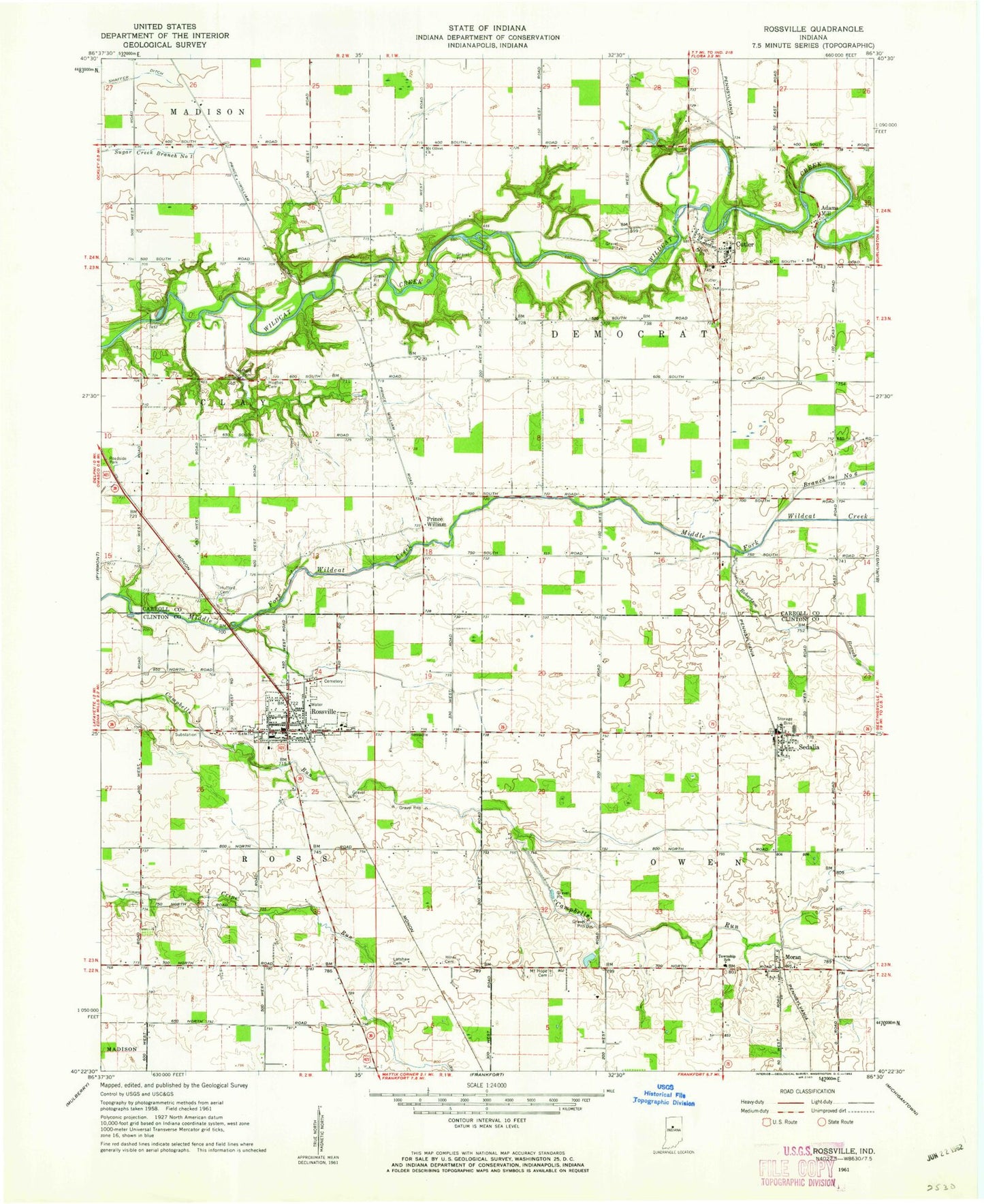
Classic USGS Rossville Indiana 7.5'x7.5' Topo Map
Couldn't load pickup availability
Historical USGS topographic quad map of Rossville in the state of Indiana. Map scale may vary for some years, but is generally around 1:24,000. Print size is approximately 24" x 27"
This quadrangle is in the following counties: Carroll, Clinton.
The map contains contour lines, roads, rivers, towns, and lakes. Printed on high-quality waterproof paper with UV fade-resistant inks, and shipped rolled.
Contains the following named places: Adams Mill, Branch Number Six, Cutler, Cutler Post Office, Gray Field, Hiner Cemetery, Hufford Cemetery, Hughes Cemetery, Latshaw Cemetery, Moran, Mount Hope Cemetery, Mount Olivet Church, Prince William, Ray, Robinson Branch, Rossville, Rossville Cemetery, Rossville Police Department, Rossville Post Office, Rossville Volunteer Ambulance Service, Rossville Volunteer Fire Department, Sedalia, Sedalia Post Office, Shaffer Ditch, Town of Rossville, Township of Democrat, Township of Owen, Township of Ross, Vernon Payne Lake, Vernon Payne Lake Dam, Wagoner Cemetery, WLFI-TV (Lafayette), ZIP Code: 46065