MyTopo
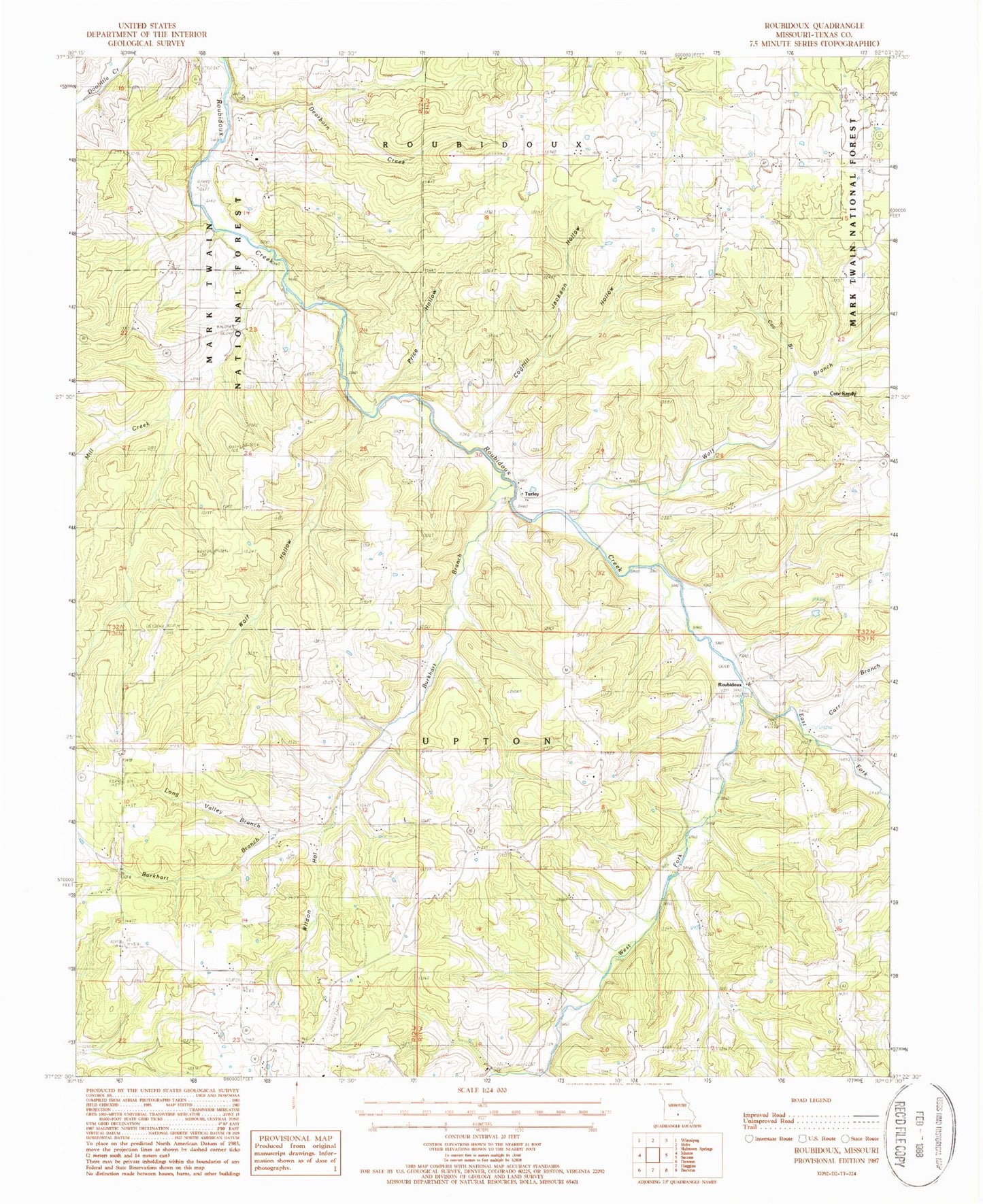
Classic USGS Roubidoux Missouri 7.5'x7.5' Topo Map
Couldn't load pickup availability
Historical USGS topographic quad map of Roubidoux in the state of Missouri. Map scale may vary for some years, but is generally around 1:24,000. Print size is approximately 24" x 27"
This quadrangle is in the following counties: Texas.
The map contains contour lines, roads, rivers, towns, and lakes. Printed on high-quality waterproof paper with UV fade-resistant inks, and shipped rolled.
Contains the following named places: Burkhart Branch, Carr Branch, Coghill Hollow, Cote Sandy, Cov Branch, Dearborn Creek, East Fork Roubidoux Creek, Embree, Embree Post Office, Huggins Volunteer Fire Department Station 2, Jackson Cemetery, Jackson Hollow, Liberty School, Long Valley Branch, Long Valley School, Mill Creek, Mill Creek School, Mount Pisgah Church, Mount Pisgah School, Old Concord Cemetery, Old Union Cemetery, Pegasus Ranch Aerodrome, Plato - Lynch Cemetery, Price Hollow, Roubidoux, Timber Ridge School, Township of Upton, Turley, West Fork Roubidoux Creek, Wilson Hollow, Windy Curve, Wolf Branch, Wolf Hollow