MyTopo
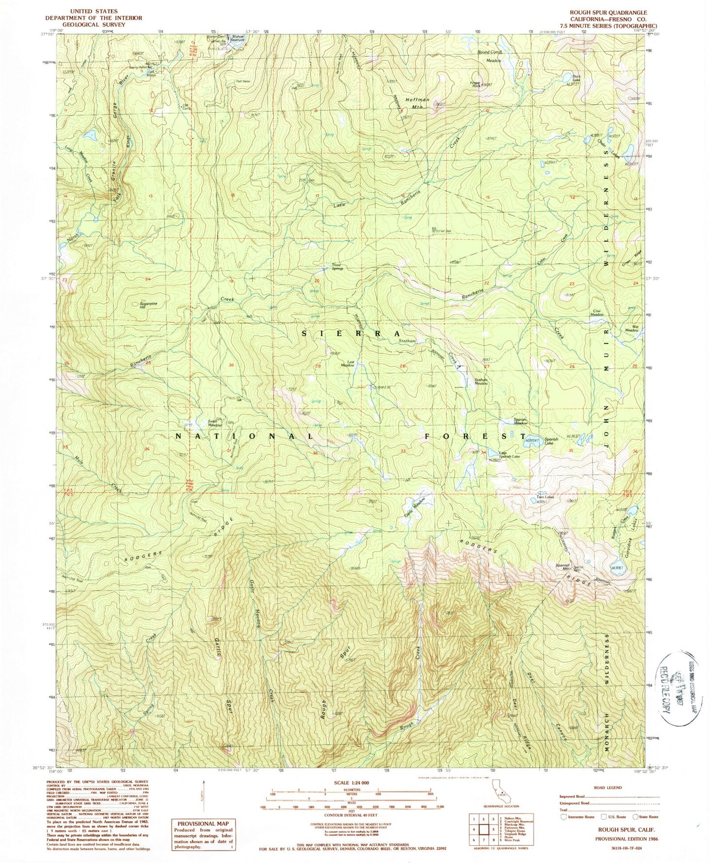
Classic USGS Rough Spur California 7.5'x7.5' Topo Map
Couldn't load pickup availability
Historical USGS topographic quad map of Rough Spur in the state of California. Typical map scale is 1:24,000, but may vary for certain years, if available. Print size: 24" x 27"
This quadrangle is in the following counties: Fresno.
The map contains contour lines, roads, rivers, towns, and lakes. Printed on high-quality waterproof paper with UV fade-resistant inks, and shipped rolled.
Contains the following named places: Cabin Creek, Chain Lakes, Cliff Bridge, Cliff Camp, Cow Meadow, Duck Lake, Finger Rock, Garlic Meadow, Garlic Spur, Geraldine Lakes, Granite Gorge, Hoffman Mountain, Little Rancheria Creek, Little Spanish Lake, Lost Meadow, Rodgers Ridge, Rough Spur, Round Corral Meadow, Smith Meadow, Long Meadow Creek, Spanish Lake, Spanish Meadow, Spanish Mountain, Statham Creek, Statham Meadow, Sugarpine Hill, Three Springs, Twin Lakes, Wet Meadow, Deer Ridge, Statham River, Kings Cavern Geological Area, Cabin Creek, Chain Lakes, Cliff Bridge, Cliff Camp, Cow Meadow, Duck Lake, Finger Rock, Garlic Meadow, Garlic Spur, Geraldine Lakes, Granite Gorge, Hoffman Mountain, Little Rancheria Creek, Little Spanish Lake, Lost Meadow, Rodgers Ridge, Rough Spur, Round Corral Meadow, Smith Meadow, Long Meadow Creek, Spanish Lake, Spanish Meadow, Spanish Mountain, Statham Creek, Statham Meadow, Sugarpine Hill, Three Springs, Twin Lakes, Wet Meadow, Deer Ridge, Statham River, Kings Cavern Geological Area