MyTopo
Classic USGS Round Island Michigan 7.5'x7.5' Topo Map
Couldn't load pickup availability
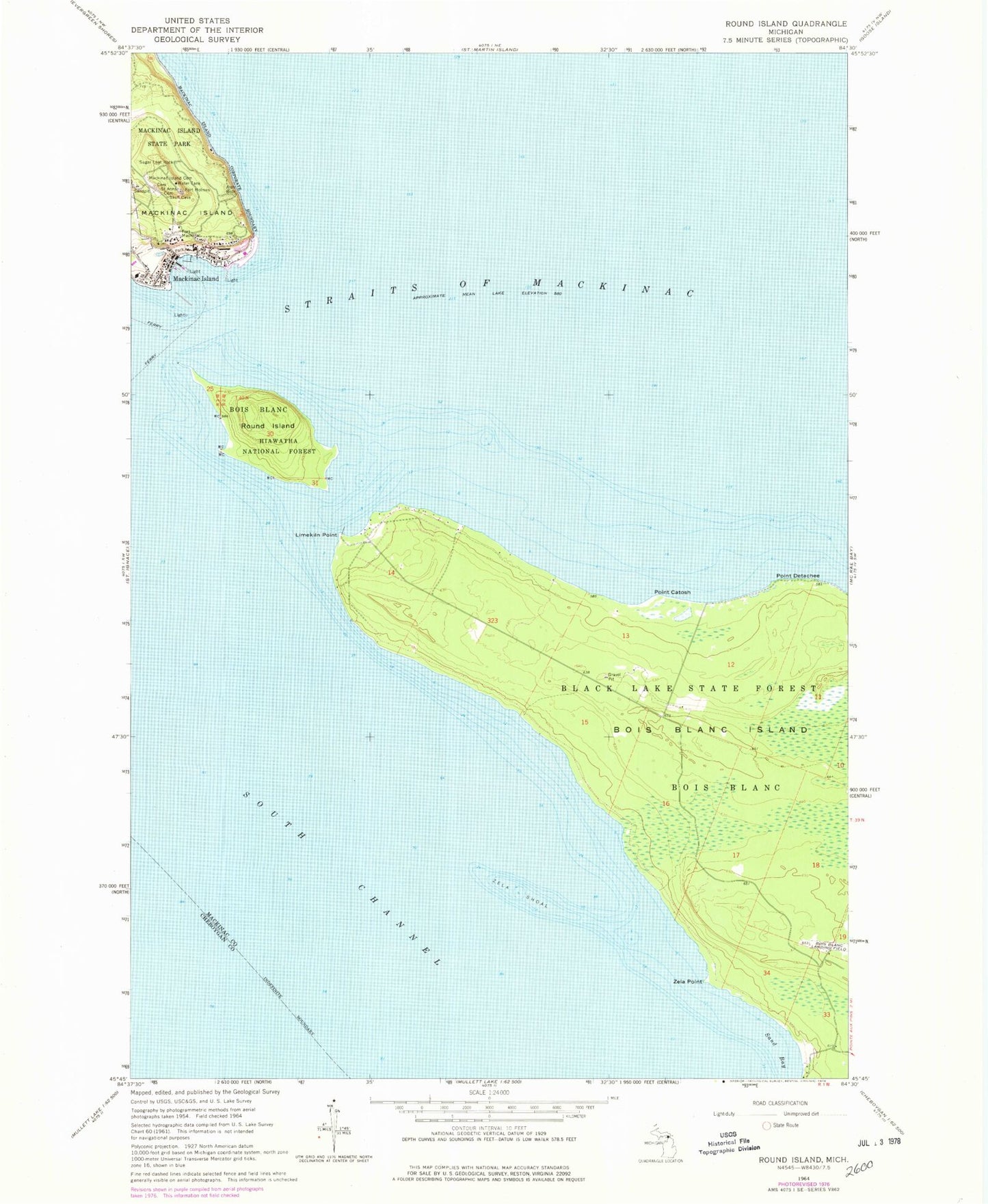
Historical USGS topographic quad map of Round Island in the state of Michigan. Map scale may vary for some years, but is generally around 1:24,000. Print size is approximately 24" x 27"
This quadrangle is in the following counties: Cheboygan, Mackinac.
The map contains contour lines, roads, rivers, towns, and lakes. Printed on high-quality waterproof paper with UV fade-resistant inks, and shipped rolled.
Contains the following named places: American Fur Company Store Historical Marker, Arch Rock, Beaumont Memorial Historical Marker, Biddle Point, Bois Blanc Island Airport, British Cannon Historical Marker, Carver Pond, City of Mackinac Island, Early Missionary Bark Chapel Historical Marker, East Breakwater Light, Fairy Arch, Fort Holmes, Fort Holmes Historical Marker, Fort Mackinac, Fort Mackinac Post Cemetery, Great Turtle Park, Greens of Mackinac, Haldimand Bay, Hanks Pond, Hennepin Point, Historic Fort Mackinac Historical Marker, Indian Dormitory Historical Marker, Island House Historical Marker, Julia Point, Lake View Hotel Historical Marker, Lime Kiln Point, Little Stone Church Historical Marker, Little Stone Congregational Church, Mackinac Conference Historical Marker, Mackinac Emergency Medical Services, Mackinac Island, Mackinac Island Cemetery, Mackinac Island City Building, Mackinac Island Fire Department, Mackinac Island Fire Department Station 2, Mackinac Island Historical Marker, Mackinac Island Medical Center, Mackinac Island Police Department, Mackinac Island Post Office, Mackinac Island Public Library, Mackinac Island Public Schools, Mackinac Island Yacht Club, Mackiniac Island City Park, Market Street Historical Marker, Marquette Park, Mission Church, Mission Church Historical Marker, Mission House Historical Marker, Mission Point, Old Agency House Historical Marker, Point Catosh, Point Catosh Post Office, Point Detache, Round Island, Round Island Lighthouse Historical Marker, Round Island Passage Light, Round Island Wilderness, Saint Anne Church Historical Marker, Saint Anne's Catholic Cemetery, Saint Anne's Catholic Church, Sand Bay, Sand Bay Post Office, Skull Cave Historical Marker, Stuart House Museum, Sugar Loaf Rock, Trinity Church Historical Marker, Trinity Episcopal Church, Union Terminal Piers Incorporated, Voyageurs Bay, West Breakwater Light, Windermere Point, Zela Point, Zela Shoal, ZIP Code: 49757