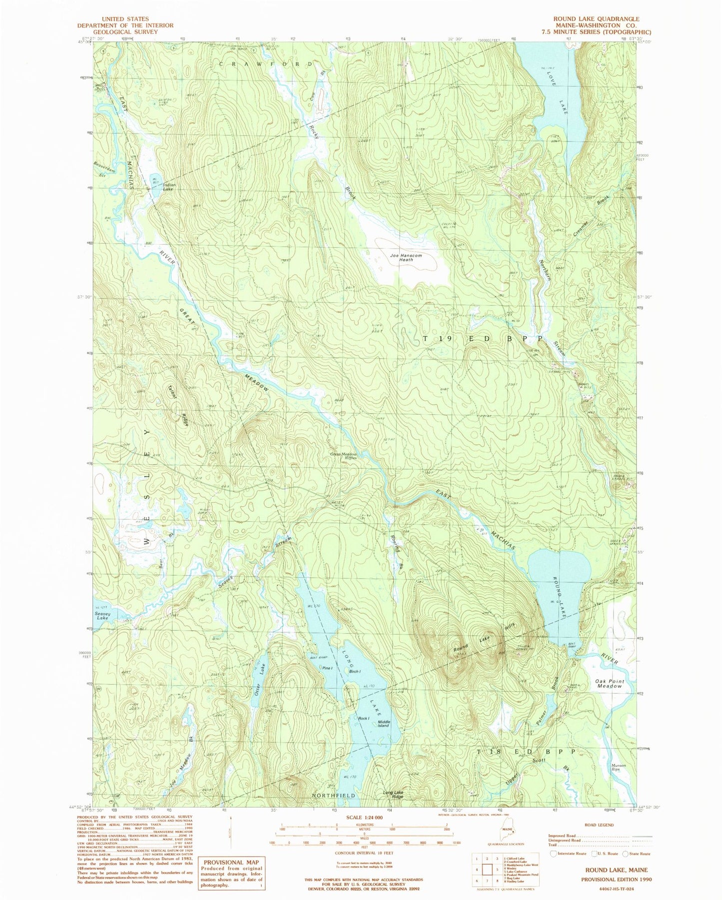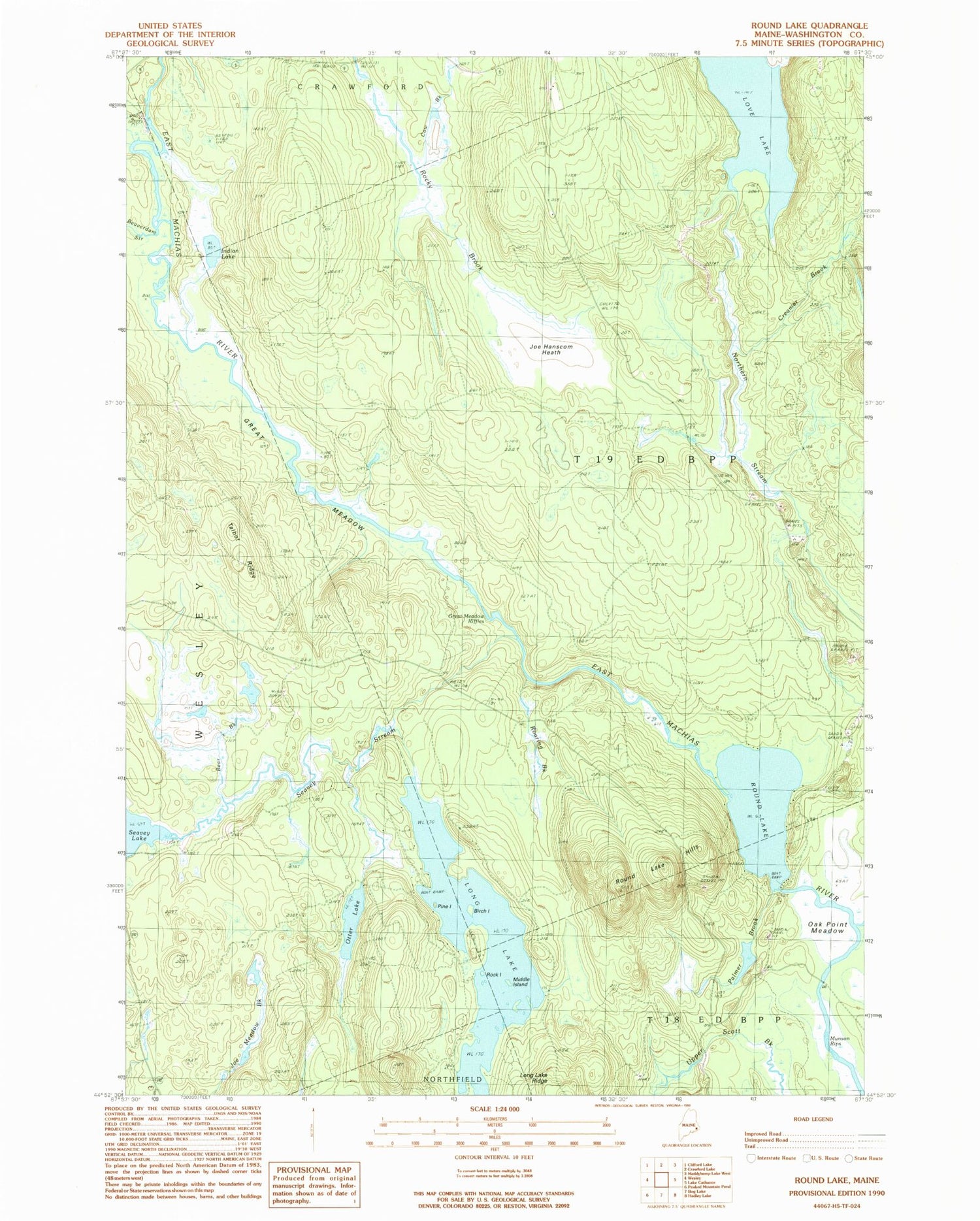
MyTopo
Classic USGS Round Lake Maine 7.5'x7.5' Topo Map
Couldn't load pickup availability
Historical USGS topographic quad map of Round Lake in the state of Maine. Map scale may vary for some years, but is generally around 1:24,000. Print size is approximately 24" x 27"
This quadrangle is in the following counties: Washington.
The map contains contour lines, roads, rivers, towns, and lakes. Printed on high-quality waterproof paper with UV fade-resistant inks, and shipped rolled.
Contains the following named places: Bear Brook, Beaverdam Stream, Birch Island, Cow Brook, Creamer Brook, Great Meadow, Great Meadow Riffles, Indian Lake, Joe Hanscom Heath, Love Lake, Middle Island, Munson Rips, Oak Point Meadow, Otter Lake, Palmer Brook, Pine Island, Roaring Brook, Rock Island, Rocky Brook, Rocky Lake Stream, Round Lake, Round Lake Hills, Seavey Lake, Seavey Stream, T19 ED BPP, Talbot Ridge, Upper Scott Brook, Washington County