MyTopo
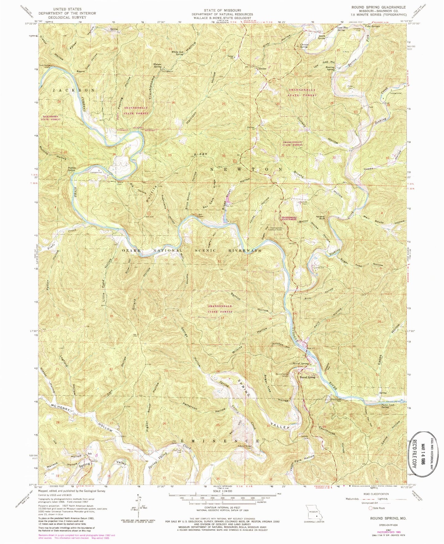
Classic USGS Round Spring Missouri 7.5'x7.5' Topo Map
Couldn't load pickup availability
Historical USGS topographic quad map of Round Spring in the state of Missouri. Typical map scale is 1:24,000, but may vary for certain years, if available. Print size: 24" x 27"
This quadrangle is in the following counties: Shannon.
The map contains contour lines, roads, rivers, towns, and lakes. Printed on high-quality waterproof paper with UV fade-resistant inks, and shipped rolled.
Contains the following named places: Bat Cave Ridge, Benton Hollow, Big Hollow, Board Tree Hollow, Boyds Creek, Brim Hollow, Broad Shoal Hollow, Brushy Hollow, Burnt House Hollow, Camp Zoe, Carr Hollow, Cave Spring, Chrisco Cemetery, Chrisco Spring, Conway Hollow, Courthouse Hollow, Dugan Hollow, Fairview Church, Fillchew Hollow, Footlog Hollow, George Hollow, Gillard Hollow, Grassy Hollow, Grassy Hollow, Harrison Hollow, Hoghair Hollow, Ink Hollow, Jacks Fork Hollow, Jones Hollow, Kelly Hollow, Limekiln Hollow, Little Field Hollow, Logfield Hollow, Lone Elm Spring, Lone Pine Piatt Cemetery, Low Gap Hollow, McHenry Hollow, Mill Hollow, Panther Bluff, Patterson Hollow, Patton Hollow, Pigeon Roost Hollow, Pulltite Hollow, Pulltite Ridge, Pulltite Spring, Pump Lead Spring, Rail Hollow, River Hollow, Roaring Spring, Round Spring, Round Spring, Round Spring State Park (historical), Shop Hollow, Slick Shoal Hollow, Smith Spring, Spring Valley, Spring Valley Creek, Sugar Tree Hollow, Sugar Tree Hollow, Sugarcamp Hollow, Summers Cemetery, Timber School, Turkey Pen Hollow, Twin Springs, Wallace Hollow, Watson Spring, Weese Cemetery, White Oak Spring, Wilhite Hollow, Big Solution Hole, Pulltite Cabin, Fire Hydrant Spring, Ink, Timber, Shannondale State Forest, Wellsford School, Boyds School, Alton Club, Forest Glen School (historical), Fairview School, Lone Pine Church (historical), Union Hill School, Barren Fork, Capps Hollow, Devils Well Hollow, Dutch Hollow, Happy Hollow, Mail Route Hollow, Parker Hollow, Sinking Creek, Sinking Hollow, Troublesome Hollow, Shannondale Lookout Tower, Round Spring Campground, Pulltite Campground, Haven Wood Airport, Alton Club Lake Dam, Township of Newton, Round Spring Natural Bridge, Timber Community Fire Protection District South