MyTopo
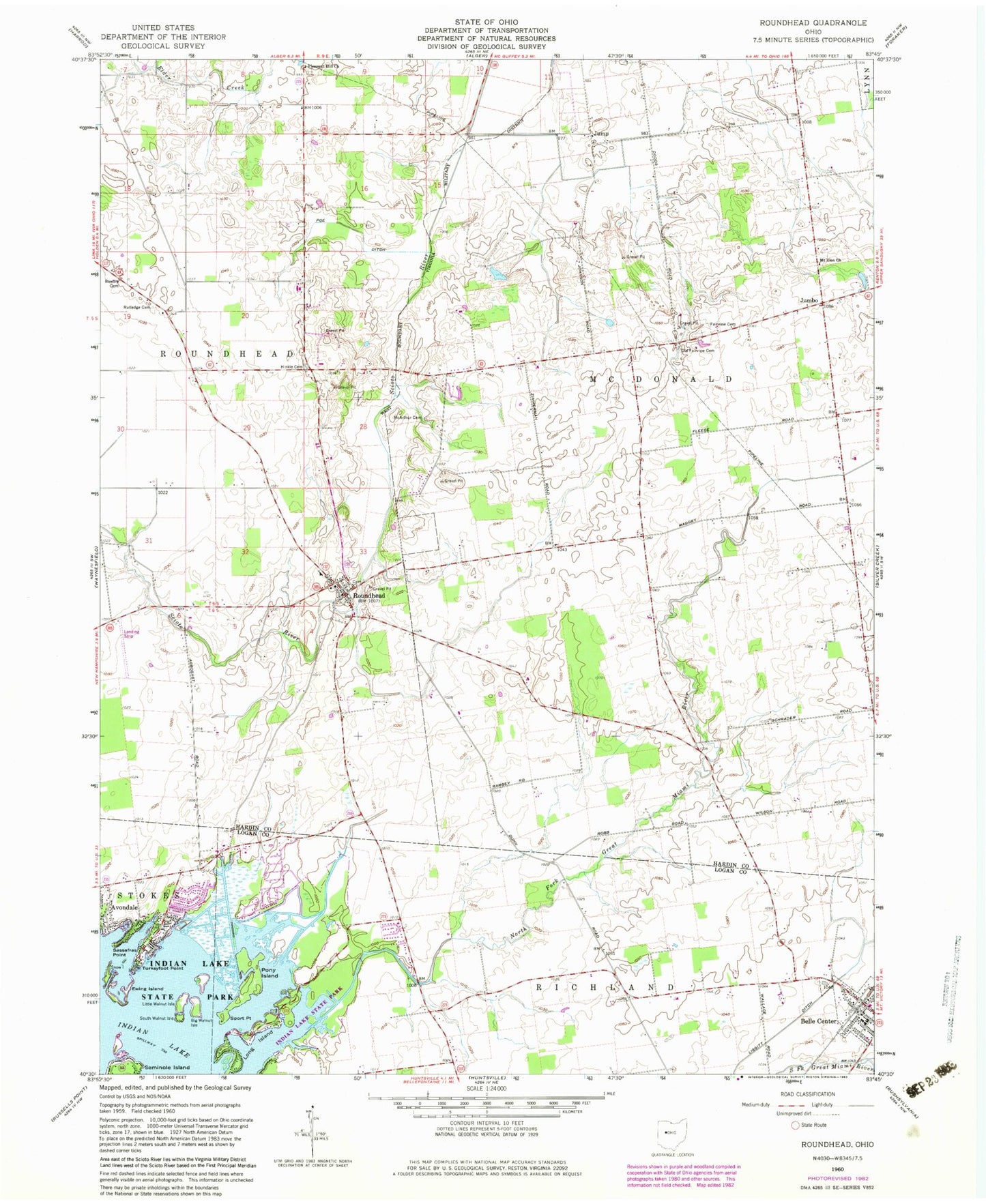
Classic USGS Roundhead Ohio 7.5'x7.5' Topo Map
Couldn't load pickup availability
Historical USGS topographic quad map of Roundhead in the state of Ohio. Map scale may vary for some years, but is generally around 1:24,000. Print size is approximately 24" x 27"
This quadrangle is in the following counties: Hardin, Logan.
The map contains contour lines, roads, rivers, towns, and lakes. Printed on high-quality waterproof paper with UV fade-resistant inks, and shipped rolled.
Contains the following named places: Anstine Hill, Avondale, Belle Center - McDonald - Richland - Taylor Creek Townships Ambulance District, Belle Center Church of Christ, Belle Center Post Office, Belle Center United Methodist Church, Big Walnut Isle, Bowdle Cemetery, Breese School, Diamond D Ranch, Ewing Island, Fairview Cemetery, Harmony School, Henkle Cemetery, Hinkle School, Jumbo, Jumbo Post Office, Jump, Jump Post Office, Lawrence School, Little Walnut Isle, Long Island, Long Island Golf Course, Mc Arthur Cemetery, Mount Zion Church, New Roundhead Cemetery, North Fork Great Miami River, North Fork School, Old Fairview Cemetery, Old Roundhead Cemetery, Pleasant Hill Cemetery, Pleasant Hill Methodist Church, Pleasant Hill School, Poe Ditch, Pony Island, Red School, Richland Township Fire Department, Roberts School, Roebuck School, Roundhead, Roundhead Elementary School, Roundhead Post Office, Roundhead United Methodist Church, Roundhead Volunteer Fire Department, Rutledge Cemetery, Sassafras Point, Seminole Island, Snow Island, South Walnut Isle, Sport Point, Street School, Tammis Mobile Village, The Points, Tip and Jo's Trailer Park, Township of McDonald, Township of Roundhead, Turkeyfoot Point, Upper Scioto Valley Ambulance District Roundhead Station, ZIP Code: 43310