MyTopo
Classic USGS Rounsaville Mississippi 7.5'x7.5' Topo Map
Couldn't load pickup availability
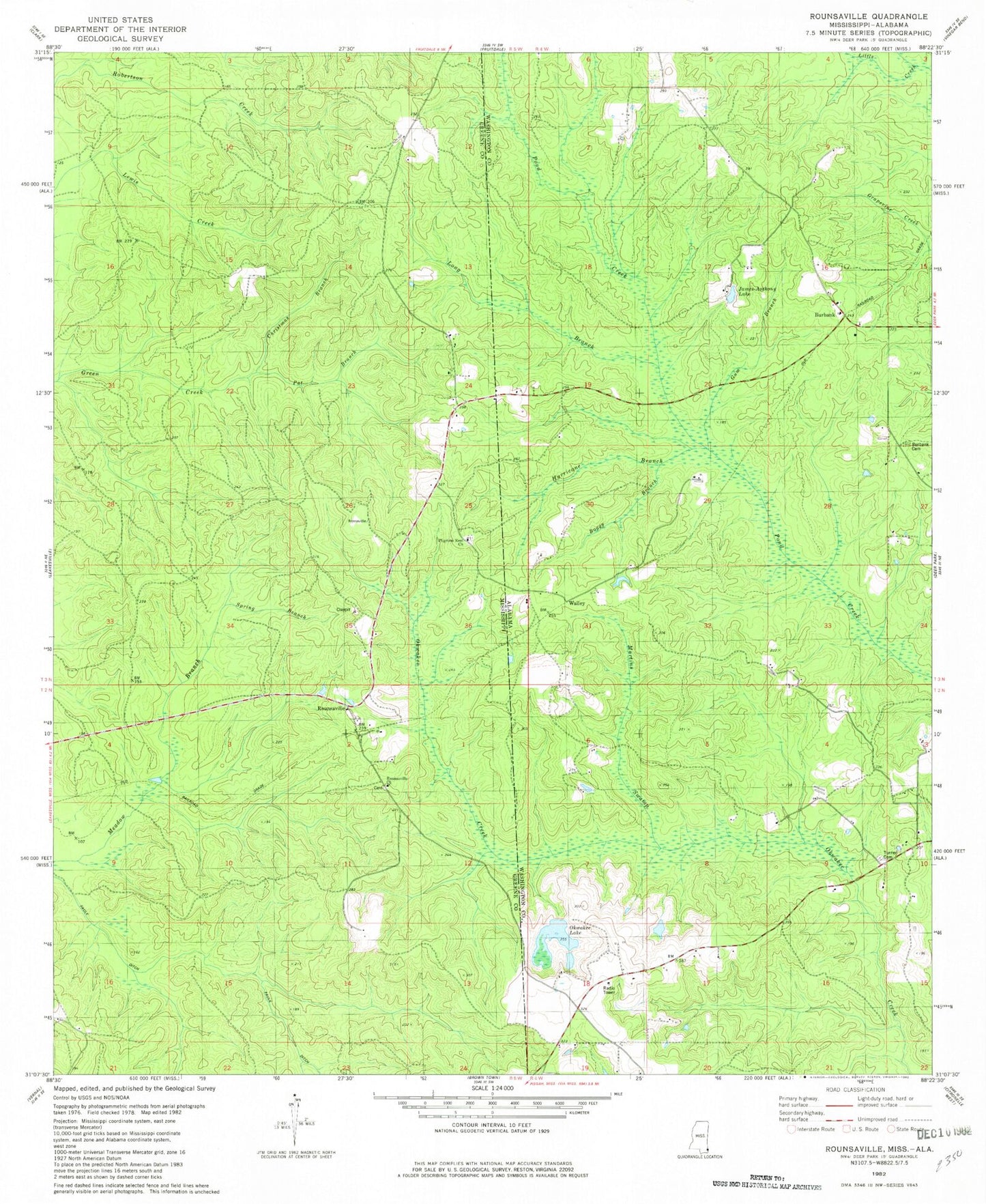
Historical USGS topographic quad map of Rounsaville in the states of Mississippi, Alabama. Map scale may vary for some years, but is generally around 1:24,000. Print size is approximately 24" x 27"
This quadrangle is in the following counties: Greene, Washington.
The map contains contour lines, roads, rivers, towns, and lakes. Printed on high-quality waterproof paper with UV fade-resistant inks, and shipped rolled.
Contains the following named places: Bethany Church, Boggy Branch, Burbank, Christmas Branch, Exsho, Gum Branch, Hurricane Branch, James Anthony Lake, Long Branch, Martins Swamp, Old Burbank Cemetery, Pat Branch, Pilgrims Rest Church, Rounsaville, Rounsaville Church, Rounsaville Hyatt Memorial Cemetery, Sand Creek, Spring Branch, Stalworth Camp, Turner Cemetery, Turners Store, Walley, ZIP Code: 36584