MyTopo
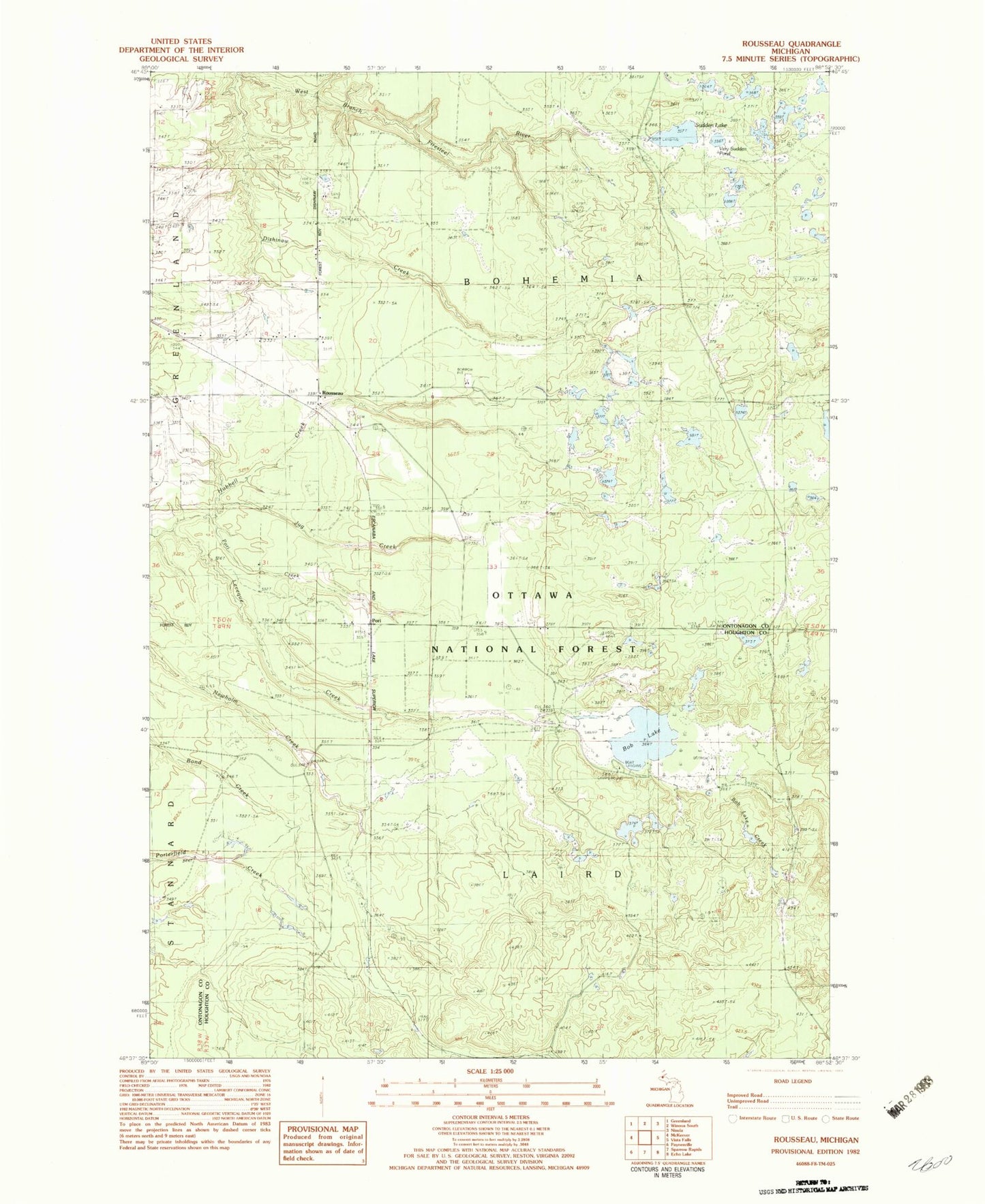
Classic USGS Rousseau Michigan 7.5'x7.5' Topo Map
Couldn't load pickup availability
Historical USGS topographic quad map of Rousseau in the state of Michigan. Map scale may vary for some years, but is generally around 1:24,000. Print size is approximately 24" x 27"
This quadrangle is in the following counties: Houghton, Ontonagon.
The map contains contour lines, roads, rivers, towns, and lakes. Printed on high-quality waterproof paper with UV fade-resistant inks, and shipped rolled.
Contains the following named places: Bob Lake, Bob Lake Campground and Picnic Area, Bob Lake Creek, Dishinaw Creek, Indian Creek, Jug Creek, Leveque Creek, Michigan College of Mining Forestry Camp, New Home Post Office, New Home Station, Nikkila Farms Airport, Ontonagon Equestrian Complex, Plato Post Office, Pori, Pori Creek, Pori Station, Rousseau, Rousseau Cemetery, Rousseau Post Office, Rousseau Station, Sudden Lake, Very Sudden Pond