MyTopo
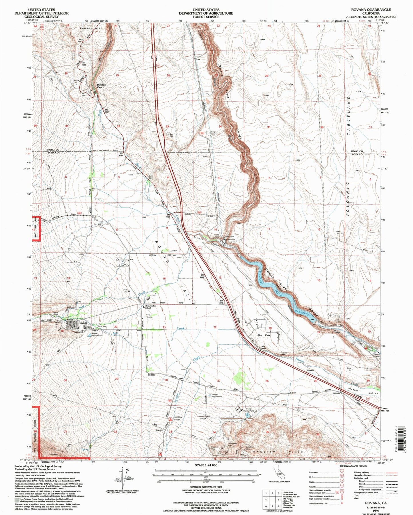
Classic USGS Rovana California 7.5'x7.5' Topo Map
Couldn't load pickup availability
Historical USGS topographic quad map of Rovana in the state of California. Map scale may vary for some years, but is generally around 1:24,000. Print size is approximately 24" x 27"
This quadrangle is in the following counties: Inyo, Mono.
The map contains contour lines, roads, rivers, towns, and lakes. Printed on high-quality waterproof paper with UV fade-resistant inks, and shipped rolled.
Contains the following named places: Alta Vista, Birchim Canyon, Department of Forestry and Fire Protection Bishop Station, Horton Creek Campground, Inyo-Mono Ecology Center, Little Shot Mine, Lower Rock Creek, Mesa Census Designated Place, Owens River Gorge, Paradise Camp, Paradise Census Designated Place, Paradise Fire Protection District, Pine Creek, Pleasant Valley 6-045 Dam, Pleasant Valley Campground, Pleasant Valley Reservoir, Rattlesnake Prospect, Round Valley, Round Valley Census Designated Place, Round Valley Elementary School, Round Valley Mine, Round Valley Quarry, Rovana, Sherwin Grade, Vanadium Ranch, Western Mine