MyTopo
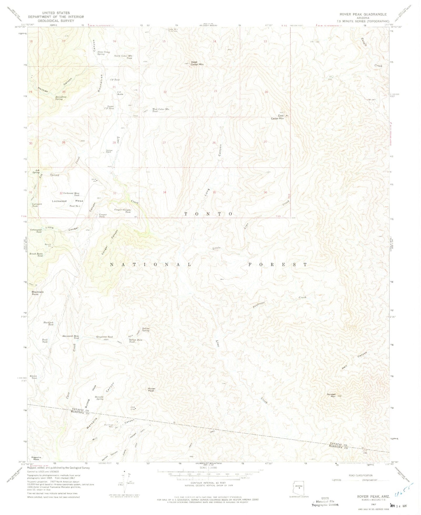
Classic USGS Rover Peak Arizona 7.5'x7.5' Topo Map
Couldn't load pickup availability
Historical USGS topographic quad map of Rover Peak in the state of Arizona. Map scale may vary for some years, but is generally around 1:24,000. Print size is approximately 24" x 27"
This quadrangle is in the following counties: Maricopa, Yavapai.
The map contains contour lines, roads, rivers, towns, and lakes. Printed on high-quality waterproof paper with UV fade-resistant inks, and shipped rolled.
Contains the following named places: Ash Spring, Ash Spring Creek, Barbara Spring, Blackjack Tank, Brush Basin Tank, Bulldog Mesa, Cave Creek Ranger District, Cedar Mountain Trick Tank, Cottonwood Tank, Cougar Canyon, Cougar Canyon Tank, Cougar Tank, CP Butte, CP Tank, East Cedar Mountain, Fifty One Ranch, Grapevine Tank, High Mesa Tank, Holmes Canyon, Holmes Creek, Indian Ruin Tank, Indian Spring, Jack Brooks Spring, Latimore Tank, Lime Cabin, Lime Spring, Little Cougar Canyon, Little Lime Creek, Lockwood Mesa, Lockwood Mesa Tank, Long Canyon, Lower CP Tank, Marcelle Canyon, Marcelle Spring, Monument Mesa Tank, North Cedar Mountain Tank, Professor Creek, Professor Spring, Red Rover Mine, Renner Spring, Rincon Tank, Roundtree Spring, Rover Peak, Seldom Trick Tank, Stone Camp Spring, Sunset Mountain, Tank Number Five, Trail Tank, West Cedar Mountain, West Cedar Mountain Tank


