MyTopo
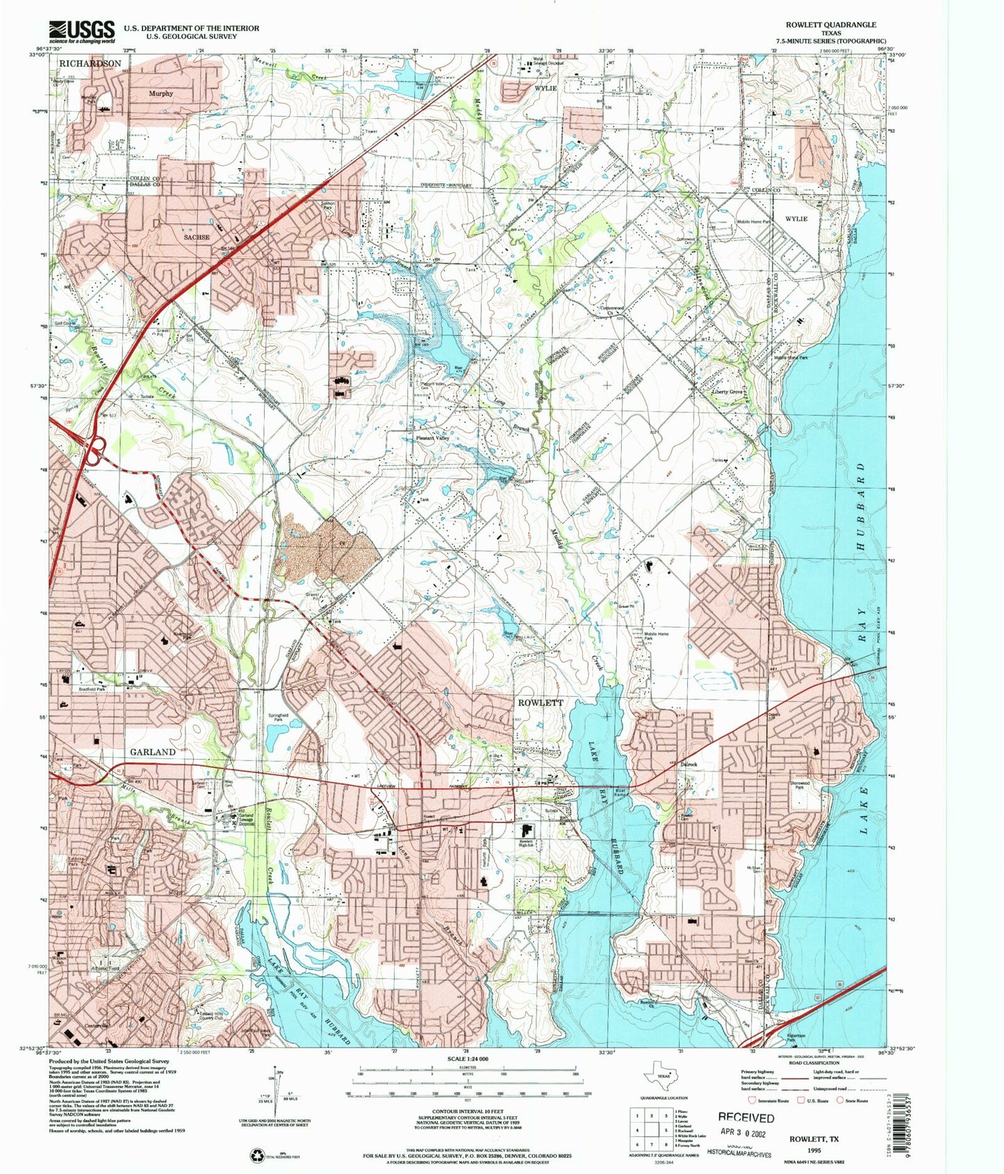
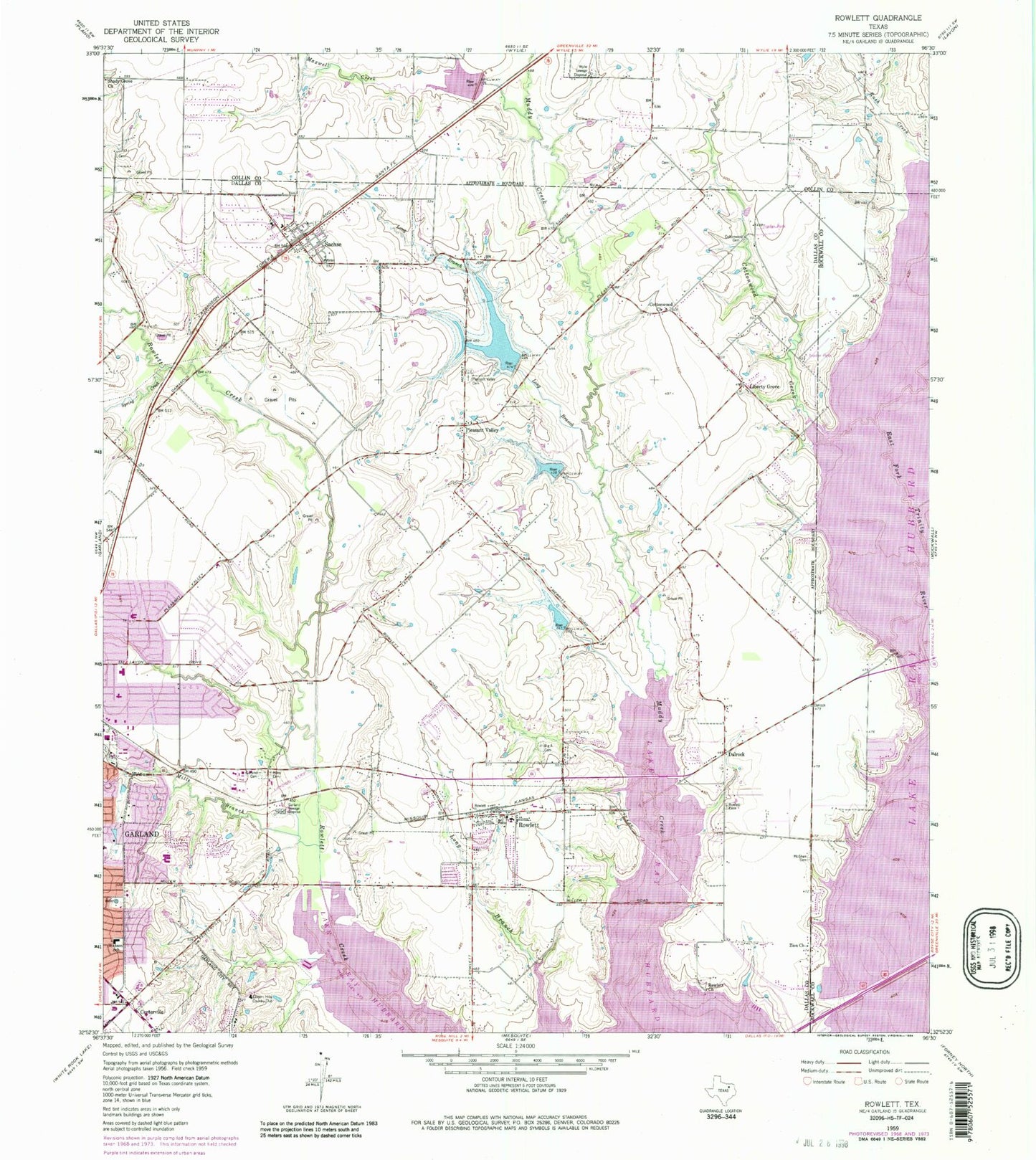
Classic USGS Rowlett Texas 7.5'x7.5' Topo Map
Couldn't load pickup availability
Historical USGS topographic quad map of Rowlett in the state of Texas. Map scale may vary for some years, but is generally around 1:24,000. Print size is approximately 24" x 27"
This quadrangle is in the following counties: Collin, Dallas, Rockwall.
The map contains contour lines, roads, rivers, towns, and lakes. Printed on high-quality waterproof paper with UV fade-resistant inks, and shipped rolled.
Contains the following named places: All State Health and Ambulance Services, Austin Academy for Excellence, Back Elementary School, Bay View Baptist Church, Bethesda Tamil Fellowship Church, Big A Cemetery, Bradfield Park, Calvary Apostolic Church, Cecil Tom Davis Chapel, Centerville, Centerville Elementary School, Church of Christ, Church of the Nazarene, City of Rowlett, City of Sachse, Club Hill Elementary School, Corder Lake, Cottonwood Cemetery, Cottonwood Church, Cottonwood Creek, Coyle Middle School, Cullins - Lake Pointe Elementary School, Dallas Nature Trail, Dalrock, Eastern Hills Country Club, Eastside Church of Christ, El Bethel Baptist Church, El Bethel Church of God in Christ, Embree Park, Emmanuel Baptist Church, First Presbyterian Church, First United Methodist Church of Sachse, Ganze Ranch Airstrip, Garland Bible Fellowship Church, Garland Fire Department Station 7, Garland Fire Department Station 8, Garland Seventh Day Adventist Church, Garland Sewage Disposal, Herfurth Elementary School, Hillside Academy for Excellence, Homer B Johnson Stadium, Hudson Middle School, John Armstrong Elementary School, Joy Lutheran Church, Keeley Elementary School, Lake Pointe Medical Center, Lakes of Springfield Presbyterian Church, Lakeside Pentecostal Church, Liberty Grove, Life Baptist Church, Long Branch, Lou Duff Park, Luna Elementary School, Madeira Airpark, Maxwell Creek, McShan Cemetery, Miles Cemetery, Miller Elementary School, Mills Branch, Mills Cemetery, Miracle Apostolic Church, Murphy Road Baptist Church, New Hope Fellowship of the Assembly of God Church, Newman Electric Plant, Norma Dorsey Elementary School, Northlake Elementary School, Pentecost Church of God in Christ, Philadelphia Pentecostal Church, Pleasant Valley, Pleasant Valley Cemetery, Pleasant Valley United Methodist Church, Primera Iglesia Bautista Rowlett Church, Princeton Park Baptist Church, Providence Presbyterian Church, Rivercrest Park, Robert Sewell Elementary School, Robertson Park, Rowlett, Rowlett Cemetery, Rowlett Church, Rowlett Church of Christ, Rowlett City Hall, Rowlett Elementary School, Rowlett Fire Rescue Station 1, Rowlett Fire Rescue Station 2, Rowlett Fire Rescue Station 3, Rowlett High School, Rowlett Police Department, Rowlett Post Office, Sachse, Sachse City Hall, Sachse Fire and Rescue Station 1, Sachse Fire and Rescue Station 2, Sachse High School, Sachse Police Department, Sacred Heart Cemetery, Salmon Park, Second Chapel Baptist Church, Sellers Middle School, Shorehaven Elementary School, Shorewood Park, Sims Chapel Baptist Church, Soil Conservation Service Site 10 Dam, Soil Conservation Service Site 10 Reservoir, Soil Conservation Service Site 11 Dam, Soil Conservation Service Site 11 Reservoir, Soil Conservation Service Site 12 Dam, Soil Conservation Service Site 12 Reservoir, Soil Conservation Service Site 7 Dam, Soil Conservation Service Site 7 Reservoir, South Garland Baptist Church, Spring Creek, Spring Creek Baptist Church, Springfield Park Trail, Squabble Creek, Stephens Elementary School, Vernal Lister Elementary School, Watson School, Watson Technology Center, Weaver Elementary School, Wylie Fire Department Station 1, Wylie Sewage Disposal, Wylie Wastewater Treatment Plant, Zion Church, ZIP Codes: 75040, 75048, 75088, 75089


