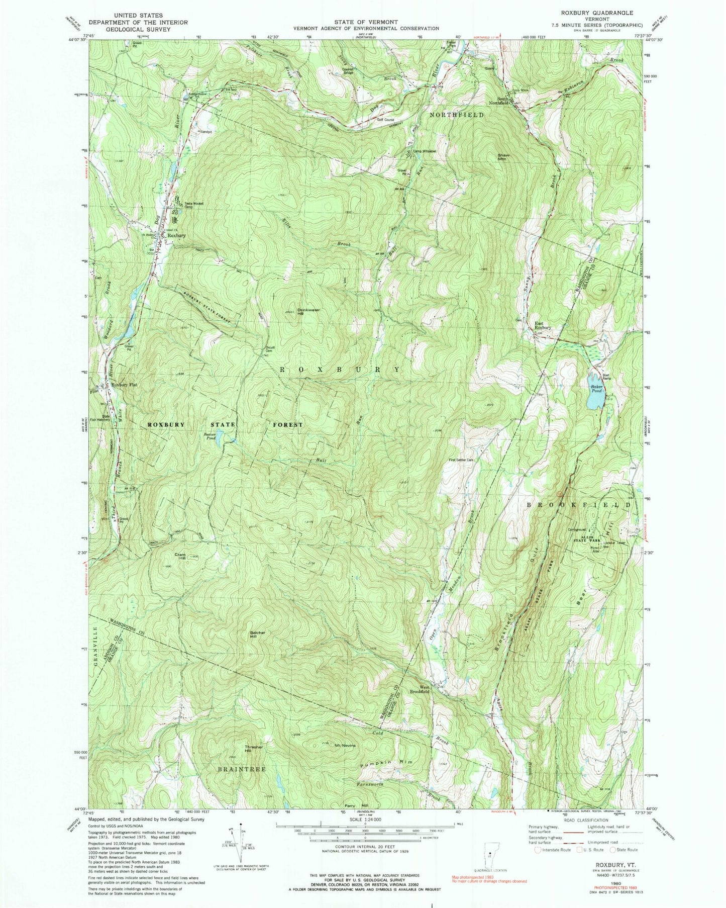
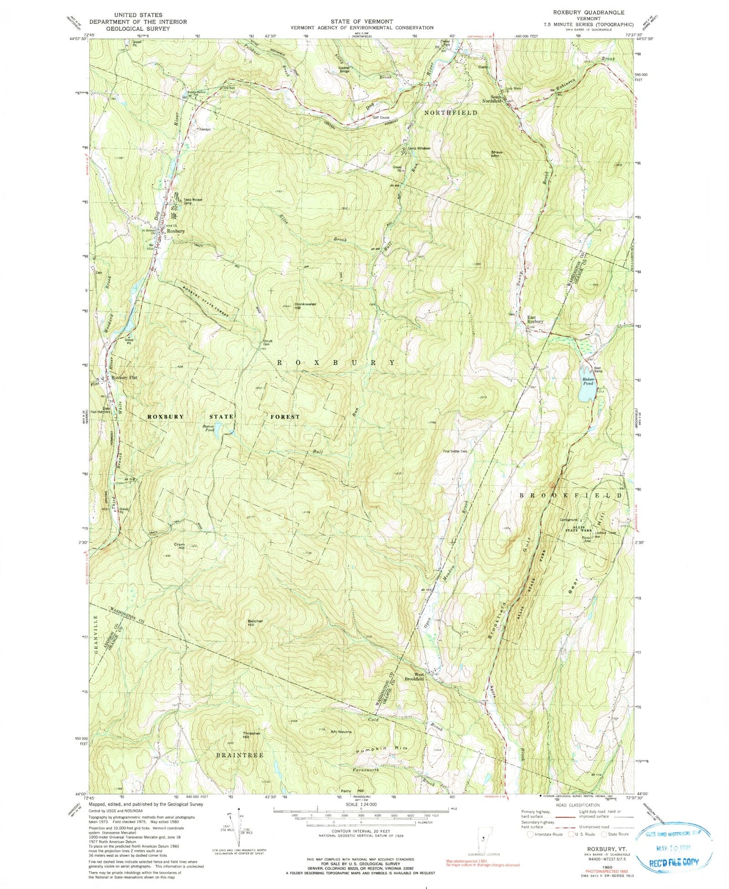
MyTopo
Classic USGS Roxbury Vermont 7.5'x7.5' Topo Map
Couldn't load pickup availability
Historical USGS topographic quad map of Roxbury in the state of Vermont. Typical map scale is 1:24,000, but may vary for certain years, if available. Print size: 24" x 27"
This quadrangle is in the following counties: Addison, Orange, Washington.
The map contains contour lines, roads, rivers, towns, and lakes. Printed on high-quality waterproof paper with UV fade-resistant inks, and shipped rolled.
Contains the following named places: Allis State Park, Baker Pond, Bear Hill, Bear Hill School, Beaver Pond, Belcher Hill, Brookfield Gulf, Bull Run, Bull Run School, Camp Wihakowi, Cold Brook, Cram Hill, Drinkwater Hill, East Roxbury, Ellis Brook, Harlow Bridge School, Mount Nevins, Open Meadow Brook, Pumpkin Rim, Rabbit Hollow School, Roxbury, Roxbury Flat, Shaw Mountain, South Northfield, Stony Brook, Sunny Brook, Teela Wooket Camp, Thresher Hill, Wardner Pond, West Brookfield, West Street School, Robinson Brook, Felchner Brook, Flint Brook, Roxbury State Forest, Woodard Brook, Town of Roxbury, Baker Pond Dam, State of Vermont, Batchellor-Spaulding Cemetery, East Roxbury Cemetery, First Settler Cemetery, Northfield Golf Course, Orcutt Cemetery, Roxbury Cemetery, Roxbury Village School, Roxbury Post Office, Stony Brook Covered Bridge, Bear Hill Trail, Connecticut Corners Cemetery, West Brookfield Cemetery, Roxbury Volunteer Fire Department