MyTopo
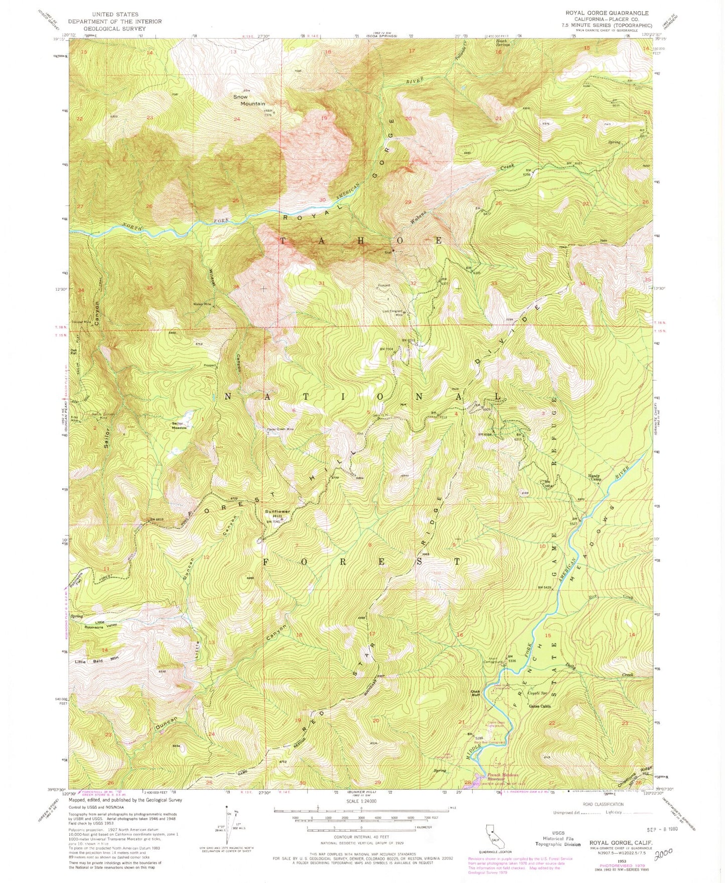
Classic USGS Royal Gorge California 7.5'x7.5' Topo Map
Couldn't load pickup availability
Historical USGS topographic quad map of Royal Gorge in the state of California. Typical map scale is 1:24,000, but may vary for certain years, if available. Print size: 24" x 27"
This quadrangle is in the following counties: Placer.
The map contains contour lines, roads, rivers, towns, and lakes. Printed on high-quality waterproof paper with UV fade-resistant inks, and shipped rolled.
Contains the following named places: Ahart Campground, Chalk Bluff, Coyote Spring, Dolly Creek, Gates Cabin, Handy Camp, Heath Spring, Lewis Campground, Little Duncan Canyon, Lost Emigrant Mine, Oak Flat, Palisade Creek, Placer Queen Mine, Rice Creek, Royal Gorge River, Sailor Canyon Mine, Sailor Flat Trail, Sailor Meadow, French Meadows, Sailor Canyon, Snow Mountain, Sunflower Hill, Trinidad Mine, Wabena Creek, Walker Mine, Wildcat Canyon, X-Ray Mine, Little Robinsons Valley, Red Star Ridge, Wabena Trail, Sailore Flat Trail, Tevis Cup Trail, Black Bear Campground, Coyote Group Campground, Deadman Flat, Gates Group Campground, Little Duncan Creek, Royal Gorge