MyTopo
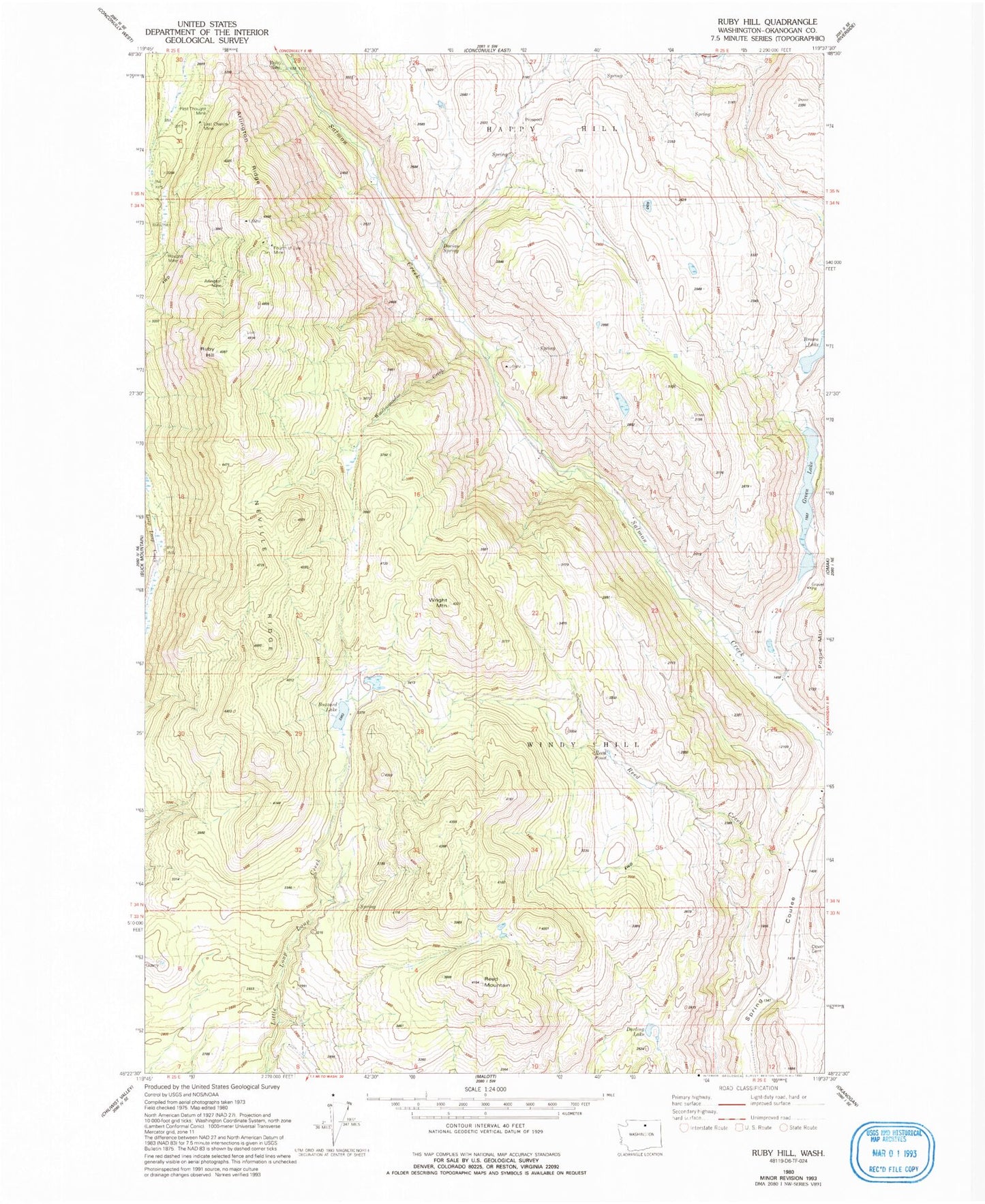
Classic USGS Ruby Hill Washington 7.5'x7.5' Topo Map
Couldn't load pickup availability
Historical USGS topographic quad map of Ruby Hill in the state of Washington. Map scale may vary for some years, but is generally around 1:24,000. Print size is approximately 24" x 27"
This quadrangle is in the following counties: Okanogan.
The map contains contour lines, roads, rivers, towns, and lakes. Printed on high-quality waterproof paper with UV fade-resistant inks, and shipped rolled.
Contains the following named places: Arlington Mine, Arlington Ridge, Brown Lake, Buzzard Lake, Darling Lake, First Thought Mine, Fourth of July Mine, Green Lake, Houghs Mine, Last Chance Mine, Little Green Lake, Little Green Lake Dam, Loop Loop, Neville Ridge, Reed Mountain, Reed Pond, Ruby, Ruby Hill, Spring Coulee Family Cemetery, Woolloomooloo Creek, Wright Mountain