MyTopo
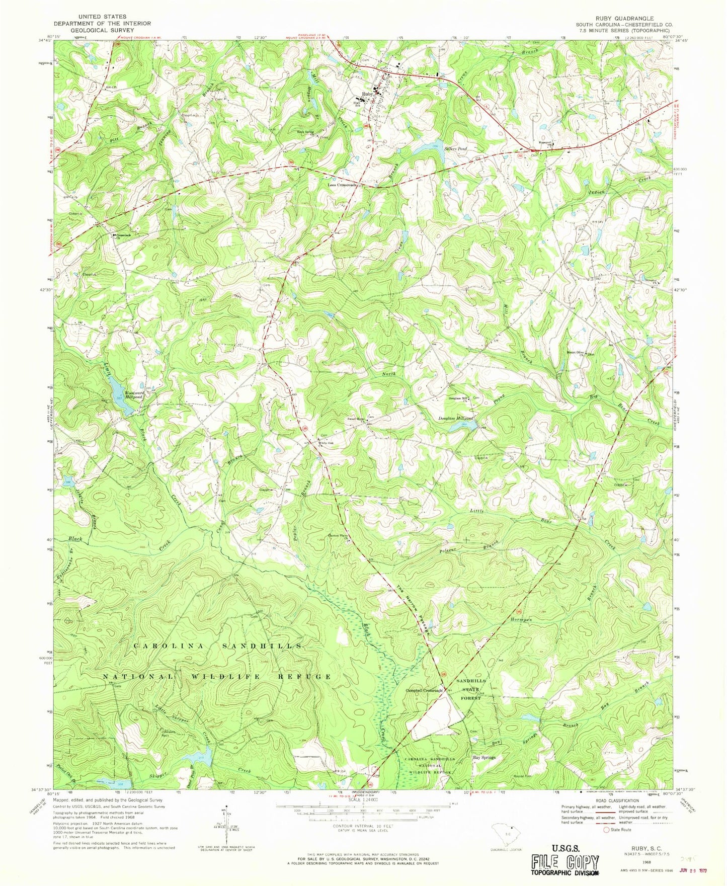
Classic USGS Ruby South Carolina 7.5'x7.5' Topo Map
Couldn't load pickup availability
Historical USGS topographic quad map of Ruby in the state of South Carolina. Map scale may vary for some years, but is generally around 1:24,000. Print size is approximately 24" x 27"
This quadrangle is in the following counties: Chesterfield.
The map contains contour lines, roads, rivers, towns, and lakes. Printed on high-quality waterproof paper with UV fade-resistant inks, and shipped rolled.
Contains the following named places: Bay Springs, Bay Springs Branch, Campbell Crossroads, Canal Branch, Cassidys Mill, Center Point School, Chesterfield County, Church of God, Clanton Plains Baptist Church, Cross Roads Cemetery, Cross Roads School, Crossroads Church, Dead Pine Branch, Douglas Mill Cemetery, Douglas Mill Church, Douglass Millpond, Douglass Millpond Dam D-3192, Gulledge Family Cemetery, Hogpen Branch, Hopewell Baptist Cemetery, Hopewell Church, Horsepen Branch, Jessies Branch, Johnsons Rock, Lees Crossroads, Little Black Creek, Little Skipper Creek, Mill Branch, Mount Airy Church, Mount Airy Methodist Church Cemetery, Mount Croghan Division, Mount Olive Church Cemetery, Mount Olive Missionary Baptist Church, North Prong Big Bear Creek, Oliver Mill, Peeled Oak Branch, Pitt Branch, Polecat Branch, Pool K, Pool L, Poplar Branch, Rattlesnake Branch, Rock Spring Baptist, Rock Springs Baptist Church, Rock Springs School, Roscoe Cemetery, Ruby, Ruby - Mount Croghan Fire Department Station 1, Ruby - Mount Croghan Fire Department Station 3, Ruby Cemetery, Ruby Elementary School, Sellers Pond, Smith Family Cemetery, South Carolina Noname 13020 D-3190 Dam, South Carolina Noname 13021 D-3191 Dam, South Carolina Noname 13043 D-3189 Dam, South Carolina Noname 13058 D-3188 Dam, Streater Church, Sweet Home Baptist Church, Sweet Home Church Cemetery, Sweet Home School, The Narrow Passage, Town of Ruby, United Church, Wamba School, Wamble Hill School, White Oak Cemetery, White Oak Church, White Oak School, Woodward Millpond, ZIP Code: 29741


