MyTopo
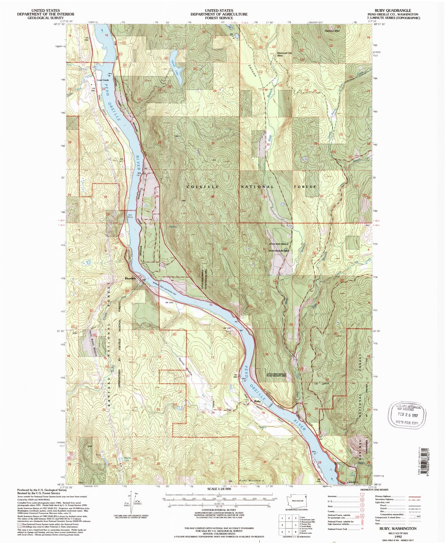
Classic USGS Ruby Washington 7.5'x7.5' Topo Map
Couldn't load pickup availability
Historical USGS topographic quad map of Ruby in the state of Washington. Map scale may vary for some years, but is generally around 1:24,000. Print size is approximately 24" x 27"
This quadrangle is in the following counties: Pend Oreille.
The map contains contour lines, roads, rivers, towns, and lakes. Printed on high-quality waterproof paper with UV fade-resistant inks, and shipped rolled.
Contains the following named places: Blueslide, Diamond City, Dry Canyon, East Branch Le Clerc Creek, Fourth of July Creek, Hanlon Mountain, Henry Brown Meadow, Le Clerc Creek, Lost Creek, Middle Branch Le Clerc Creek, Middle Creek, Misery Lake, Panhandle Campground, Pend Oreille County, Pend Oreille County Fire District 2, Ruby, Ruby Creek, South Fork Lost Creek, Squirrel Meadow, West Branch LeClerc Creek, Yocum Lake, Yokum Lake Lookout, ZIP Code: 99119