MyTopo
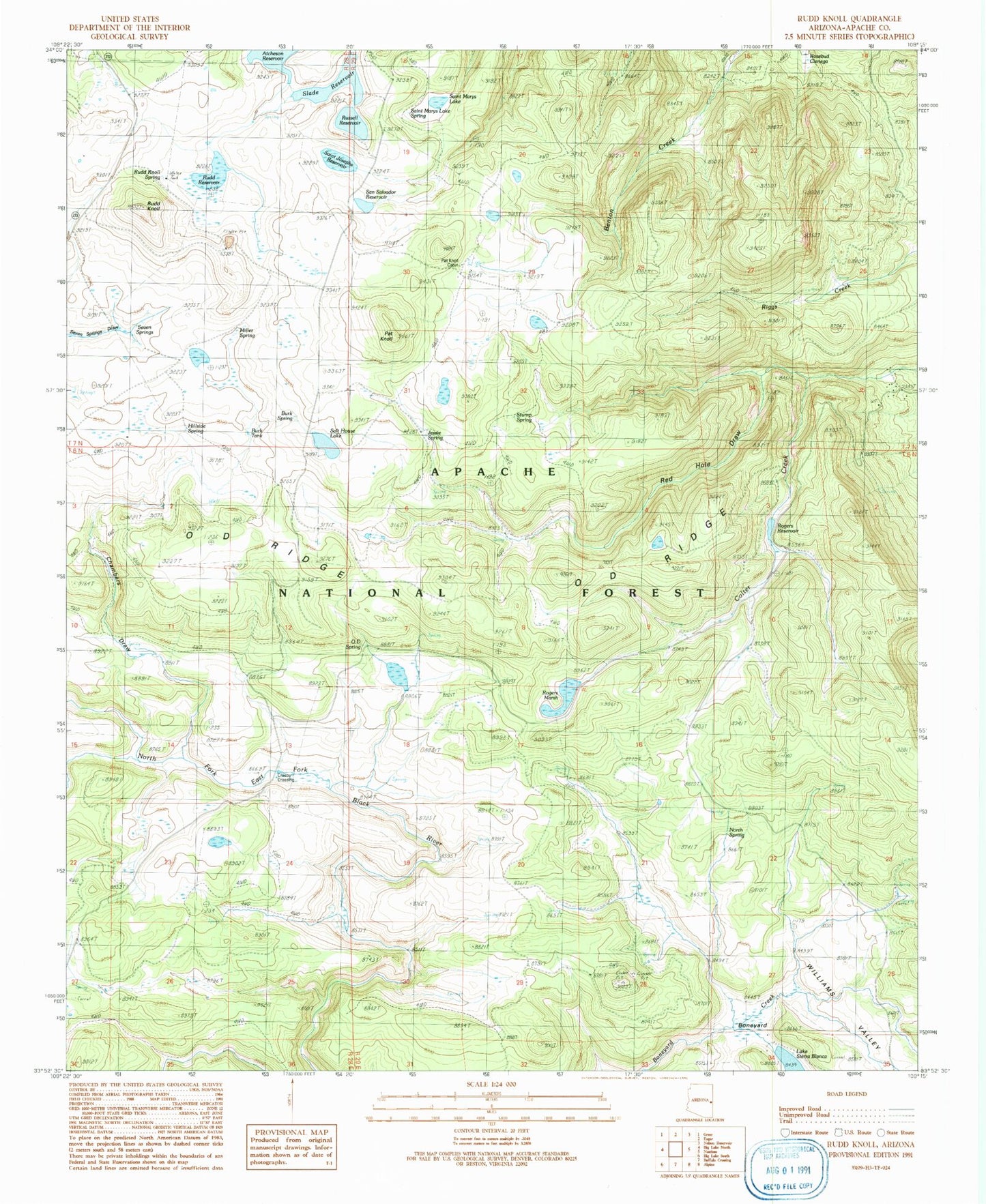
Classic USGS Rudd Knoll Arizona 7.5'x7.5' Topo Map
Couldn't load pickup availability
Historical USGS topographic quad map of Rudd Knoll in the state of Arizona. Typical map scale is 1:24,000, but may vary for certain years, if available. Print size: 24" x 27"
This quadrangle is in the following counties: Apache.
The map contains contour lines, roads, rivers, towns, and lakes. Printed on high-quality waterproof paper with UV fade-resistant inks, and shipped rolled.
Contains the following named places: Atcheson Reservoir, Burk Spring, Crosby Crossing, Hillside Spring, Jessie Spring, Saint Marys Lake Spring, Miller Spring, North Spring, O D Ridge, Pat Knoll, Pat Knoll Guard Station, Rudd Knoll Spring, Rudd Knoll Spring, Rudd Reservoir, Saint Marys Lake, Salt House Tank, Seven Springs, Slade Reservoir, Stump Spring, Williams Valley, Boneyard, Chambers Draw, Rogers Dam, Rogers Reservoir, Russell Reservoir, Saint Josephs Reservoir, Saint Marys Dam, San Salvador Dam, San Salvador Reservoir, Sierra Blanca Dam, East Fork Springs Number Four, Udall Pit Number Five, East Fork Springs Number Five, Udall Pit, East Fork Spring Number Six, Boneyard Spring, Udall Pit Number Two, Udall Pit Number Three, East Fork Spring Number One, East Fork Spring Number Two, East Fork Number Three Spring, Turkey Tank, Pat Sink, Pat Knoll Tank, Jessie Spring Marsh, Salt House Tank (historical), Udall Pit Number One Tank, Udall Pit Number Two Tank, Miller Spring, Rudd Knoll Pit Tank Number 1, Pat Knoll, Pat Knoll Pit Springs, Road Tank, Sickel Tank, Stit Spring, Rudd Knoll Pit Tank Number 114, Rudd Knoll Pit Number Three, Pin Tank, Section Twenty-Three Tank, Conklin Spring, Udall Hole Tank, OD Spring, Bottom Spring, Upper Spring, Burky Tank, Milkpen Tank, Arrow Tank, Hill Tank, Moon Tank, Number Four Tank, Flat Tank, Saint Marys Tank, Burk Tank, Rogers Marsh, Rosebud Cienega, O D Spring, Red Hole Draw, Fly Spring, Udall Pit Tank Number 6, Udall Pit Tank Number 4, Crosby Spring, Timber Spring, Tom Thumb Spring, Bog Tank, Bluff Tank, East Fork Black River Spring, Milkpen Spring, Burn Meadow Tank, Pat Knoll Lake, Lost Spring


