MyTopo
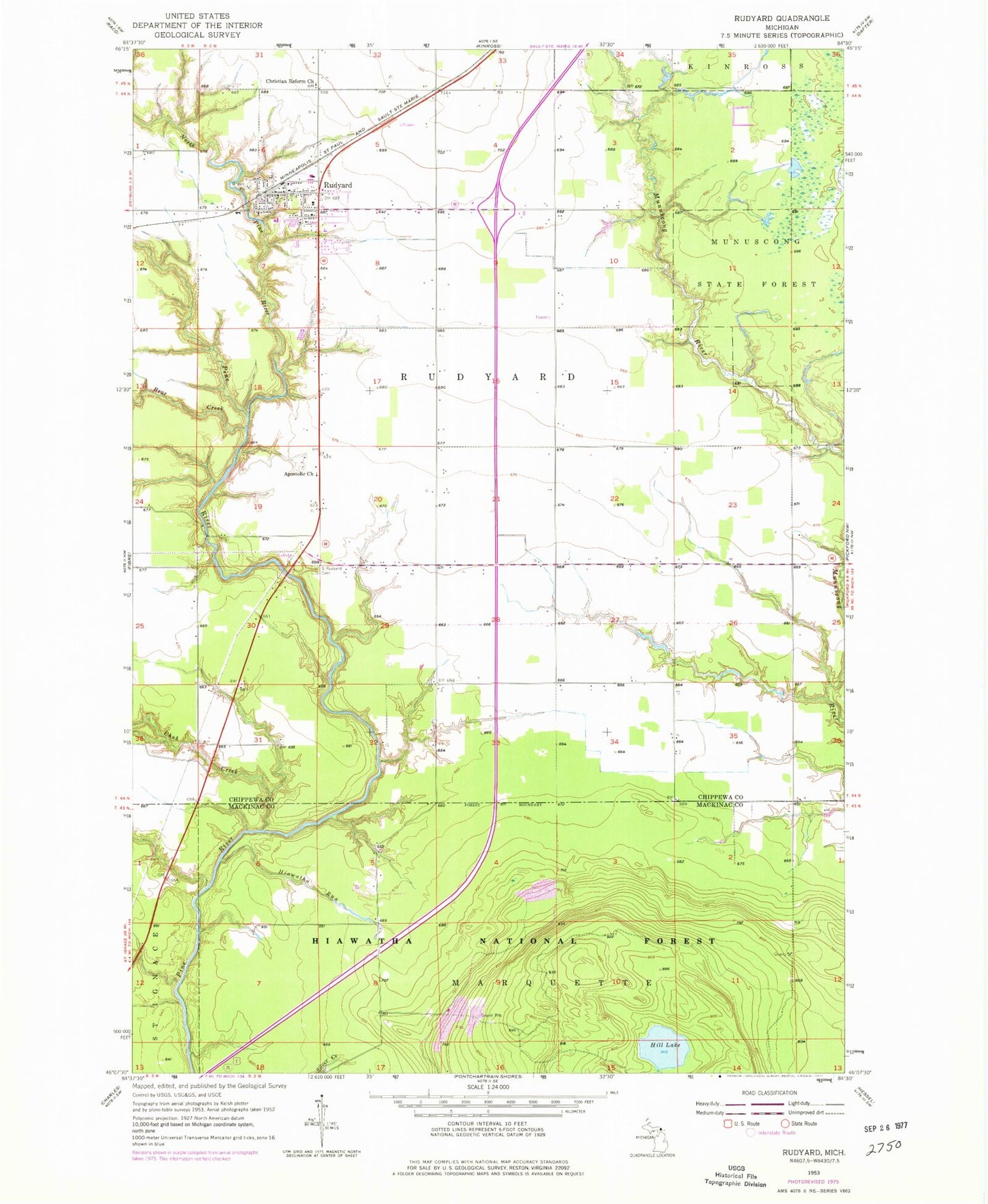
Classic USGS Rudyard Michigan 7.5'x7.5' Topo Map
Couldn't load pickup availability
Historical USGS topographic quad map of Rudyard in the state of Michigan. Map scale may vary for some years, but is generally around 1:24,000. Print size is approximately 24" x 27"
This quadrangle is in the following counties: Chippewa, Mackinac.
The map contains contour lines, roads, rivers, towns, and lakes. Printed on high-quality waterproof paper with UV fade-resistant inks, and shipped rolled.
Contains the following named places: Apostolic Church, Bear Creek, Christian Reform Church, Chub Creek, Hiawatha Run, Hill Lake, North Pine River, Presbyterian Church, Rudyard, Rudyard Bible Church, Rudyard High School, Rudyard Post Office, Rudyard Public Library, Rudyard Station, Rudyard Township Park, Rudyard Township Volunteer Fire Department, Saint James Lutheran Church, Saint Joseph Roman Catholic Church, Saint Rudyard Cemetery, South Rudyard Cemetery, Township of Rudyard, Turner Howson Elementary School